Introduction To Localization
420 likes | 634 Vues
Introduction To Localization. Two Research Threads. Mobile Computing (top down). Localization Activity/Gesture Smart Content Psychological Computing. Application. Security. Transport. Network. MAC / Link. PHY/MAC Protocols Battery Life Localization Sensor Assisted Networks.

Introduction To Localization
E N D
Presentation Transcript
Two Research Threads Mobile Computing (top down) • Localization • Activity/Gesture • Smart Content • Psychological Computing Application Security Transport Network MAC / Link • PHY/MAC Protocols • Battery Life • Localization • Sensor Assisted Networks PHY Wireless Networking (bottom up)
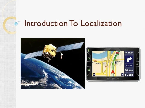
Smartphone Positioning Systems: The problem space
Motivation • Sudden growth in smartphone industry • Localization technology caught unprepared • Industry viewing location as “address” for content delivery
Motivation • Sudden growth in smartphone industry • Localization technology caught unprepared • Industry viewing location as “address” for content delivery “I firmly believe location will be the cornerstone of most successful applications of the foreseeable future” – R. Lynch, CEO, Verizon
Isn’t today’s technology, such as GPS, adequate?
Apps • Reminders when passing a library • Targeted ads in Starbucks, Wal-mart • Information about paintings in museums • Access files only from this room • Walking directions in shopping malls
Apps • Reminders when passing a library • Targeted ads in Starbucks, Wall-mart • Information about paintings in museums • Access files only from this room • Walking directions in shopping malls . . • Information about visible objects (augmented reality)
I wonder how much it costs to live there! $7.8M 207 Coast Road
Enabling Technology Apps Localization
Enabling Technology Apps 1. Outdoor Continuous Localization 2. Indoor Semantic 3. High Precision Indoor 4. Object localization
Enabling Technology Constraints • Accuracy • Energy • Calibration • Infrastructure Apps 1. Outdoor Continuous Localization 2. Indoor Semantic 3. High Precision Indoor 4. Object localization
Enabling Technology Constraints • Accuracy • Energy • Calibration • Infrastructure Apps 1. Outdoor Continuous Localization 2. Indoor Semantic 3. High Precision Indoor 4. Object localization Software Hardware GPS WiFi Inertial / Mag. Sensors Camera Mic.
Global Positioning System • Worldwide radio-navigation system formed from a constellation of 24 satellites and their ground stations. • GPS uses these "man-made stars" as reference points to calculate positions accurate to a matter of meters. • With advanced forms of GPS you can make measurements to better than a centimetre
Global Positioning System • GPS receivers have been miniaturized to just a few integrated circuits and so are becoming very economical. • That makes the technology accessible to virtually everyone. • These days GPS is finding its way into cars, boats, planes, construction equipment, movie making gear, farm machinery, and laptop computers.
Four Primary Functions of GPS • Position and coordinates. • The distance and direction between any two waypoints, or a position and a waypoint. • Travel progress reports. • Accurate time measurement.
GPS works in three logical steps • The basis of GPS is "triangulation" from satellites. • To "triangulate," a GPS receiver measures distance using the travel time of radio signals. • To measure travel time, GPS needs very accurate timing which it achieves with some tricks. • Along with distance, you need to know exactly where the satellites are in space. • High orbits and careful monitoring are the secret. • Finally you must correct for any delays the signal experiences as it travels through the atmosphere.
What a satellite transmits • A GPS signal contains three different bits of information • ID to identify which satellite is transmitting information. • Ephemeris data which contains information about the status, current date and time • Almanac data which tell the receiver where each GPS satellite should be at any time throughout the day
Position is Based on Time Signal leaves satellite at time “T” T Signal is picked up by the receiver at time “T + 3” T + 3 Distance between satellite and receiver = “3 times the speed of light”
Signal From One Satellite The receiver is somewhere on this sphere.
Triangulation/trilateration • Two spheres intersect at a circle and three spheres intersect at two points. • Distance calculation- • If received time t and transmit time ti then distance is c*(t-ti) where c is the speed of light • 4 satellites are used
xi,yi,zi are the coordinates of a satellite i • di is the distance from satellite i • tB is the clock offset • Triangulate position based on the data.
Timing • How can you measure the distance to something that's floating around in space? • We do it by timing how long it takes for a signal sent from the satellite to arrive at our receiver.
Timing • In a sense, the whole thing boils down to • Velocity (60 mph) x Time (2 hours) = Distance (120 miles) • In the case of GPS we're measuring a radio signal so the velocity is going to be the speed of light or roughly 186,000 miles per second. • The problem is measuring the travel time.
Timing • The timing problem is tricky. • First, the times are going to be awfully short. • If a satellite were right overhead the travel time would be something like 0.06 seconds. • So there is a need for a really precise clocks. • Measuring travel time • Satellites and receivers use something called a "Pseudo Random Code"
Pseudo Random Noise Code Time Difference Satellite PRN Receiver PRN
What Time is it Anyway? Universal Coordinated Time Zulu Time GPS Time - 13* Greenwich Mean Time Local Time: AM and PM (adjusted for local time zone) Military Time(local time on a 24 hour clock) * GPS Time is currently ahead of UTC by 13 seconds.
Timing • Distance to a satellite is determined by measuring how long a radio signal takes to reach us from that satellite. • To make the measurement we assume that both the satellite and our receiver are generating the same pseudo-random codes at exactly the same time. • By comparing how late the satellite's pseudo-random code appears compared to our receiver's code, we determine how long it took to reach us. • Multiply that travel time by the speed of light and you've got distance.
Errors in GPS signals • Signal multipath • Receiver clock errors • Orbital errors • Number of satellites visible • Satellite geometry/shading
Intentional Error • The U.S. government is intentionally degrading its accuracy in a policy called "Selective Availability" or "SA” and the idea behind it is to make sure that no hostile force can use GPS to make accurate weapons. • Basically the DoD introduces some "noise" into the satellite's clock data which, in turn, adds noise (or inaccuracy) into position calculations. The DoD may also be sending slightly erroneous orbital data to the satellites which they transmit back to receivers on the ground as part of a status message. • Together these factors make SA the biggest single source of inaccuracy in the system. • Military receivers use a decryption key to remove the SA errors and so they're much more accurate.
Differential GPS - DGPS • Used for applications where GPS accuracy is not enough • In a typical DGPS application • There is a reference receiver (base receiver) at an exactly known location • And there are other receivers (rover receivers) that can receive the correction signals sent by the base receiver.
Differential GPS • Differential GPS or "DGPS" can yield measurements good to a couple of meters in moving applications and even better in stationary situations. • That improved accuracy has a profound effect on the importance of GPS as a resource. • With it, GPS becomes more than just a system for navigating boats and planes around the world. • It becomes a universal measurement system capable of positioning things on a very precise scale.
Differential GPS • The satellites are so far out in space that the little distances we travel here on earth are insignificant. • So if two receivers are fairly close to each other, say within a few hundred kilometres, the signals that reach both of them will have travelled through virtually the same slice of atmosphere, and so will have virtually the same errors
Differential GPS - DGPS DGPS Correction Signals DGPS Transmitter GPS Referance Station GPS & DGPS Receiver
Differential GPS - DGPS • Since the exact location of the reference station is known it can calculate the distances to satellites accurately • It compares these distances with its own solutions as a GPS • Calculates corrections from these measurements • Sends these corrections to the rover receivers from a different frequency than the GPS frequencies.
Differential GPS - DGPS • Transmission is usually over a FM channel • The rover receivers are able to receive these corrections and they use them to correct their solutions • Corrections are valid within a certain range • Referance and rover receivers must have the same satellites in view
The idea is simple. • Put the reference receiver on a point that's been very accurately surveyed and keep it there. • This reference station receives the same GPS signals as the roving receiver but instead of working like a normal GPS receiver it attacks the equations backwards. • Instead of using timing signals to calculate its position, it uses its known position to calculate timing. It figures out what the travel time of the GPS signals should be, and compares it with what they actually are. • The difference is an "error correction" factor. • The receiver then transmits this error information to the roving receiver so it can use it to correct its measurements.