Week 9 Update on Trail Designations and Parameters by TRAILS DESIGN GROUP
In Week 9 of the TRAILS DESIGN GROUP's report, team leaders Robert Gransbury, Ruel Binonwangan, Nick Choromanski, Kyle Hardie, David Krom, and Kristine Smulski provided insights into various trail designations including Hiking-Pedestrian, Bicycle, Cross-Country Ski, and Snowmobile. The team categorized trails by difficulty classes, ensuring suitable specifications for different users. Discussions included trail width, grades, and signage as well as mapping out the Great One and Princess/Blair Lake areas. Ongoing efforts focus on creating a comprehensive plan for summer and winter trails.
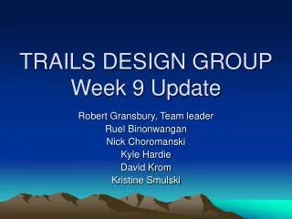

Week 9 Update on Trail Designations and Parameters by TRAILS DESIGN GROUP
E N D
Presentation Transcript
TRAILS DESIGN GROUPWeek 9 Update Robert Gransbury, Team leader Ruel Binonwangan Nick Choromanski Kyle Hardie David Krom Kristine Smulski
Trail Designations • Hiking-Pedestrian • Bicycle • Cross Country Ski • Snowmobile • Classes: • I – Smallest/hardest • II • III – Moderate • IV • V – Largest/easiest
Hiking/Pedestrian 12-124” width 25-5% grade (avg.) 0-24” clearing Bicycle 6-60” width Native to hardened surface 18-5% grade (avg.) 36-18” clearing XC Skiing 3’-10’ width (single) Ski packed or groomed 15-8% (avg.) 6’-2’ clearing Snowmobile 4’ to 10’ width User packed or groomed 20-10% grade (avg.) 8’ to 25’ turn radii Trail Parameters By Use
Hiking/Pedestrian Class 2: 18.3 mi Class 3: 1.9 mi Class 4: 4.7 mi Bicycle Class 2: 44.4 XC Skiing Class 2: 4.4 mi Class 3: 2.3 mi Class 4: 7.2 mi Snowmobile Class 2: 17.0 mi Signs: Trailheads/X-ings: 36 Trail Quantities
- locate all trails (50%) - give cost group estimates (25%) - designate trail types (75%) - designate trail classes (25%) - check grades, radii, etc. to design parameters (0%) - designate sign locations and type (25%) - locate remote campsites, not seen from trail/river/road (10%) - locate remote cabins, not seen from trail/river/road (0%) - develop winter use plan, with use conflict in mind (25-50%) - coordinate trailhead locations with other groups (25%) - Final report, presentation, drawings (10%) Group Tasks
Princess/Blair Lake Area VC Area Entrance Area