Advancements and Challenges in Coastal Hazards Science: A Comprehensive Report
This report, led by Chair Margery Overton and the Science Panel on Coastal Hazards, covers critical topics such as updated technology for erosion rate determination, innovative structural solutions, sediment compatibility, inlet hazard delineation, and the implications of sea-level rise. Participants from esteemed institutions such as ECU and UNCW provide valuable insights into the ongoing efforts to assess and mitigate coastal hazards. The report recommends maintaining and improving water level gauge networks and reassessing planning predictions every five years to adapt to future changes.

Advancements and Challenges in Coastal Hazards Science: A Comprehensive Report
E N D
Presentation Transcript
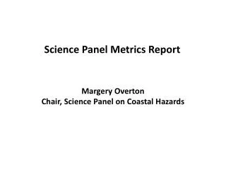
Science Panel Metrics Report Margery Overton Chair, Science Panel on Coastal Hazards
Major topics considered • Update of technology used to determine erosion rate • Determination of innovative structures • Sediment compatibility rules • Inlet hazard delineation • Inlet hazard rules • Sea level rise • Review of terminal groin study
Other participants • Mark Brinson, Dept Biology, ECU • Martin Posey, Dept Biology and Marine Biology, UNCW • Anne Deaton, Division of Marine Fisheries • Carolyn Currin, Center for Coastal Habitats and Fisheries Research • Reide Corbett, East Carolina University Geology
Literature Considered • CECW-CE Circular No. 1165-2-211 issued July 1 2009 Expire 1 July 2011 Water Resource Policies and Authorities Incorporating Sea-Level Change Considerations in Civil Works Programs. • Church, J.A., White, N. J., 2006. Geophys. Res. Lett. 33, L01602 • Fletcher, Charles H. 2009. Sea level by the end of the 21st century: A review. Shore and Beach Vol. 77 no. 4, Fall 2009. • Horton, B. P. and R. Corbett, S. J. Culver, R. J. Edwards, C. Hillier, 2006. Modern saltmarsh diatom distribution of the Outer Banks, North Carolina, and the development of a transfer function for high resolution reconstructions of sea level. Estuarine, Coastal and Shelf Science, 69, p 381-394. • Heberger, M. and H. Cooley, P. Herrera, P. Gleick, E. Moore, 2009. The Impacts of Sea-Level on the California Coast, California Climate Change Center, 115 pgs. • Jevrejeva, S. and J. C. Moore, A. Grinsted, P.L. Woodworth, 2008. Recent global sea level acceleratin started over 200 years ago? Geophysical Research Letters, Vol. 35, L08715. • Kemp, A. C. and B. P Horton, S. J. Culver, D. R. Corbett, O. van do Plassche, W.R. Gehrels, B. C. Douglas, A. C. Parnell, 2009. Geology, pp 1035 – 1038. • Kemp. A. C. and B. P. Horton, D. R. Corbett, S. J. Culver, R. J. Edwards, O. van de Plassce, 2009. Quaternary Research, 71, 9-21. • Miami-Dade County Climate Change Task Force, 2008. Statement on Sea Level in the Coming Century. 9 pgs. • NOAA Technical Report NOS CO-OPS 051. August 2009. Elevated East Coast Sea Level Anomaly: June – July 2009. 30 pgs. • Pfeffer, W. T. and J. T. Harper, S. O’Neet, 2008. Kinematic Constraints on Glacier Contributions to 21st-Century Sea-Level Rise. Scinece, vol 321, pp 1340-1343. • Rahmstorf, S, 2007. A Semi-Empirical Approach to Projecting Future Sea-Level Rise. Science, 315, pp368-370. • Vinhateiro, N. D. and P Rubinoff, 2007. The science of sea level rise: Overview and policy implications for the state of Rhode Island. 22 pgs. • Zervas, Chris, 2004. North Carolina Bathymetry/Topography Sea Level Rise Project: Determination of Sea Level Rise Trends. NOAA Technical Report NOS CO-OPS 041.
4.59 ft 3.28 ft 1.26 ft
Sea Level Rise Monitoring • To justify actions that may become necessary if sea level accelerates, it is recommended that the long-term tidal observations be maintained and new stations added to the long-term record to provide better geographic coverage of our coast. • The state should insure that our existing tide stations are maintained for the future and that new, better-distributed water level gauges are maintained or installed to develop long-term records. • Existing short-term gauges should be considered for conversion and funding support to long-term operations, to establish multiple decades for each station. • New water level gauges should be installed for a comprehensive geographic coverage. • Continued investment in geospatial topo/bathy data to capture the dynamics of the coast and to document change is needed.
When’s the next meeting? • Predicting sea level rise in North Carolina for the next century is now and will be for an extended period, an inexact exact science. Immediate actions should be guided by what we know best, the historical sea level and storm records with reasonable safety factors. • With improvements in data collection, climate science and modeling, sea level decadal to century-scale predictions should improve in the future. • The Panel recommends a general reassessment of the planning predictions every five years or more frequently should any significant breakthroughs develop.
NC DCM Coastal Construction Setback • Use aerial photography • Two dates • > 50 yr time interval • Baseline assumption 2 ft/yr (0.6 m/yr) horizontal loss • Program has approximately a 30 yr history • Established rates in early 1980’s and updated three times, 1986, 1992, 1998
Communicated and implemented using spatially averaged, blocked factors on orthophoto base maps.
Challenge • Plan for a vertical rise of 1 m (or a low of 0.4 m to a high of 1.4 m) by 2100 • At a rate of 4.27 mm/yr for the first 25 years • But that could, for example, accelerate at 0.0286 cm/yr2 resulting in a rate of 23 mm/yr 2100 • While investing in data collection and analysis of water level and topographic and bathymetric surfaces • In order to review this recommendation every 5 years because it can all change And reviewed every 5 years because it can all change
Challenge In complex three dimensional world Helena Mitasova, NCSU
Challenge that is constantly changing The core and envelope surfaces bound terrain evolution within the study period and define a 3D dynamic layer Helena Mitasova, NCSU animation by Eric Hardin