
Uploaded by
tova
44 SLIDES
576 VUES
440LIKES
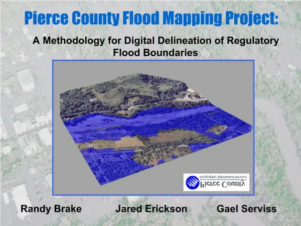
Assessing 100-Year Flood Plains in Pierce County: A GIS-Based Approach
DESCRIPTION
The Pierce County Flood Mapping Project investigates the feasibility of creating 100-year floodplain maps using digital terrain models and GIS technology. This study aims to enhance flood risk management by providing accurate floodplain data. The project includes a pilot phase, systematic data collection, and rigorous methodology. Expansion plans are discussed to improve regional flood mapping. Quality control processes ensured data accuracy, and the final report outlines both challenges faced and successes achieved in this innovative initiative.
Download
1 / 44
Télécharger la présentation 
Assessing 100-Year Flood Plains in Pierce County: A GIS-Based Approach
An Image/Link below is provided (as is) to download presentation
Download Policy: Content on the Website is provided to you AS IS for your information and personal use and may not be sold / licensed / shared on other websites without getting consent from its author.
Content is provided to you AS IS for your information and personal use only.
Download presentation by click this link.
While downloading, if for some reason you are not able to download a presentation, the publisher may have deleted the file from their server.
During download, if you can't get a presentation, the file might be deleted by the publisher.
E N D
Presentation Transcript


More Related