Download
1 / 16
160 likes | 290 Vues
The Center for Geospatial Information Services at Penn State Harrisburg is launching a web-based Geoportal to enhance the sustainability of Central Pennsylvania’s economy, ecology, and demography. This collaborative platform will allow users to discover, view, edit, and contribute valuable geographic information, shifting from traditional one-way data access to an interactive model that encourages community contribution. The Geoportal aims to centralize fragmented data, making it accessible and actionable for addressing various socio-economic challenges in the region.

E N D
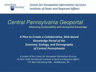
Center for Geospatial Information Services Institute of State and Regional Affairs Central Pennsylvania Geoportal Advancing Sustainability with Geospatial Knowledge A Plan to Create a Collaborative, Web-based Knowledge Portal of the Economy, Ecology, and Demography of Central Pennsylvania A project of the Center for Geospatial Information Services At Penn State Harrisburg’s Institute of State and Regional Affairs 777 West Harrisburg Pike – Middletown, PA
Center for Geospatial Information Services Institute of State and Regional Affairs What Is a Geoportal? Why Do We Need a Geoportal? What Geography Will It Cover? What Knowledge Will It Contain? Who Will Build and Maintain It? What Is the Sustainable Business Model? How Will We Get Started
Center for Geospatial Information Services Institute of State and Regional Affairs What is a Geoportal? • A web-based means for discovering, viewing, editing, and contributing information about various geographies • Users to access information by viewing a map and selecting areas of interest to explore. • Current geoportals are often “one-way” affairs and only allow users to display, print, and sometimes download information about an area. • Ours will follow the Web 2.0 paradigm and encourage users to contribute knowledge via a concept called “volunteered geographic information”
Center for Geospatial Information Services Institute of State and Regional Affairs Why Do We Need a GeoPortal? • Natural disasters, terrorist attacks, economic recessions, political sea-changes, and swings in cultural trends often initiate cascading • We have the data and the tools to recognize both the ominous signs and the opportunities for avoidance. • Unfortunately, most of the data is warehoused, stove-piped, fragmented, and otherwise inaccessible. • A geoportal, as described above, offers a promising means of tapping the data we already possess and turning it in to actionable knowledge.
Center for Geospatial Information Services Institute of State and Regional Affairs What Geography Will it Cover?
Center for Geospatial Information Services Institute of State and Regional Affairs Expandable from a single county…
Center for Geospatial Information Services Institute of State and Regional Affairs … to multi-county groups
Center for Geospatial Information Services Institute of State and Regional Affairs … to the South Central Region
Center for Geospatial Information Services Institute of State and Regional Affairs … to the Susquehanna Basin
Center for Geospatial Information Services Institute of State and Regional Affairs What Knowledge Will it Contain? • A geoportal is first, an indexed view of where things are – their absolute locations on the earth’s surface and their locations relative to each other • The geoportal will contain all the features one would expect to see on a “consumer” travel map: roads; highways; cities and towns; streams and water bodies; important commercial, governmental, recreational, and cultural features; airports and railways; topography and aerial imagery • Beyond locations the portal will open access to “attribute” information about these spatial features – environmental, economic, demographic, socio-cultural, and governmental. • Geoportal partners and collaborators will contribute new layers of information with their own domain of locations and attributes
Center for Geospatial Information Services Institute of State and Regional Affairs Who Will Build and Maintain It? • The geoportal will be built and maintained by its partners and contributors • A small staff of Penn State Harrisburg professionals who will facilitate, support, moderate, and referee content. • The Penn State Harrisburg staff will also, in collaboration with others, build the web-based geoportal “engine” and maintain user contributed data and metadata. • Much of the framework data already exists. Aerial imagery and topography; transportation networks; hydrography; and political, administrative, and census boundaries are maintained at Penn State’s PASDA and the State Data Center • Other data layers will be created and contributed by a wide range of users with interests in the region: municipalities, counties, state government, watershed and river basin organizations, local and regional authorities, and others.
Center for Geospatial Information Services Institute of State and Regional Affairs
Center for Geospatial Information Services Institute of State and Regional Affairs What Is the Sustainable Business Model? • The portal will be “financially” sustained in the following ways: • Seed funding to build the initial system and develop a critical mass for the project. • The source of this funding can be the Regional Chamber, counties and municipalities, private firms, and foundations • Long term sustainable funding will include continued contributions by the seed funders along with various levels and classes of “sponsors” and “subscribers.” • Customized and “off the shelf” map products and services will also be developed and offered to the community on a for fee basis.
Center for Geospatial Information Services Institute of State and Regional Affairs The GeoPortal Will Be A Success If It… • Creates useful functionality to the community – it becomes their “go to” site • Can offer a high value proposition to collaborators/investors – opportunity and image • Is viewed by the community as a valuable Penn State Harrisburg outreach service • Involves a broad cross-section of Penn State Harrisburg faculty/staff • Can help to further the community presence of Penn State Harrisburg • Can help improve the quality of life in South Central Pennsylvania
Center for Geospatial Information Services Institute of State and Regional Affairs How Do We Get Started? • Assemble small team of “outward energy” collaborators – (community/political) • Assemble small team of “inward energy” collaborators -- (technology professionals) • Development presentation for introduction and promotion to community • Build small prototype application that can be used to demonstrate the concept • Recruit project partners/investors to support initial development • Evolve the working prototype into a full-functioning model • Promote to the broader community and begin to recruit knowledge contributors • Build sustaining energy within community – users, contributors, financial supporters
Center for Geospatial Information Services Institute of State and Regional Affairs QUESTIONS? Brady M. Stroh, Director Center for Geospatial Information Services ISRA – Penn State Harrisburg Phone: 717-948-6428 Email: bms16@psu.edu or bradystroh@gmail.com