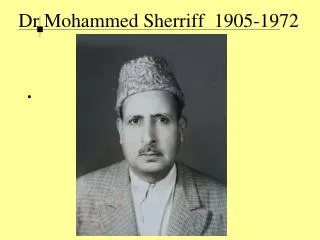
Dr. Mohammed Kamal Tolba Ewida
320 likes | 685 Vues
Real-Time Remote Sensing for Early Warning & Mitigation of Disasters & Epidemics: The Kamal Ewida Earth Observatory (KEEO) SfP 983168 PPD : Prof. Dr. Magdy Abdel Wahab – Cairo University, Egypt NPD : Gilbert L. Rochon, Ph. D.,MPH – Purdue University, USA.

Dr. Mohammed Kamal Tolba Ewida
E N D
Presentation Transcript
Real-Time Remote Sensing for Early Warning & Mitigation of Disasters & Epidemics: The Kamal Ewida Earth Observatory (KEEO) SfP 983168 PPD: Prof. Dr. Magdy Abdel Wahab – Cairo University, Egypt NPD: Gilbert L. Rochon, Ph. D.,MPH – Purdue University, USA Presentation before the NATO SfP Expert Panel on Environmental Security- NATO HQ Brussels, Belgium June 2, 2008
Dr. Mohammed Kamal Tolba Ewida • Dean, Faculty of Engineering- Zagazig University, Sharkia, Egypt • Delegate from Egypt to the NATO CCMS Pilot Study on Clean Products & Processes • Project Coordinator, 1st Phase- eLearning System for Water & Environmental Studies (eSWES) Departed Nov. 4, 2006
NATO Science for Peace Project • REAL-TIME REMOTE SENSING FOR EARLY WARNING & MITIGATION OF DISASTERS & EPIDEMICS • Geostationary Groundstation at Al Azhar University – European Space Agency’s Meteosat • Tracking Groundstation at Cairo University for NOAA AVHRR, NASA Terra MODIS & Aqua MODIS, Chinese Space Agency’s FENG YUN, INPE-Brazil’s CBERS & Egypt-NARSS EgyptSat I
NATO SfP KEEO Project Team Right to Left: M.Shokr (Environment Canada) Magdy Wahab (PPD-Cairo U.) M. Atef (Aero/Astro-Cairo U.) Gülay Altay (KOERI) G.Rochon (NPD-Purdue U.) Okan Ersoy (Purdue U.) Gamal El Afandi(COO-Al Azhar U.)
Mitigation Problems to be Addressed • Natural Disasters • Earthquakes • Storms & Flooding • Wild Fires • Drought & Desertification • Epidemics & Epizootics • Crop Failure, Famine & Food Insecurity • Anthropogenic Disasters • Unintentional • Oil & Chemical Spills • Air Pollution & Water Pollution • Deliberate • Terrorist Incidents
Disaster Management Stages:Remote Sensing Contributes at each Stage • Vulnerability Assessment & Remediation • Disaster Preparedness, Drills & Simulations • Early Warning • Emergency Response, Search & Rescue • Humanitarian Relief • Recovery • Post-Disaster Reconstruction
Current Status of Technology • EgyptSat I • Existing Groundstations • Need for Academic Community Access • Fiber Optic Backbone Among Egyptian Universities • Archival & Real-Time Data • Collaborative Ties with other Data Providers, Spatial Data Scientists & End-Users within Governmental Ministries, Multi-Lateral Agencies & Universities
Goals of the Project • To establish two groundstations for real-time satellite remote sensing in Cairo, Egypt, a geostationary groundstation for ESA Meteosat at Al Azhar University and a tracking groundstation at Cairo University, initially for NOAA AVHRR, NASA MODIS Terra & Aqua and EgyptSat I. • To provide training for faculty, students and Ministry staff & scientific curricular enhancement for utilization of this technology for disaster mitigation, food security, disease vector habitat monitoring and environmental sustainability. • To collaborate with end-users in research and in supporting operational disaster management & data product dissemination.
Novel Characteristics • Provides real-time data from satellite remote sensing to Egypt’s academic community for the first time. • Establishes critical redundancy during over-flight conflicts for data acquisition with Egypt’s National Authority for Remote Sensing & Space Sciences • Enables Research on Vulnerability Assessment & Best Management Practices for Disaster Mitigation, Early Warning, Humanitarian Response & Recovery within the Egyptian & Regional Contexts • Provides training and career opportunities for faculty & students addressing applications of space-based technologies for sustainable development, food security & public safety at two Egyptian Universities, with a combined total enrollment of 700,000 students.
Scientific Activities • Collaborative research between the NATO SfP Partnering Universities and the WHO Regional Office, based in Cairo, to integrate real-time remote sensing & meteorological data with medical ecology data and epidemiological data, so as to identify, map and monitor infectious disease vector habitat, for timely intervention. • Collaborative interdisciplinary research on the contributing causes , potential mitigating factors & best management practices associated with an array of biogenic & anthropogenic disasters & on the optimal use of remote sensing tools.
Deliverables/Milestones • Bid Specifications/Solicitation & Installation of Groundstations in first quarter of 2009. • Implementation of Data Dissemination & Collaborative Research with Ministries, Multi-Lateral Agencies and Academic Departments. • Relevant Curricular Enhancement &Training for Faculty, Students & End-Users • Development of a Hub for Broader Access to Near-Real-Time Data Product Distribution • Video Documentary on the NATO SfP KEEO Collaboration among institutions in Egypt, Turkey & the USA.
Quantified Criteria for Success • Successful Vendor Selection and Installation of 2 Groundstations during First Quarter, 2009. • Real-Time Acquisition of ESA Meteosat Data 24 hrs./day 7 days/week • Real-Time Acquisition of data from at least 3 polar orbiting satellites (e.g NASA MODIS Terra & Aqua, NOAA AVHRR, CBERS, Feng Yun & EgyptSat I) & Near-Real-Time Data Transfer • Operational Data Utilization by 2 Ministries and 1 UN Agency for Disaster Mitigation.
Quantified Criteria for Success Continued • Training Established for 5 end-users, 10 faculty and 40 students in application of remote sensing applications for disaster mitigation • 10-15 minute video documentary completed on the collaboration among NATO sponsored universities in Egypt, Turkey and the USA with their regional end-users of remotely sensed data for disaster early warning & mitigation. • A Disaster-Mitigation Hub established in FY 2 • Publication of 2 peer reviewed journal articles and presentation at 2 major conferences/year
Institutes Involved & Their Expertise • Cairo University – Giza, Egypt • Meteorology, Storms, Flooding • Aerospace Engineering, Technology & Applications • Al Azhar University – Nasr City, Egypt • Meteorology, Drought, Desertification • Environmental Hazard Remediation • Boğaziçi University – Istanbul, Turkey • Kandilli Observatory & Earthquake Research Institute • Disaster Monitoring, Mitigation & In Situ Sensing • Purdue University – W. Lafayette, Indiana, USA • Purdue Terrestrial Observatory & Public Health Applications • Remote Sensing & High Performance Computing • Sustainable Development & Environmental Sustainability
Cairo University • Centennial Anniversary on Dec. 21, 2008 • Student Enrollment 200,000 • Partner Country Project Director-PPD: Prof. Dr. M. Magdy Abdel Wahab, Chair, Dept. of Meteorology & Astronomy, Faculty of Science
Al Azhar University was founded 988 A.D.- 1,020 years old in 2008 2nd oldest continuous university after the University of Al Karaouine in Fes, Morocco, [859 A.D.]. • Multi-Campus Student Enrollment: 500,000 • Project Co-Director: Dr. Gamal El Afandi, Dept. of Meteorology & Astronomy, Faculty of Science • Al Azhar University
Boğaziçi University- Kandilli Observatory & Earthquake Research Institute (KOERI) • Founded in 1868 in Istanbul, Turkey, during the reign of Abdülâziz, the 32nd Sultan of the Ottoman Empire • Project Co-Director, Prof. Dr. Gülay Altay, Director, KOERI
Purdue University-W. Lafayette, Indiana USA Founded 1869 69,000 students Multi-Campus NATO Country Project Director (NPD): Dr. Gilbert Rochon Co-Director: Dr. Okan Ersoy • Purdue Terrestrial Observatory
Project Management KEEO ADVISORY BOARD
Collaborators/End-Users • Dr. Mohamed A. Fawzi, Director, Crisis & Disaster Management Sector, Office of the Prime Minister • Prof. Dr. Ayman El-Dessouki, Chairman National Authority for Remote Sensing & Space Sciences (NARSS) & Eng. Belal M. Elleithy, Ground Receiving Manager, NARSS • Prof. Dr. Ayman Abu Hadid, President, Agricultural Research Center
Collaborators/End Users • Altaf S. Musani, MPH,Regional Advisor, Emergency Preparedness & Humanitarian Action, WHO • Babiker Abdalla Ibrahim, Ph.D., Regional Project Coordinator (Egypt, Sudan & Ethiopia) Flood Preparedness & Early Warning-Eastern Nile Technical Office (ENTRO) • Prof. Dr. Mostafa M. Emara, Director, Science Center for Detection & Remediation of Environmental Hazards (SCDREH) Al Azhar University • Prof. Dr. Mortada Mourad El-Aref, Director, Basel Convention Regional Training Center & Director, Cairo Univ. Center for Environmental Hazard Mitigation
End-Users & Their Contributions • NARSS- Egypt’s Space Agency is contributing the expertise of its Aswan Ground Station Manager, access to data from EgyptSat I, joint sharing of data archives & critical redundancy in data collection for orbital conflicts & disaster mitigation. • Ministry of Agriculture’s Agricultural Research Center is offering access to their laboratories for ground reference information (e.g. analysis of soil, vegetation, water & insect vector samples).
End-Users/Collaborators • Office of the Prime Minister- is committed to fully integrating data from the NATO SfP KEEO into their disaster planning, simulation, mitigation & response activities & to provide fellowships for junior faculty and internships for students to obtain operational experience and service learning. • The WHO Regional Office has welcomed the KEEO team to collaborate in research to develop a spatial database incorporating real-time data on disease vector habitat. • ENTRO will partner with KEEO on its World-Bank supported Nile Flooding project, sharing data & technical personnel.
Distribution of NATO SfP Funding EGYPT: 255K Euros TURKEY: 22.5K Euros USA: 22.5K Euros TOTAL: 300K Euros
How Possible NATO Funding will change the previous research at the partnering Universities in Egypt • Cairo University • Greatly encourage multi-disciplinary research & a focus on remote sensing applications for disaster preparedness & environmental hazards, jointly with the Basel Convention. • Al Azhar University • Significantly impact closer ties among faculties &departments as well as stronger interactions with UN agencies/governmental ministries for applied research collaborations & simulation exercises.
PROJECT STRENGTHS & OPENESS ISSUES • The project benefits from a coalition of exceptionally strong research universities in Egypt, Turkey & the USA • The project has established high level commitment from key government ministries in Egypt, regional offices of the UN and established operatives in both the remote sensing & disaster mitigation communities. • The project is offering its raw data freely to other universities & will develop a hub for wide dissemination of standard data products
PROJECT’S CONTRIBUTION TO STABILITY, SECURITY & PEACE • NATO SfP support of this KEEO project will directly enable: • Real-time remote sensing applications for a wide array of time-critical events, including natural and man-made disasters, public health emergencies, and food security issues • Closer on-going collaboration between the academic community, governmental ministries and multi-lateral agencies charged with public safety, peaceful resolution of conflict, regional environmental sustainability and sustainable development.
Equal Opportunity Technology: Applications in Africa, Asia & Latin America • Famine Early Warning (FEWS) Project & Food Security • Africa Real-Time Environmental Monitoring Information System (ARTEMIS) • African Association for Remote Sensing of Environment (AARSE) • Precision Agriculture & Water Resources Conservation • Coastal Zone Morphology • Regional Impact of Climate Change • Forest Resource Assessment • Biodiversity & Natural Resource Management • Sustainable Industrial Development Infectious Disease Vector Habitat Identification
http://modland.nascom.nasa.gov/gallery/ ?Korea.A2000097.0235.825x1075.jpg MODIS Image: April 6, 2000 Korea 36 Bands Moderate Resolution Imaging Spectro-Radiometer (MODIS)
NOAA AVHRR- UN FAO- ARTEMISFEWS & Desert Locust-Schistocerca gregaria • DOC NOAA- US Dept of Commerce, National Oceanic & Atmospheric Administration • AVHRR – Advanced Very High Resolution Radiometer HRPT – High Resolution Picture Transmission • GAC- Global Area Coverage (4 km) • LAC- Local Area Coverage (1.1 km) UN FAO ARTEMIS