Download
1 / 29
290 likes | 434 Vues
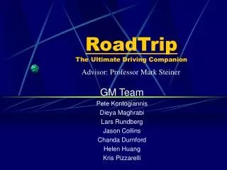
RoadTrip The Ultimate Driving Companion. Advisor: Professor Mark Steiner. GM Team Pete Kontogiannis Dieya Maghrabi Lars Rundberg Jason Collins Chanda Durnford Helen Huang Kris Pizzarelli. GM Project Concept.

E N D
RoadTripThe Ultimate Driving Companion Advisor: Professor Mark Steiner GM Team Pete Kontogiannis Dieya Maghrabi Lars Rundberg Jason Collins Chanda Durnford Helen Huang Kris Pizzarelli
GM Project Concept A GPS Based In-Vehicle Navigation System that not only plans a route or guides a driver along the route, but a system that is also capable of presenting varying levels of driving information, communication information, and internet access to the vehicle operator and passengers.
Concept Proposal We propose to design and prototype an in-vehicle navigation system that consists of a GPS unit, a laptop pc, a cellular modem, Java based mapping software, an MS Access database of local information, and a small display of LEDs with the associated hardware components. This system will be capable of reacting to GPS coordinate based triggers which will in turn activate information display windows, the LEDs (to simulate a display system), and possibly a text to speech function.
System Design Techniques • Top Down System Engineering approach • Object Oriented software design using the Unified Modeling Language (UML) • Human Factors approach to information push/pull strategy • Data normalization with relational databases • Continuous design feedback and improvement
Road Information Speed limit # of lanes Road signs One way/two way Traffic Construction areas Road type Toll/Non-toll Restrictions Weather Information Temperature Precipitation Wind Mapping Route guidance Compass Turn indication Distance to Waypoint/Destination Driver Informational Needs
Banks/ATMs Gas/Service Stations Rest Stops Police/Fire/EMS Hospitals Restaurants Hotels/Motels Camping Toll Stations Driver Informational Needs Services
System Needs: • Link GPS coordinates with Real-Time Moving Map • Link GPS coordinates to information populated database • Present information to driver and occupants in a usable format • Cellular communication
System Requirements: GPS Unit • Shall connect to laptop pc through a RS-232 Serial Port • Shall be capable of providing RTCM SC-104 standard GPS coordinates • Shall be capable of long term use in a +12VDC mobile environment
System Requirements: Laptop PC • Shall be capable of running Real-Time Mapping Software • Shall have a RS-232 Serial Port • Shall have a Parallel Port • Shall be capable of long term use in a +12VDC mobile environment
System Requirements: Cellular Modem • Shall be capable of being operated by Java based software • Shall be capable of data and voice communications • Shall be capable of operating with Win2K Server through a Type II PCMCIA card slot
System Requirements: Software • Shall be capable of running properly on a Windows 2000 Server equipped laptop pc • Shall be capable of accepting RTCM SC-104 GPS coordinates from a RS-232 Serial Port • Shall be capable of interfacing with MS Access databases • Shall be capable of presenting information on the laptop screen in addition to the Real-Time Moving Map
System Requirements: Software Continued • Shall be capable of outputting digital high/low signals through the parallel port • Shall be available with source code • Shall be capable of being modified and re-compiled • Shall be capable of using scanned maps
Requirement Based Technology GPS Unit Garmin StreetPilot ColorMap GPS Unit • Connects to PC through a RS-232 Serial Port Connection • Outputs RTCM SC-104 standard GPS coordinates • Capable of long term operation in a +12VDC mobile environment
Requirement Based Technology Laptop PC Dell Inspiron 7000GT Laptop PC with Windows 2000 Server • Capable of running any Real-Time Moving Map software produced for Windows 2000 • Possesses both an RS-232 Serial Port and a Parallel Port • Capable of long term operation in a +12VDC mobile environment
Requirement Based Technology Cellular Modem GlobeWave Wireless Modem • Capable of running on Win2K Server equipped laptop through the Type II PCMCIA card slot • Capable of communication via Java based software
Requirement Based Technology Software EPS: The Elgaard Positioning System Version 0.8.5 (Java) • Available with source code • Capable of being modified and re-compiled • Capable of using scanned maps • Accepts RTCM SC-104 standard GPS coordinates
Requirement Based Technology Java Based Software • Runs on Win2K Server equipped Laptop PC • Capable of interfacing with MS Access databases • Capable of presenting information on Laptop PC screen in addition to the Real-Time Moving Map • Capable of sending digital high/low signals through the Parallel Port
Prototype Hardware • Dell Inspiron 7000GT Laptop PC • Garmin StreetPilot ColorMap GPS Unit • Cellular Modem (PCMCIA) • Scanner • Parallel and serial cables • LEDs and associated hardware
Software • MS Windows 2000 Server • MS Access 2000 • Sun Java 2 Standard Development Kit • MS Internet Explorer • Scanning Software
Prototype Cost • Laptop PC with MS Win2K, MS Access, and MS Internet Explorer (Possess): $0 • GPS Unit with cables: $699.95 • GlobeWave Wireless Modem $449.95 • LEDs and associated hardware: Under $150 • EPS GPS Software (Free): $0 • Sun Java 2 SDK (Free): $0 • Scannable maps: Under $50 • Scanner and scanning software (RPI ACS): $0 • Other (Mounting hardware, etc): Under $100 • TOTAL COST APPROXIMATELY $1500
Work Breakdown Lars Rundberg Industrial and Management Engineering • Project Leader/Manager • Java software modification • Simulated display hardware design • Overall system integration lead • IME Design requirements
Work Breakdown • Pete Kontogiannis • Industrial and Management Engineering • Relational Database design • Data normalization • Database population • Statistical analysis of user feedback • IME Design requirements
Work Breakdown • Dieya Maghrabi • Industrial and Management Engineering • Relational database design • Data normalization • Database population • IME Design requirements
Work Breakdown • Chanda Durnford • Transportation Engineer (Civil) • GPS data farming • GPS data resourcing • GPS integration • Troy locality information farming • Civil Engineering Capstone requirements
Work Breakdown • Helen Huang • Transportation Engineer (Civil) • GPS data farming • GPS data resourcing • GPS integration • Troy locality information farming • Civil Engineering Capstone requirements
Work Breakdown Jason Collins Information Technology • Java software modification • Design documentation management • GM Team website administrator • Information Technology Capstone requirements
Work Breakdown Kris Pizzarelli Mechanical Engineer • Human factors design adherence for the overall system and information presentation • Relational database design • Individual study requirements
Thank You The GM Team “Guiding the driving future”