Download

1 / 11
110 likes | 351 Vues
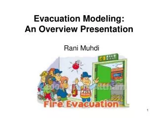
Evacuation Modeling. Ava Damri, Calvin Smellage, Al Zinkand. Introduction. Model for planning an evacuation of the Gulf Freeway area prior to a hurricane Chain of cities from Galveston to Houston Prospective users: FEMA, TXDoT Account for situational requirements

E N D
Evacuation Modeling Ava Damri, Calvin Smellage, Al Zinkand
Introduction • Model for planning an evacuation of the Gulf Freeway area prior to a hurricane • Chain of cities from Galveston to Houston • Prospective users: FEMA, TXDoT • Account for situational requirements • Network flow model used for solution • Model will be expanded to reflect real world complexities
Problem Statement • Create a scalable model to minimize the evacuation time of the I-45 Corridor • Test the impact of decisions involving on-ramp control, lane reversals, population distribution, and related assumptions
Solution Assumptions • 3 persons per vehicle • Highway capacity of 2,400 cars per lane per hour • On-ramp capacity of 250 cars per hour • Flow free of traffic accidents • Vehicles limited to civilian cars • Approximately 10 minutes of travel time between cities
Solution Solution Multiperiod, Unidirectional Network Flow Model • Implemented in an optimization modeling language • Creates links between cities • Subdivided into time periods • Subject to on-ramp & highway capacity • Based on flow conservation • Cars coming in = Cars going out
Multiperiod, Unidirectional Network Flow Time 1 Time 2 Time 3 Time 4 Time 5 Population Pool Galveston (19,000 cars) Staying Evacuating Evacuating Population Pool Stranded Texas City (15,000) Staying Evacuated to Houston
Multiperiod, Unidirectional Network Flow Time 1 Time 2 Time 3 Time 4 Time 5 Population Pool Galveston (19,000 cars) C=1 C=10 C=… C=99 Flow ≤1,000 Population Pool Stranded Texas City (15,000) Evacuated to Houston
Analysis • No “waiting” vehicles • 100% evacuation • On-ramp capacity is limiting factor • Southern cities given “priority” • Highway system is sufficient
Current Functionality • Full-scale, working model • Successfully evacuates populations • Expandable • Accounts for: • Initial populations • Highway capacities • On-ramp capacities • On-ramp control • Maximizes the number of safe people
Future Functionality • Further Research • Lane reversal • Emergency vehicles • Off-ramps • Fuel coordination • Embedded safety zones • Cost scheduling
Next Steps • Apply real-world traffic data from TXDoT • Incorporate results of further research • Demonstrate the value of mathematical modeling in planning city evacuations