Download
1 / 18
180 likes | 289 Vues
Learn how GIS technology revolutionized the Florida Department of Health, from the SUPER Act Program to Enterprise GIS integration, showcasing the growth, benefits, and future prospects of GIS within the organization.

E N D
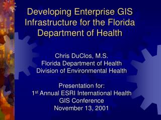
Developing Enterprise GIS Infrastructure for the Florida Department of Health Chris DuClos, M.S. Florida Department of HealthDivision of Environmental Health Presentation for: 1st Annual ESRI International HealthGIS Conference November 13, 2001
The History of GIS at Florida DOH - The SUPER Act Program • SUPER Act = State Underground Petroleum Environmental Response Act (NOT federal Superfund program) • Created in 1986 by Florida Legislature; samples wells around contaminated petroleum facilities • Florida has ~23,000contaminated facilities
GIS & GPS to the Rescue! • Handheld computers with GPS units used to record attribute data & Latitude/Longitude • Data is exported fromhandheld to database • GPS Database connectedto ArcView GIS software • ArcView used to produce hardcopy maps • GIS Analyst hired to improvebasemap data layers
GIS Grows from SUPER Act Program to the Entire Bureau GIS Analyst for SUPER Act gave presentations highlighting how other programs in the Bureau of Environmental Epidemiology can benefit from GIS Other programs agreed to participate in GIS (esp. childhood lead, pesticides, epi surveillance) Bureau agreed to standardize on ESRI products to save money and facilitate data sharing Two high-profile GIS projects led to a period of expansion
Division ofEnvironmental Health GIS The Bureau of Environmental Epidemiology’s GIS Analyst became the Division’s GIS/GPS Coordinator The GIS/GPS Coordinator visited with all programs in all five bureaus to promote GIS The GIS/GPS Coordinator expanded GIS in the Division and created a Department-wide GIS Workgroup The GIS Workgroup grew to over 75 members
The GISWorkgroup GIS users in other Divisions became more educated By participating in the DOH Workgroup, employees received access to GIS data housed on Environmental Health server Demand increased beyond the ability of Environmental Health to support The Division of Information Technology finally took notice…
GIS Standards Discussion Group • Formed from larger GIS Workgroup • Standards drafted by Discussion Group and then revised several times • Comments and suggestions accepted from larger GIS Workgroup • Final revisions made and submitted to the Department of Health’s Information Technology Standards Workgroup
Integrating GIS as Partof the Enterprise IT asks Environmental Health to submit a plan for Enterprise GIS EH had a vested interest because we needed to modernize GIS resources Enterprise GIS as part of an Integrated Health Information System (IHIS) IT hires a GIS Consultant to get the Enterprise plan moving
Enterprise GIS Resources - Data • Geographic Data Technologies Dynamap 2000 • Florida Geographic Data Library (from University of Florida GeoPlan Center) • 1994/95 and 1999 USGS Aerials • USGS Digital Raster Graphics (DRGs) - scanned quadrangle maps • Program Databases
Enterprise GIS Resources - Software ArcGIS 8.1(ArcView & ArcInfo) ArcIMS ArcExplorer Accumail AddressValidation/CleanupSoftware
Ongoing Support Desktop Support for ArcGIS Updating ArcIMS websites Documenting Data Backup Requirements and Operational Support Requirements Establishing Security Access Profiles and System Problem Notification Procedures
Training Issues Workgroup meetings Local training options Onsite training Cooperation withother governmentagencies to holdjoint training