Extratropical Transition: One Trajectory through a Cyclone Phase Space
290 likes | 541 Vues
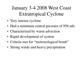
Extratropical Transition: One Trajectory through a Cyclone Phase Space. 2 May 2002 Robert Hart and Jenni Evans Department of Meteorology Penn State University. http://eyewall.met.psu.edu/cyclonephase/. http://eyewall.met.psu.edu/cyclonephase/. Which 5 are officially tropical cyclones?.

Extratropical Transition: One Trajectory through a Cyclone Phase Space
E N D
Presentation Transcript
Extratropical Transition: One Trajectory through a Cyclone Phase Space 2 May 2002 Robert Hart and Jenni Evans Department of Meteorology Penn State University http://eyewall.met.psu.edu/cyclonephase/ http://eyewall.met.psu.edu/cyclonephase/
Which 5 are officially tropical cyclones? Images courtesy NOAA/NCDC
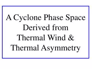
Generalized, continuum approach to describing cyclone structure proposed schematically by Beven (1997) and also recently suggested by Reale and Atlas (2001). • Objectively defined phase diagram proposed in Hart (2002, MWR and Poster P1.28). • Provides considerably more freedom than two discrete groups of tropical, extratropical cyclones • Cyclones described here using objective physically insightful parameters Cyclone phase diagram
Cyclone Parameter B: Thermal Asymmetry • Storm-relative 900-600hPa mean thickness field (shaded) asymmetry within 500km radius: 3160m 3260m L
Cyclone Parameter B: Thermal Asymmetry Forming (B0) Mature(B0) Decay(B0) Conventional Tropical cyclone: B 0 L L L Developing(B>>0) Mature(B>0) Occlusion(B0) Conventional Extratropical cyclone: B varies L L L
Warm-core example: Floyd 14 Sep 1999 Cyclone Parameter -VT: Thermal Wind Focus here on 900-600hPa -VTL >> 0
Cold-core example: Cleveland Superbomb 26 Jan 1978 Cyclone Parameter -VT: Thermal Wind Focus here on 900-600hPa -VTL << 0
Cyclone phase diagram: B Vs. -VTL Asymmetric cold-core Asymmetric warm-core Symmetric warm-core Symmetric cold-core
Extratropical transition (NHC) Rapid movement & trough interaction Category 4 TC Case example: Hurricane Floyd (1999) Track image from NHC Best-Track Analysis/web page
1200 UTC 9 Sept 1999 Phase diagnosis: symmetric, moderately strong warm-core Asymmetric cold-core B Asymmetric warm-core Symmetric cold-core Symmetric warm-core • NHC Best-track: Tropical Storm 1000hPa /45knots -VTL
0000 UTC 15 Sept 1999 Asymmetric cold-core B Asymmetric warm-core • Phase diagnosis: very strong, symmetric warm-core Symmetric cold-core • NHC Best-track: Hurricane 933hPa /115knots -VTL
0000 UTC 16 Sept 1999 Asymmetric cold-core B Asymmetric warm-core • Phase diagnosis: extratropical transition begins Symmetric cold-core • NHC Best-track: Hurricane 950hPa /90knots -VTL
1200 UTC 16 Sept 1999 Asymmetric cold-core B Asymmetric warm-core • Phase diagnosis: hybrid cyclone Symmetric cold-core • NHC Best-track: Hurricane 967hPa /70knots -VTL
1200 UTC 17 Sept 1999 Asymmetric cold-core B • Phase diagnosis: extratropical transition completion Symmetric cold-core -VTL • NHC Best-track: Extratropical 984hPa /45knots
1200 UTC 19 Sept 1999 Asymmetric cold-core B • Phase diagnosis: asymmetric, cold-core Symmetric cold-core -VTL
Erin (2001): NGP Michelle (2001): AVN Recent transition cases of similar trajectory but varied analysis, geography & season Vance (1999): NGP
Summary • Extratropical transition is correctly identified within the phase space as the conversion:symmetric/warm-core asymmetric cold-core • Objective diagnoses (and forecast guidance when applied to model output) for the commencement & completion of extratropical transition possible • Allows for comparison to satellite & model diagnostics presented by Harr & Elsberry (2000) and Klein et al. (2000)
Summary • The reverse (subtropical or tropical) transition can also be diagnosed or forecast by also looking at –VTL Vs. -VTU: Karen, Olga, Noel (2001) • Phase diagrams are being produced in real-time and were used experimentally by CHC, NHC during the 2001 season: http://eyewall.met.psu.edu/cyclonephase • Intercomparison of phase diagrams from many forecast models may provide measure of lifecycle predictability & uncertainty ensembling
Future work • Further dynamical insight provided by other measures? e.g. Thermal vorticity (Darr 2002) • Examine phase predictability • Impact of synthetic bogus on phase evolution: • Delay or acceleration of transitions?
Future work • Can phase diagram be used to indicate when bogussing should cease? • Synoptic evaluation of common trajectories • Dynamics evolution along phase trajectory • Dynamics of hybrid cyclones
Acknowledgments • Penn State University: Jenni Evans, Bill Frank, Mike Fritsch, Nelson Seaman • SUNY Albany: Lance Bosart, John Molinari • University of Wisconsin/CIMSS: Chris Velden • National Hurricane Center (NHC): Jack Beven, Richard Pasch, Miles Lawrence, Lixion Avila • Canadian Hurricane Center (CHC): Pete Bowyer • Lawrence Livermore National Lab: Mike Fiorino • NCDC: Satellite imagery • NCEP: Real-time gridded analyses & forecasts • NCAR/CDC: NCEP/NCAR Reanalyses
Unnamed TC (1991) Michael (2000) Images courtesy NCDC “Perfect” Storm (1991) Noel (2001) President’s Day Blizzard (1979) Extratropical Low Floyd (1999) Superstorm of 1993 Gloria (1985)
Cyclone parameter -VT: Thermal Wind e.g. 700hPa height ZMAX 500km Z = ZMAX-ZMIN: isobaric height difference within 500km radius Proportional to geostrophic wind (Vg) magnitude Z = d f |Vg| / g where d=distance between height extrema, f=coriolis, g=gravity ZMIN Vertical profile of ZMAX-ZMIN is proportional to thermal wind (VT) if d is constant: 900-600hPa: -VTL 600-300hPa: -VTU -VT < 0 = Cold-core, -VT > 0 = Warm-core
Other Paths to Transition: Extended hybrid status. Gabrielle (2001) Charley (1986) Results from competing forcings driving vertical structure change: 1. Trough interaction can drive asymmetric/cold-core development 2. Gulf stream can drive symmetric/warm-core development Hybrid structure maintained over several days until one ultimately dominates or dissipation occurs
-VTU Tropical transition completes when –VTU > 0 (tropical status) Tropical transition begins when –VTL > 0 (subtropical status) -VTL Cold-to-warm core transition: Tropical Transition of Hurricane Olga (2001) -VTU Vs. -VTL -VTU Vs. –VTL can show tendency toward a shallow or even deep warm-core structure when conventional analyses of MSLP, PV may be ambiguous or insufficient.
B -VTL Symmetric warm-core evolution:Hurricane Mitch (1998) B Vs. -VTL SYMMETRIC WARM-CORE
B -VTL Asymmetric cold-core evolution: Extratropical Cyclone B Vs. -VTL Increasing B as baroclinic development occurs. After peak in B, intensification ensues followed by weakening of cold-core & occlusion.
Cold-core phase diagnosis compared to NHC ET declaration1979-1993 ECMWF 1.125° Reanalysis [60 storms]