Download
1 / 34
340 likes | 428 Vues
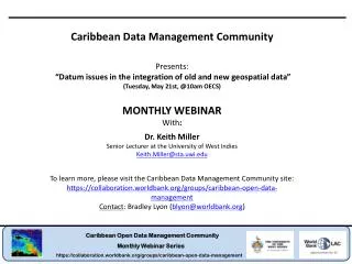
Caribbean Data Management Community Presents: “ Datum issues in the integration of old and new geospatial data ” (Tuesday, May 21st, @10am OECS) MONTHLY WEBINAR With : Dr. Keith Miller Senior Lecturer at the University of West Indies Keith.Miller@sta.uwi.edu

E N D
Caribbean Data Management Community Presents: “Datum issues in the integration of old and new geospatial data” (Tuesday, May 21st, @10am OECS) MONTHLY WEBINAR With: Dr. Keith Miller Senior Lecturer at the University of West Indies Keith.Miller@sta.uwi.edu To learn more, please visit the Caribbean Data Management Community site: https://collaboration.worldbank.org/groups/caribbean-open-data-management Contact: Bradley Lyon (blyon@worldbank.org)
Presentation plan • Principles - models of the Earth • Uniqueness of traditional datum definition. • Need for an international datum • Issues associated with moving spatial data between datums • Horizontal • Vertical • Support in geospatial data management through UWI
Earth gravity and potential Level surface - a surface of constant potential. Level surfaces are not parallel and do not cross. Gravitational acceleration – rate of change of potential along a plumb line.
The Geoid as a reference surface Geoid - a surface of constant potential corresponding to Mean Sea Level • A surveyor levels an instrument on a physical level surface. • Latitudes and longitudes measured independently do not provide relative data about two points. • Level surfaces are not suitable for mapping purposes
The Spheroid as a reference surface Spheroid – an ellipse rotated about the pole that approximates the geoid. Different people measured the shape of the Earth in different parts of the World to produce different results.
Spheroids of the Americas There are over 150 different spheroids defined worldwide. Some of those for the Americas as computed by Clarke are: There is some confusion over which of the 27 different definitions of the foot Clarke used.
Defining a datum point A point observed on a level surface is made equivalent to coordinates on the spheroid The spheroid is connected to the level surface at this point, so differentdatums place the spheroid differently in space.
Importance of metadata • The Naparima datum of Trinidad uses the International 1924 spheroid, with Naparima Hill as the datum point. • Observed astronomical coordinates, and hence location of this point on the Naparima datum are: 1016’44.860” North 6134’22.620” West • The Provisional South American Datum of 1956 uses the International 1924 spheroid and has La Canoa in Venezuela as its datum point. • The coordinates of Naparima Hill, Trinidad on PSAD56 are: 1017’02.416”North 6127’22.606” West • The same point is displaced by some 650 metres, yet both coordinates are correct. • Coordinates must be supported with datum information.
A datum is provided by: • A point in latitude and longitude. • Definition of a spheroid. • Orientation by direction to another point. • Scale by measuring a distance. Triangulation extends the framework across the land mass with points being marked.
Abbreviations used • NAD 1927 is the North American Datum 1927 which has an origin at Meades Ranch (3913’26.686” North, 9832’30.506” West) and uses the Clarke 1866 spheroid. • British West Indies TM is the Transverse Mercator projection that was implemented by the Directorate of Overseas Surveys of Great Britain for the West Indies. It has a central meridian of 62, a scale factor at this longitude of 0.9995, a latitude of origin at the equator and a false Eastings of 400km.
Traditional datums are unique • There is no spatial relationship between datum points. Each was determined independently on a level surface. • Until recent times a datum could only be transferred between land masses when a line of sight existed.
Need for a seamless World • Modern satellite positioning systems operate globally. • GIS and remote sensing provide global data sets and applications that operate seamlessly between land masses.
A Global Spheroid • Gravity data obtained from satellite motion has provided better definition of the geoid globally. • A global best fitting spheroid to the geoidwas adopted for use with GPS: the World Geodetic System of 1984 (WGS84) with: • a = 6378137m, and 1/f = 298.257223563
Transforming between datums • In the horizontal component, a number of methods exist: • Affine – used locally on the projection plane, implemented within GPS processing software, requires observation of local control • 3 parameter (block shift) – ΔX, ΔY, ΔZ commonly used, assumes that axis of the spheroids adopted within datumsare aligned. • Molodensky – ΔX, ΔY, ΔZ, δa, δfin practice offers no benefit over the 3 parameter, but is implemented in many hand held receivers. • Bursa-Wolf (7 parameter ) – ΔX, ΔY, ΔZ, rX, rY, rZ, s accommodates rotations and scale. • Molodensky-Badekas– ΔX, ΔY, ΔZ, rX, rY, rZ, s and an origin. Improves computation of parameters, but will offer the same results as Bursa-Wolf.
Determining parameters Existing control is observed with GPS so that coordinates of points are known in both datums. • In Barbados, 2 GPS campaigns were undertaken with some points included in both to obtain an indication of accuracy of GPS observations. Note that GPS is more accurate in the horizontal component. Resulting parameters are used only for horizontal transformations.
Co-located points Point data for Barbados as numeric values for 16 control points used to compute parameters offers redundancy. Resulting parameters are applied to this data for assessment. The histogram shows that some points do not conform with the general trend.
Issues with existing control • Control in the Caribbean was typically observed in the 1960’s: • In the case of Barbados control point S38 is located in the Scotland district where localised deformation has occurred. • In one case on another island, when a point was destroyed it was rebuilt by the government department, about 100 m from its previous location, but new coordinates were never determined. • In another instance a farmer moved the concrete monument about 2 m with his tractor, because it was in his way. • Errors in coordinates are common due to transcription. • Observation methods used and changes through time have lead to inconsistencies in existing control. GPS coordinates can be accurate at the sub-cm level.
Accuracy of transformations For Barbados, accuracy levels represented as 68% confidence levels in East and North for parameters (after removal of point S38) are: • 3 parameter and Molodensky: σE = 0.487 m, σN = 0.437 m • 7 parameter and Molodensky-Badekas: σE = 0.117 m, σN = 0.108 m For Trinidad, horizontal accuracy levels are about: • 3 parameter:0.5m • 7 parameter: 0.5 m • But, may be up to 0.8 m in some areas. • Integrity of the original network has not been retained so well in Trinidad where a lot more deformation has taken place.
Spatial variation in accuracy For Barbados it was also established that orientation of the local datum and WGS84 differ by 12”. As the 3 parameter transformation does not accommodate rotations then accuracy of these parameters degenerates with distance from the centre of the island. • Parameters are applicable across the region in which they are derived. e.g. One of the datums in use in Jamaica is NAD27, but transformation parameters used for NAD27 in the USA or elsewhere wouldnot be applicable in Jamaica. Extrapolation offshore may also be an issue. Across large areas such as the USA, no one set of parameters will work, and techniques to vary parameters across the continent are used.
Which way to transform? Transformation parameters are provided in a particular direction e.g. Barbados transformation parameters WGS84 to Challenger Astro 3 parameter TX = 32.055 m TY = 301.786 m TZ = 419.928 m Software will also require data in a given direction. • Change in direction between given data and software needs requires a change in sign. In instances where there are only 3 parameters available then set rotations and scale to 0. It is normal to transform from a traditional datum to WGS84. As already indicated, the traditional datum is less accurate, to take good GPS data onto a traditional datum is degrading the quality of the information.
Be careful with rotation signs There is a standard convention for positive East or X, and North or Y in translations. But, the convention for rotations is not so well defined. There are 2 conventions for direction of rotation parameters, the International Earth Rotation Service (IERS) has one convention while the International Association of Geodesy (IAG) adopts the reverse. The solution is to change the signs for the rotations, but knowledge of the convention adopted by an application is required. Generally, Europe adopts the IERS convention while Australia and the USA use the IAG.
Third party parameters (NIMA) Note the inaccuracies. These parameters were computed a long time ago often from minimal co-located points. These values are often used as defaults in hand held receivers. In Trinidad different companies used different control points to compute parameters and lots of variations exist between results.
Vertical datums Land survey datum is typically Mean Sea Level (MSL). Chart datum is typically Lowest Astronomical Tide (LAT). Vertical reference levels were established in former British Caribbean during the 1930’s, when many datum points were also observed.
Bench marks Triangulation points carry heights, and these were mostly observed using trigonometric heighting, which is not accurate. Differential levelling is used to height bench marks. As these were established along communications routes many have been destroyed by development.
Accuracy of vertical datums Sea level observations made in the 1930’s were short term, often 1 or 3 months. • 18.6 years of data is required to cover a full astronomical tidal cycle. • In the Caribbean there is seasonal variation in sea level of 0.1 to 0.2 m • Longer observation periods reduce effects of atmospheric variation. In Trinidad the estimate for MSL has been validated, but sea level has risen about 0.15 m since it was observed, and in some places vertical deformation of the land mass has had a significant impact on levels assigned to bench marks. In Barbados an error in the reference level used for observations means that MSL is about 0.3 m higher than the land survey datum was when it was established.
Heights and GPS GPS provides latitude, longitude and height relative to the spheroid. • Water flows on level surfaces and not on the spheroid. • The geoid is the level surface that corresponds to MSL • For drainage and water flow we need to retain heighting conventions relative to the geoid, or MSL. • For heighting with GPS, a correction (N) needs to be applied. Geoidal models are built in to some receivers. P * Terrain H h Geoid N Spheroid
A way forward Existing horizontal control lacks integrity and the WGS84 datum is aligned with international trends in geospatial data management. • It is better to transform existing data to WGS84, with an appreciation of the limitations of parameters. • In cases where use of the traditional datum is a requirement (e.g. legislation) then keep the WGS84 data for future use. • Issue and publish a set of transformation parameters that can be used by all, then at least all transformed data will be compatible. Retain MSL for vertical control. • Check the existing datum against MSL • Validate thegeoidal model that is freely available from EGM2008
The webinar has ended Thanks to everyone for your participation! A video recording will be shared on the community site • Caribbean Data Management Community • Presents: • “Datum issues in the integration of old and new geospatial data” • (Tuesday, May 21st, @10am OECS) • MONTHLY WEBINAR • With: • Dr. Keith Miller • Senior Lecturer at the University of West Indies • Keith.Miller@sta.uwi.edu • To learn more, please visit the Caribbean Data Management Community site: • https://collaboration.worldbank.org/groups/caribbean-open-data-management • Contact: Bradley Lyon (blyon@worldbank.org)