Download
1 / 24
240 likes | 261 Vues
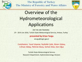
The Republic of Turkey The Ministry of Forestry and Water Affairs. Overview of the Hydrometeorological A pplications. presented by Ertan Turgu eturgu@mgm.gov.tr Contributors : Yusuf Ulupınar, Seyfullah Çelik, Ekrem Gülsoy, A.İhsan Akbaş, Mehmet Aksoy, Serhan Köse, Esin Oğuz

E N D
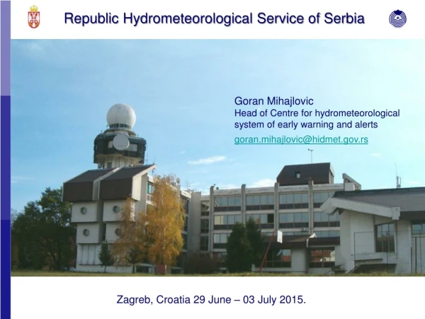
TheRepublic of Turkey The Ministry of Forestry and Water Affairs Overview of the Hydrometeorological Applications presented by Ertan Turgu eturgu@mgm.gov.tr Contributors: Yusuf Ulupınar, Seyfullah Çelik, Ekrem Gülsoy, A.İhsan Akbaş, Mehmet Aksoy, Serhan Köse, Esin Oğuz Turkish State Meteorological Service Research Department, Hydrometeorology Division ON THE JOB TRAINING 19 – 28 th Jan 2016, TurkishState Meteorological Service, Ankara, Turkey
Missions of Hydrometeorology Division • Objectives of the HydrometeorologyDivisionas stipulated in the regulation(No: 25) are: • To makeorhavestudiesmaderesearchanddevelopment onhydrometeorologicalissues. • To makeorhavestudiesmaderesearchanddevelopmenton earlywarning of flashfloods. • To makestudies on evaluatingandanalysing precipitation. • To carry out the tasks instructedbyhead of ResearchDepartmentregardinghydro-meteorological events.
Staffof HydrometeorologyDivision (HD) • TSMS has a total of 3050 employees. • HD has a total of 15employees. Out of these 1divisionmanager, 11engineer, 1 geomorpholog, 1mathematician, 1 technician. • HD is composed of twoUnits: • Unit 1 works on EarlyWarning of Flash Flood (8 personnel) • Unit 2 works on HydrometerorologicalStudyandanalysisparticularly precipitation andevaporation (5 personnel).
Hydrometeorological Applications (1) ** Analysing a rainfall intensity-duration-frequency equation for each returnperiods (T = 2, 5, 10, 25, 50, 75 and 100 years): The maximum annual rainfall values for 5, 10, 15, 30 and 60 minutes arestatistically analyzed by using some statistical distributions such as theGeneralized Extreme Values (GEV), Gumbel, Normal, Two-parameter Lognormal, Three-parameterLognormal, Gamma, Pearson type III and Log-Pearson type III distributions. χ2 goodness-of-fit test was usedto choose the best statistical distribution among all distributions. ** Analysing water year (from 1 October to 30 September), seasonal, yearly, monthly and daily precipitation totals. ** Implementing FFGS project.
Hydrometeorological Applications (2) ** Calculating mean areal precipitation (MAP) on basis of whole Turkey, geographic regions and river basin areas. A research was carried out by Hydrometeorology researchers to find the best method to represent the MAP. Various geostatistical methods of spatial interpolation such as Arithmetical mean, Thiessen polygon, Inverse Distance Weighting, Weighted polygon (Sen), Isohyetal, Kriging methods were employed to compute the MAP using GIS software. Kriging method is considered superior and more applicable compared to the other methods mentioned above.
Hydrometeorological Applications (3) MAP of 574 mm fortheperiodfrom 1981 to 2010 forTurkeywascalculatedbyKriginginterpolationtechnique. Thisamount of precipitation is usedto plan waterresourcesconsumedbyAgriculturalsector, industrialsectorandmunicipalityfordomesticuseanddrinkablewater in Turkey.
Background of the FFGS project (1) The WMO Congress XV in 2007 approved the implementation of a Flash Flood Guidance System (FFGS) project with a global coverage, developed by Commission for Hydrology (CHy) jointly with WMO Commission for Basic System (CBS) in collaboration with the US National Weather Service, the US Hydrologic Research Center and USAID/OFDA. On 25 February 2009 WMO signed a Memorandum of Understanding (MoU) with USAID, HRC, and NOAA on the implementation of the project. Based on the Memorandum of Understanding, WMO, HRC and USAID agreed to start preparations for the implementation of the project in the Black Sea and Middle East Region.
Background of the FFGS project (2) BSME-FFG initial meeting was held in İstanbul on 29-31 March 2010 with the participating countries of Turkey, Azerbaijan, Georgia, Armenia, Iraq, Syria and Lebanon. Turkey was elected as regional center. • Armenia, Azerbaijan, Bulgaria, Georgia, Iraq, Lebanon, Syria, Turkey and Jordan sent Letter of Commitment to WMO . • Turkey is currently hosting the regional centers for BSMEFFG system and SEEFFG system.
Main Objectives of the FFGS project • To contribute towards reducing the vulnerability of regions around the world to hydro-meteorological disasters, specifically flash floods, • to provide real time flash floods warnings with high hit rate, • to implement new technologieson the flash flood guidance system and provide training, • to develop and implement flash flood guidancesystem to strengthen regionalcapacity to develop timely and accurate flash flood warnings.
What are natural flash flood causes? Intense rainfall from slow moving thunderstorms or tropical systems. Orographic rainfall in steep terrain Soil saturation or impervious land surfaces Hydraulic channel properties Also sudden release of impounded water (natural dam or human made dam)
Flash Floods vs River Floods River floods: • occur in river basins and generally last more than 6 hours even days • are caused by heavy rain and snow melt over long periods e.g., days, • leading to rising water levels and flooding as the flood wave takes days to movedown river. Flash flood: • “a flood of short duration with a relatively high peak discharge” (WMO definition) • “a rapid and extreme flow of high water into geomorphic low-lying areas, rivers, dry lakes and basins, or a rapid water level rise in a stream or creek above apredetermined flood level” (US NWS definition) • occurs in less than six hours from the time of the causative event, • is a local hydrometeorological phenomenon that requires both hydrologic and meteorological expertise for real-time forecasting and warning.
Phases of the FFGS project (1) As part of the development and implementation programs for BSMEFFG system, various tasks and activities are accomplished: Phase 1: Generation of Basin delineation. At the regional level more than 6.900 sub-basins with average area of 200 km2 were generated while 2.900 sub-basins were generated for Turkey. We have been using high resolution of basin delineation with approximately 11.800 sub-basins for Turkey since 2014.
Phases of the FFGS project (2) Phase 2: Setting up model parameters for more than 40 Hidro-meteorological historical data variables were processed in GIS and put FFG ftp server at TSMS. Some of these parameters are as follows:Soil data, LU/LC, DEM (SRTM 90m, 30m) data, stream flow data, dams and lakes, rivers, long term precipitation, temperature, humidity, wind data, evaporation, soil moisture, radiation data etc.
Phases of the FFGS project (3) Phase 3: Model Calibration. This was performed by using co-located 19 meteorological station data and stream gauge station data where flash floods occured. Phase 4: System Beta version became available. It was started to test model products using real time meteorological data and to evaluate model products. Phase 5: Long term training given by HRC, California, U.S.A. to 4 persons of TSMS. Phase 6: Installation and implementation of FFGS at TSMS.
Phases of the FFGS project (4) Phase 7: Employees of NWP department of TSMS and employees of Regional Forecasting and Warning Centre (called BTUM) from provinces were trained by employees of Hydrometeorology Division on how to use effectively FFGS products in their operations. Phase 8: Workshop was held between participating countries. Phase 9: Run the FFG system with higher resolution of basin delineation, i.e., from 90 m DEM to 30m DEM.
Phases of the FFGS project (5) Phase 10: Start to use the FFG system operationally and made verification. Phase 11: Calculate cross sections of each sub-basin and find mathematical relationships. Phase 12: Visualize the FFGS products to all users including member state users in two and threee dimensional displays using GIS software. (not ready) Phase 13: Running the FFGS with different NWP models such as WRF and ECMWF besides Aladin-Alaro model. (now ready) Phase 14: Increasing a number of AWOS to be input to the FFGS to give more accurate data. (now ready)
Global Implementation of the FFGS The system design is such that it allows for efficient global data ingest and it supports regional cooperation among NMHSs. The design is characterized by distributed operations and functions. Several centres of computation and product dissemination will support the operational functions of the NMHSs through the timely provision of data, software, hardware and training.
FFGS Technical Components(Schematic Flow Chart)(1) Important technical elements of the FFGand Warning System: • Developmentand use of bias-corrected remotelysensed data fromradar, satelliteandraingauge. • High-resolution NWP model outputs. • Hydrologicalmodelling to determine FFGand FFT. • Precipitation is main input to FFGS. • Precipitation and air temperature are input to SNOW17.
FFGS Technical Components(Schematic Flow Chart)(2) The primary source for satellite precipitation estimates used is the Global Hydro-Estimator (GHE) product produced by the NOAA National Environmental Satellite, Data, and Information Service (NESDIS), due to the operational mandate and short latency time. This product is available within 30 minutes of observation. The rainfall data are quality controlled, MERGED, corrected for regional bias using thelocal real-time observations, and used to compute MAP for small watersheds defined for the region. (Theresa, 2014)
FFGS Technical Components(Schematic Flow Chart)(3) Hydrologic technical components include a)Estimating the characteristic runoff volume for each watershed associated with bankfull conditions at the watershed outlet (Threshold runoff) b)Accounting for current soil moisture conditions (SAC-SMA)c)Modelling of snowpack (SNOW-17) The other key element of the system is Forecaster input. These systemsare designed to be a tool and provide guidance to the forecaster; the system is NOT designed to automatically produce flash flood warnings. The products are designed to be evaluated and potentially modified by knowledgeable forecasting personnel. (Theresa, 2014)
FFGS Technical Components(Schematic Flow Chart)(4) Forecasters may have “last minute” information, which may include local observations not available to the regional system or reports from local observers. They also have knowledge of local meteorological and hydrologic response in their region that can influence their decision on whether to issue a flash flood warning or advisory to the public or disaster management agencies. (Theresa, 2014)