Download
1 / 14
170 likes | 437 Vues
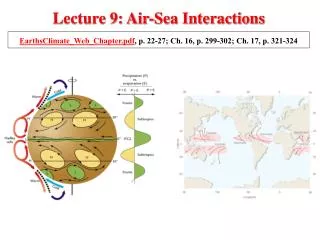
Lecture 9: Air-Sea Interactions. EarthsClimate_Web_Chapter.pdf , p. 22-27; Ch. 16, p. 299-302; Ch. 17, p. 321-324. Geographic Feature of High and Low Pressure Systems. L. L. H. H. H. H. H. L. L. L. L. L. When averaged over time, planetary waves are geographically

E N D
Lecture 9: Air-Sea Interactions EarthsClimate_Web_Chapter.pdf, p. 22-27; Ch. 16, p. 299-302; Ch. 17, p. 321-324
Geographic Feature of High and Low Pressure Systems L L H H H H H L L L L L • When averaged over time, planetary waves are geographically • anchored as a result of land/ocean contrasts and mountains • The result is high and low pressure systems that appear to persist • throughout the year: so-called semipermanent lows and highs Figure 2-19 • Variations in the strength of these semipermanent features • produce changes in weather and climate over large regions
Air–Sea Interactions in the Pacific: NormalConditions Atmosphere: Subtropical H near coasts of Peru and Ecuador. L in the west. Sinking air in the east: dry. Rising air in the west: wet. Strong easterly trade winds, part of Walker Circulation. Ocean: Cool surface waterin theeastbecause of upwelling Warm surface waterin the west because of trade winds Fisheries in the east: Excellent
Air–Sea Interactions: El NiñoConditions Atmosphere: Pressure in the east falls. Pressure in the west rises. Rising air in the east: wet. Sinking air in the west: dry. Easterly trade winds weaken or reverse. Ocean: Surface waterwarmsin theeastbecause upwelling stops Warm surface waterin the west spreads EASTWARD. Fisheries in the east: Poor
El Niño–Southern Oscillation (ENSO) Warming of sea surface temperature in the central and eastern tropical Pacific Ocean El Niño: Southern Oscillation: A seasaw pattern of reversing surface air pressure at opposite ends of the tropical Pacific Ocean La Niña: Sea surface temperature in the central and eastern tropical Pacific Ocean colder than normal El Niño and Southern Oscillation are LINKED, thus ENSO. El Niño events occur about every 2-7 years
El Nino Seen From Satellite Satellite imagery shows the eastward movement of higher ocean levels, or Kelvin wave, in white and red colors, caused by the reversal of the Walker Circulation and El Nino event.
Sea Surface Temperature Departures from Normal as Measured by Satellite Warmer SST During the El Nino conditions Cooler SST during the La Nina conditions
ENSO Index El Nino Southern Oscillation (ENSO) intensity has been tracked using 6 parameters, including air and sea temperature, sea level pressure, wind speed and direction, and cloudiness. A graph of the ENSO index shows eastern Pacific warm El Nino and cool La Nina years. Two largest ENSO events: 1982-83 and 1997-98.
ENSO is a phenomenon in the tropical Pacific Ocean. Why should we care about it in Texas? ENSO can impact the weather beyond the tropical Pacific ocean through teleconnections!
The North Atlantic Oscillation warm & wet cold & dry L L cold & dry warm & wet H H A fluctuation in atmospheric pressure between Iceland low and Azores high Positive Phase Negative Phase A Dominant Orchestrator of NH Weather and Climate Changes in mean wind speed and direction Changes in number, intensity, paths of stormsChanges in moisture transport
The North Atlantic Oscillation Winter Index 1864-2000 Lisbon minus Reykjavik Strong Westerly Flow onto Europe
NAO Influence on Winter Surface Temperature A substantial portion of the Northern Hemisphere warming in recent decades is associated with the upward trend in the NAO The Earth’s climate record includes both natural variability as as well as human-induced effects
NAO Influence on Winter Precipitation • This pattern, together with the upward trend in the NAO, is consistent • with observed changes in precipitation over the Atlantic basin • Advance of Scandinavian glaciers • Retreat of Alpine glaciers • Severe drought over parts of the Iberian peninsula • Together with surface warming, there are significant impacts, e.g. • Agriculture (longer growing season) • Energy supply/demand and water management • Marine and terrestrial ecosystems
Pacific Decadal Oscillation Scientists recently discovered a 20–30 year sea surface temperature (SST) reversal in a more northern section of the Pacific. During the warm, positive, phase, SSTs are warmer off the Pacific Northwest coast, which strengthens the Aleutian low and generates warmer winters. During a cool phase, Pacific Northwest coastal SSTs are cooler, causing colder winters.