Download
1 / 60
600 likes | 730 Vues
City of Minot Comprehensive Plan. Steering Committee December 12, 2011. Planning Process . We are in the Alternatives phase, Phase 3 of 5 phases Each phase includes opportunities for review by the community, Steering Committee, Planning Commission, and City Council

E N D
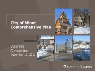
City of Minot Comprehensive Plan Steering Committee December 12, 2011
Planning Process • We are in the Alternatives phase, Phase 3 of 5 phases • Each phase includes opportunities for review by the community, Steering Committee, Planning Commission, and City Council • The Plan will be completed by the middle of 2012
Five Key Elements Minot Master Plan • Revitalized Downtown • Greenway Connections • Compact Development • Housing Opportunities • Transportation
Five Key Elements1) Revitalized Downtown • Keep the “heart” of Minot strong • Connect downtown to the River and to the Park/Trail system • Focused redevelopment, especially housing, based on market demand • Address parking – ramp, surface, street • Streetscape enhancements
Five Key Elements 2) Greenway Connections • Protect and enhance drainage corridors • Provide amenity • Connect major destinations with biking/walking routes • Provide active living choices • Connect wildlife habitat • Enhance existing streets
Five Key Elements 3) Compact Development • Continue efficient, economical development pattern • Provide services near all neighborhoods • Encourage walking, biking, active living • Reduce car trips • Extend infrastructure in a cost-effective, staged plan
Five Key Elements 4) Housing Opportunities • Ensure “life cycle” housing opportunities for all • Encourage compact development to keep housing costs lower • Look for redevelopment sites • Provide opportunities for new housing in or near downtown
Five Key Elements5) Transportation • Develop and maintain a safe efficient roadway system • Create a network of connections vs. closed, dead-end streets/plats • Improve north-south connections • Integrate pedestrian/bicycle trails • Provide improved rail crossings or overpasses
Why Are Land Use Plans Essential? • Traffic generation • Sewer flows • Water consumption • Stormwater management • Demand for schools • Demand for parks • Demand for fire/ police protection
How We Plan Natural Features • Steep Slopes • Water • Wetlands • Floodplain Manmade Features • Roadways • Parks/Trails • Institutional Uses • Commercial Areas
Putting it All Together Neighborhood Land Use Elements • Greenway Corridors • Roadways • Commercial Areas • Multi-Family • Parks/Trails • ¼ mile walk to parks • Rest of the neighborhood is mostly single family
Compact walkable neighborhoods matter • Environment: Cars are a leading cause of air pollution. Feet are zero-pollution transportation machines. • Health: The average resident of a walkable neighborhood weighs 6-10 pounds less than someone who lives in a sprawling neighborhood. • Finances: One point of Walk Score is worth up to $3,000 of value for your property. • Community:Studies show that for every 10 minutes a person spends in a daily car commute, time spent in community activities falls by 10%. • Economics: Compact neighborhoods cost less per acre for infrastructure: roads, sewer, water, parks, etc.
What makes a neighborhood walkable? • A center: Walkable neighborhoods have a center – a main street or a public space. • People: Enough people for businesses to flourish and for public transit to run frequently. • Mixed income, mixed use: Affordable housing located near businesses. • Parks and public space: Plenty of public places to gather and play. • Pedestrian design: Buildings are close to the street, parking lots to the side or rear. • Schools and workplaces: Close enough that most residents can walk from their homes. • Complete streets: Streets designed for bicyclists, pedestrians, and transit.
Minot Walk Score Walk Score Description 90–100 Walker's Paradise — Daily errands do not require a car. 70–89 Very Walkable — Most errands can be accomplished on foot. 50–69 Somewhat Walkable — Some amenities within walking distance. 25–49 Car-Dependent — A few amenities within walking distance. 0–24 Very Car-Dependent — Almost all errands require a car.
Growth Areas • 7 Growth Areas: • Southwest • Northwest • Northeast • East • East SE • Southeast • Downtown
Draft Growth Phasing Plan • Shows potential development in future Growth Areas by phase • Each phase represents 3-10 years of growth • Goal is compact, orderly development
Staged Growth – Principles • Efficiency and cost effectiveness • Sufficient land supply to insure competition and avoid escalating land prices • Clear shared understanding of location and timing of municipal investment, costs and benefits • Fairness
Draft Future Land Use Plan • Shows existing and future City development color code for various land uses • Six Growth Areas (plus Downtown) shown as they are expected to develop • Future roadway system, park system, greenway connections shown
Greenway Connections • While the floods have been personally devastating to many Minot residents and businesses, the Souris Valley Project provides an opportunity to create a lasting benefit to the community – and not just for flood protection • The Comprehensive Plan will incorporate the Souris Valley Project into the overall Plan generally and more specifically with neighborhood plans to be developed later
Preliminary Souris River Project • Preliminary plans suggest a new wide Greenway along the river bounded by a wall or dike to contain flood waters • This Greenway creates an opportunity for park and trail connections to and from Downtown to Oak Park and Roosevelt Park and points beyond • Oak Park • Oak Park • Roosevelt Park • Downtown
Overall City Concept Plan • The Souris River Greenway provides the main link for park and trail connections throughout the City to existing neighborhoods, parks, and future Growth Areas • Parks, trails, sidewalks and natural features would be integrated into the system • Benefits: stormwater management, active living, wildlife habitat, and amenity
Minot Concept Plan • Start with the existing wetlands, river valley, and coulees • Add the Greenway proposed for the Souris River valley • Together these form the backbone of a “green” connection system for the City
Minot Concept Plan • Add the existing park and trail system • Add new parks and trails in growth areas at the edges of the City and in redeveloping areas inside the existing City
Minot Concept Plan • Add the existing and future major Commercial and Industrial areas
Minot Concept Plan • Add the existing and future major roadways to complete the Concept Plan for the future of Minot • Includes potential new Ring Route around SW and SE Minot, similar to West Bypass and NE Bypass
Minot Ring Route Expansion NE Bypass West Bypass 55th St SE 54th Ave SE – previous plan 30th St SW 42nd St SE 66th Ave SE 66th Ave SW Possible SW & SE Ring Route
66th Ave E of 83 looking east toward 2nd Larson Coulee – crossing challenging but possible 66th Ave SW
US 52 42nd St SE looking N to US 52 – part of possible Ring Route connection from 66th Ave SE across 52 and Souris River 42nd St SE
US 52 Approx. Flood Inundation Approx. Mouse River Project Limits 37th Ave SE either side of Souris River looking SW – connecting 55th St SE (extension of NE Bypass) across Hwy 52 to extension of 66th Ave SE 37th Ave SE 55th St SE
Very Low Density Residential Land Use Map Color • Building type: Detached and attached single-family homes • Density (or net density): 2-3 units per acre • For areas challenged by slopes and terrain where efficient development and density is not feasible
Low Density Residential Land Use Map Color • Building type: Detached and attached single-family homes • Density (or net density): 4-6 units per acre • For most of Minot’s new neighborhoods
Medium Density Residential Land Use Map Color • Building type: Twin/Townhome, multiplex, rowhouse • Density (or net density): 6- 12 units per acre • Best land use for creating compact, walkable neighborhoods
High Density Residential Land Use Map Color Building type: Multiplex, Low- or High-rise Apartment Building, Condominium Density (or net density): 12-24 units per acre and greater
Manufactured Home Park Land Use Map Color Building type: Mobile homes, trailers, for existing parks only, no new parks shown Density (or net density): 4-8 units per acre
Commercial - regional, highway or neighborhood oriented Land Use Map Color Regional and highway-oriented supports uses such as fast food restaurants, convenience stores, gas stations, big box retail, and other auto-oriented businesses, and have a regional draw. Neighborhood commercial supports such uses as a small grocery or convenience store, coffee shop/deli, personal and health type services. The site and architecture design should be of small scale and compatible with the surrounding uses
Office Business Park Land Use Map Color Supports uses such as office space, light industrial uses, warehousing, research and high-tech manufacturing. Less intense than industrial with no outdoor uses or storage. Standards requiring high quality, attractive building materials, landscaping and site design standards are an important consideration.
Industrial Land Use Map Color Supports uses such as manufacturing, warehousing, automotive, office and other related industrial uses. Could include outdoor storage. Due to potential impacts such as traffic, noise, and dust; uses typically are not as compatible with residential uses or some commercial uses
Public/Semi Public Land Use Map Color Areas used for the benefit of the public: • Schools • City and County Government buildings, • Utility/infrastructure related uses such as sewage treatment plants, power plants, etc.. Also includes semi-public use/private institutional uses: • College, religious institutions
Parks and Open Space P Designates existing parks and open space areas and general location for future community parks and playfields.
Conceptual Park and Greenway Connections Natural and manmade areas that serve as connecting spaces for parks & trails, recreation, stormwater, wildlife, and general amenity. No significant buildings or development
SW Growth Area • Preserve ROW for future Ring Route – 30th Street to 66th Ave • Business Park vs. Industrial on Ring Route • Need large Community park and neighborhood parks • Major commercial node at 37st Ave SW and 30th Street • Create compact, walkable neighborhoods • Control land use outside of Ring Route • 1st Phase: +3,500-6,500 pop. • Ultimate: +26,000-49,000 pop.
NW Growth Area • 16th Street & 8th Street as connecting arterials • Connect frontage roads either side of West Bypass • Major commercial node at 21st Ave NW and Bypass • Need large Community park and neighborhood parks • Control land use outside of Bypass • Create compact, walkable neighborhoods • Phase 1: +3,000-6,000 pop. • Ultimate: +18,000-32,000 pop.
NE Growth Area • Provide arterial access to Industrial on NE side of airport • Potential conflict – Residential vs. Industrial unless carefully planned • Business Park along 46th Avenue Bypass • Need Community park & neighborhood parks • Livingston Creek greenway • Compact, walkable neighborhoods • Phase 1: +1,200-2,100 pop. • Ultimate: +36,000-64,000 pop.
East Growth Area • Significant Industrial opportunity on RR hub • Provide access to airport and Minot AFB via new 55th Street/ NE Bypass
East SE Growth Area • Current FEMA site • Future residential growth • Future extension of 55th Street Bypass • Some areas impacted by flood project • Phase 1: +800-1,300 pop. • Ultimate: +4,700-8,000 pop.
SE Growth Area • Mostly Residential – limited by topography, coulees • Recreational opportunities with hills, coulees • Need large community park & neighborhood parks • Create compact, walkable neighborhoods • Potential future Ring Route along 66th Ave SE to 42nd St SE • 13th St arterial connector • Phase 1: +2,600-4,300 pop. • Ultimate: +23,000-39,000 pop.
Downtown • Heart of the community • New park and open space on River Greenway connects Downtown to Oak Park, Roosevelt Park • Encourage new Residential development • Greenway connections • Downtown parks/squares • Needs additional studies of parking, land use, streetscape, infrastructure • Potential: +500-1,000 units, +1,000-2,000 pop.