GPS Technology
GPS Technology. Technology & Tools for the Private Investigator. Darrell R Wilson. “we make tracking affordable”. Did You Know!. Kate Warne. Born in New York, hired as first female Private Detective in the United States in 1856. Eugene Francois Vidocq.

GPS Technology
E N D
Presentation Transcript
GPS Technology Technology & Tools for the Private Investigator Darrell R Wilson “we make tracking affordable”
Did You Know! Kate Warne Born in New York, hired as first female Private Detective in the United States in 1856. Eugene Francois Vidocq Formed first Private Detective Agency 1833. French Solider, Introduced first record keeping system, criminology and ballistics, made first plaster casts of shoe impressions and created indelible ink. The Man Pack 1980 Rockwell International 17 pounds Received only one satellite signal Strapped to a truck or helicopter
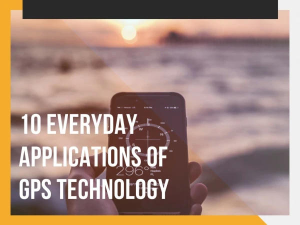
Why GPS Tracking • Follow detailed activity of vehicle/person without chance of being seen • Detailed activity log of addresses and times to develop a pattern • Follow for long distances without leaving your location • Work multiple cases and identify key target addresses • Relieve stress from sitting for long periods • Cheap investment for long term revenue • Pick your place and time for interviews • Select appropriate place for video/photographs and documented evidence • Track to locations that you cannot access • Delegate surveillance or work to others in minutes over long distances
Between 1955 and 1957, scientists had developed tracking systems capable of monitoring known and unknown satellites orbiting the Earth. Roger L. Easton, of Vermont, is widely credited as the man who invented GPS tracking as a practical technique used for military purposes. Between 1967 and 1977, four satellites were used to test his methods. 1983 GPS system was only available to the US military. In 1983 Korean Air Lines Flight 007, a civilian Korean Air airplane carrying 269 passengers, was shot down after mistakenly entering Soviet airspace — killing all passengers on board. In response to this tragedy, President Ronald Reagan issued a directive that when GPS technology was operational, it would be free and available to the world. July 17, 1995, the global positioning system was complete. 1996, President Bill Clinton made further advances in the use of GPS as a civilian tool when he issued a policy directive declaring that GPS was a dual-use system technology, meaning it was to be used for both peaceful and military aims. In 2000, the U.S. military stopped its practice of intentionally blurring the signals. 2004, President Bush further ensured the availability and accessibility of personal GPS units when he issued a policy that would ensure that civilian GPS would be free of direct user fees. Soon after, in 2005, the first modernized GPS satellite was launched. This modern satellite began transmitting a second civil signal that “provided] civil users with an open access signal on a different frequency.” 2006, Sprint became the first carrier to begin using signal triangulation from cell-phone towers, creating an augmented global positioning system. The first handheld cell phone, on March 13, 1984 Motorola DynaTac8000X. 1999 Mobile phone manufacturer Benefon launched the first commercially-available GPS phone, a safety phone called the Benefon Esc! The GSM phone was sold mainly in Europe. Sometime after 2004 GPS Covert devices began to emerge on the market.
QUESTIONS? • Can I legally put a tracker on a vehicle? • What was the Jones Vs USA decision • Villanova Vs Innovative Investigations • Does it matter who owns the vehicle? • Which Tracker should I buy for covert tracking? • How many days will my tracker report? • What is the difference in server updates and pings? • What is CDMA, GSM, GPRS, AGPS? • 2G - 3G - 4G • 9. What is the difference in a motion sensor or accelerometer? • 10. What is the difference between sleep or hibernation? • What are battery life “killers”? • Why does my tracker show one place on mapping and sitting somewhere else
Global Positioning System The Global Positioning System (GPS) is a space-based satellite navigation system that provides location and time information in all weather conditions, anywhere on or near the Earth where there is an unobstructed line of sight to four or more GPS satellites. 186,000 miles per second/speed of light 3 Segments to GPS 1. Space - 24 Operating Satellites managed by the US Air Force 2. Control – World wide monitor and control stations, commands, maneuvers, and adjustments 3. User – GPS receivers used by public and military GPS modernization program
FACTS GPS Satellite system became operational in 1995. Global Positioning System has never been deactivated, despite U.S. involvement in wars, anti-terrorism, and other military activities. The actual accuracy users attain depends on factors outside the government's control, including atmospheric effects, sky blockage, and receiver quality, user interactions and selection of equipment, placement of devices and battery choices. Selective Availability (SA) was an intentional degradation of public GPS signals implemented for national security reasons. In 2000 President Clinton directed to discontinue this use of SA. Many countries have GPS Satellites, (Russia GLONASS) became global in 2009 competing with the US.
How do we get what we get? Ephemeris Data is transmitted L1 and L2 Bands for Civilian Use
Passive & Real Time GPS Passive tracker that attaches to vehicle and provides information stored within the device. Tracker is removed, inserted into computer, information is downloaded to the PC. • Has GPS Receiver • USB to PC connection • Software to view mapping Real Time Tracker attaches to vehicle and sends information in real time to the Investigator either sms or GPRS which can be viewed on PC or cell phone. • Has GPS Receiver • Has cellular receiver and transmitter • Can be remotely controlled/programmed • Needs a server/cell phone to report to
GPS Tracker Communications • [11/6/2014 3:58:32 AM] (64.162.222.252:62644/SensorLogic/tcp) Disconnect • [11/6/2014 3:50:08 AM] (64.162.222.252:62644/SensorLogic/tcp) Info: Pooled Disconnect • [11/6/2014 3:50:06 AM] (64.162.222.252:62644/SensorLogic/tcp) Server: +SACK:3065$ • [11/6/2014 3:50:05 AM] (64.162.222.252:62644/SensorLogic/tcp) Report: Invalid (0, 0) (null) (11/6/2014 8:50:41 AM)(GsmSignalLevel=10)(BatteryLevel=100)(Speed=0 x)(_MaintenanceDue=False x) • [11/6/2014 3:50:05 AM] (64.162.222.252:62644/SensorLogic/tcp) Login: Tracker_3/867844001595407 • [11/6/2014 3:50:05 AM] (64.162.222.252:62644/SensorLogic/tcp) Client:+RESP:GTINF,02010D,867844001595407,,41,8901260762270975270f,10,0,1,0.0,,4.43,0,2,1,0,0,20141105224753,100,1,,,,20141106085041,3065$ • [11/6/2014 3:50:05 AM] (64.162.222.252:62644/SensorLogic/tcp) Connect • [11/5/2014 10:57:25 PM] (64.162.222.252:59011/SensorLogic/tcp) Disconnect • [11/5/2014 10:51:13 PM] (64.162.222.252:59011/SensorLogic/tcp) Info: Pooled Disconnect • [11/5/2014 10:51:10 PM] (64.162.222.252:59011/SensorLogic/tcp) Server: +SACK:3064$ • [11/5/2014 10:51:10 PM] (64.162.222.252:59011/SensorLogic/tcp) Report: Invalid (0, 0) (null) (11/6/2014 3:51:36 AM)(GsmSignalLevel=11)(BatteryLevel=100)(Speed=0 x)(_MaintenanceDue=False x) Time of Data Transmission IP address of server with GSM modem Type of device sending information Report of location in longitude and latitude GSM signal level, level of cellular signal Battery percentage of unit Any other data that the unit reports or is programmed to report
GPS Tracker Important Information 8.2 Feet Standby time is time that the unit is not moving and is not reporting the location. 40 miles driven in one day (12 hours) = 6% battery life 6% daily = 16 days when programmed correctly
Batteries • FACTS: • Not all batteries of same voltage have same life expectancy • 3.7V batteries are standard in 99% of all GPS trackers • 1300mAh batteries are standard in 99% of all GPS trackers • Not all batteries are “New” product builds • Always research battery discharge rates • Always use a “PCB” power control board in extended packs • 99% of all GPS “PCB” batteries end power at 2.5V • Always use the charger that comes with the battery • Doubling the battery size “does not” double life of tracker
Tracker Life Power • Battery Size 1300mAh standard • Manufacture of battery • Recycled or new • Power Draws, lights turned on/off, constant Ping or reporting • Times battery is charged and charging life (300-500 charges) • Motion sensitivity/continuous tracking Reporting • Ping attempts • Tracking interval • Terminal check in (heart beat report) Tracker Placement GPS / GPRS / GSM • Optimum placement • Facing the sky • Anything but metal and water • Facing ground receiving bounced signals • Side panels, or facing any direction but up/down
Best Business Practice What do I want to use my GPS Tracker for? Do I tell the client I am using a tracker? Do I include tracking information in my reports? Protect Your Investment Conserve your battery Always charge to 100% and turn off tracker Always use the charger that came with the unit and not a generic Never charge if 50% more is left on battery life Use mapping that has battery percentage and set to 15% or less Clean your tracker with water and remove any grease or metallic material
Future of Private Investigations and GPS Drone “P.I. in the sky” 1946 Decision of Supreme Court, air is a highway Today 400 feet above property is navigable airspace Trespass complaints come from landing and taking off FAA controls all airspace (class G uncontrolled) • Is it legal • Range of drone • Capabilities • Cost • Training • Gps coordinates can be entered • Flight paths with multiple locations • Streaming Video up to 500 meters • Still photographs or real time video • Stabilized flights and auto control • Access to areas that are off limits • Verification of assets/vehicles/persons
Thank You! “we make tracking affordable” Wilson Tracking 336-793-0013