Download
1 / 22
220 likes | 333 Vues
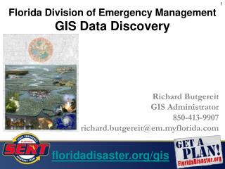
Has Emergency Management use of GIS improved since GeoInsight - (2002)?. Mark Garvey AFSM GIS Manager, Country Fire Authority of Victoria and Chair, EMSINA Kerrie Purcell GIS Manager, Queensland Fire and Rescue Service and Deputy Chair, EMSINA.

E N D
Has Emergency Management use of GIS improved since GeoInsight - (2002)? Mark Garvey AFSM GIS Manager, Country Fire Authority of Victoria and Chair, EMSINA Kerrie Purcell GIS Manager, Queensland Fire and Rescue Service and Deputy Chair, EMSINA
Emergency Management covers a variety of risk environments • Flood • Storm • Bushfire • Landslip • Earthquake • Explosions • Chemical Spills
In 2001 the federally funded “GeoInsight Project” endeavoured to achieve a wider use of GIS throughout the EM community in Australia • A nationwide tour included seminars for both senior managers and operational workers • Interactive training materials were provided to all attendees
GeoInsight identified several significant barriers to uptake of GIS in emergency management: • Lack of awareness at senior management level • Suitable industry specific cost-benefit analyses do not exist • A shortage of spatially skilled workers • Lack of suitable telecommunications bandwidth in rural areas • State Government data pricing policies restrict the uptake of GIS • Lack of understanding by the industry of the real needs of emergency management when providing software, hardware and training
The GeoInsight team, as it progressed around Australia, formed the view that a national EM GIS User Group would make a valuable contribution to the use of spatial information across the sector A workshop with 80 participants was held in Canberra in October 2001. A national Emergency Management GIS User Group “EMSINA” was formed
Stuff that’s happened since 2001 • EMSINA formed • State ESO’s becoming much more interactive via User Groups • Much greater dialogue between EM GIS professionals – can provide a representative voice of the industry sector (e.g. COAG Bushfire Review) • More is being done in the mitigation, risk modelling, etc side of things. We will see some fine examples today
GIS Staff shared at emergencies • GIS Teams using labour from different organisations coming together regularly during operations • e.g. Sydney severe storm, NSW fires, ACT fires, Alpine fires
Stuff that’s happened since 2001 • Some standardisation of technologies (Intra state but not much between states) • Access to EM federal agencies involved in GIS much improved (GA, BoM, EMA) • General awareness improved • Management aware but some think the job is already done • General population of EM workers more likely to use or ask for GIS Products, both management and at incidents • People using GPS’s, Google Earth, mapping engines
Technology Sharing of technology in the form of operational GIS / mapping systems from different states
Stuff that’s happened since 2001 • Technology has improved by leaps and bounds • Accessibility has increased dramatically as corporate networks and broadband speeds improve • Most EM agencies are collecting field data by handheld devices and sending back to HQ databases by wireless means • Most states have or are embarking on creation of Emergency Map Books • Web Mapping standard part of GIS – makes GIS accessible to all
Report card – where are we now and what needs to be done? • Technological capacity • Data • Access • People
Report card – Technology • GIS has hit mainstream IT • Just about everything we as EM Managers would want to do with a GIS is possible right now • Live spatial information from incidents logged into corporate databases • Integration of spatial data from different sources in real time (technologically possible but not widely implemented) • High end functionality still expensive • Low end affordable B+
Report card – Access • Network capacity improving all the time with broadband possible between most regional centres around the Country • Still have some very low line speeds into homes the bush which makes it difficult to share the vision with many rural people • Wireless communications technologies now being used by many agencies and can vary from limited data sets (point or polygon data) to extensive images from aircraft C+
Report card – Data • Small scale data generally available across the country that is useful and appropriate for big incidents • Large scale data (1:10,000 – 1:50,000) varies significantly from state to state • Data to drive models e.g. vegetation for bushfires is very disjointed and varies significantly in scale and quality • Licenses and cost of large scale data restricts access to data in some states and jurisdictions • EICU in NSW remains the stand out initiative although some states are catching up e.g. Tas and WA C-
Report card – People • More professional GIS officers have been hired by EM Agencies • Low level skills by non-GIS EM professionals improved somewhat; Access to GPS and Internet maps (e.g. Google Earth) improving awareness significantly • Training for field GIS remain an Agency by Agency issue – there is a need for a national qualification and accreditation for EM workers using GIS at incidents B-
GeoInsight identified several significant barriers to uptake of GIS in emergency management: • Lack of awareness at senior management level • Suitable industry specific cost-benefit analyses do not exist • A shortage of spatially skilled workers • Lack of suitable telecommunications bandwidth in rural areas • State Government data pricing policies restrict the uptake of GIS • Lack of understanding by the industry of the real needs of emergency management when providing software, hardware and training
Has Emergency Management use of GIS improved since GeoInsight - (2002)? Yes Major Projects for EMSINA • Common Symbology • Data quality and access • Education and accreditation • Ensure all ESO’s across Australia are using GIS effectively
EMSINA – a network of people creating the capacity of EM workers to use spatial information tools
For further information see:www.emsina.netNB: Site being built