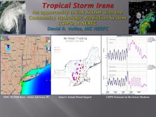
NHC SLOSH Run – Irene Advisory 29
110 likes | 267 Vues
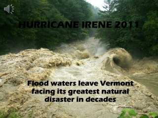
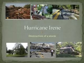
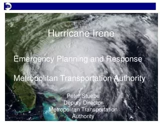
Tropical Storm Irene An opportunity to link SLOSH with the Community Hydrologic Prediction System (CHPS) at NERFC David R. Vallee, HIC NERFC. NHC SLOSH Run – Irene Advisory 29. Irene’s Actual Flood Impact. CHPS Forecast on the lower Hudson. Outline. A bit about the NERFC & CHPS

NHC SLOSH Run – Irene Advisory 29
E N D
Presentation Transcript
Tropical Storm IreneAn opportunity to link SLOSH with the Community Hydrologic Prediction System (CHPS) at NERFC David R. Vallee, HIC NERFC NHC SLOSH Run – Irene Advisory 29 Irene’s Actual Flood Impact CHPS Forecast on the lower Hudson
Outline • A bit about the NERFC & CHPS • Hydraulic Modeling of the lower Hudson • Event successes and challenges of incorporating SLOSH grids as the boundary condition for river forecasts at Poughkeepsie and Albany, NY
NERFC • Service area covers all 6 states of New England and much of New York State (less the Susquehanna River Basin) • 180 forecast points • 4 operational tidal segments • Poughkeepsie & Albany / Hudson • Middletown & Hartford / CT Rvr • Running USACE HEC-RAS • Boundary conditions: • NOS Astronomical Tides • GFS MRPSSE ET Surge • Hourly time steps
Background For 3 decades NWS River Forecast System (NWSRFS) has been the NWS hydrologic forecasting foundation for over 30 years NWSRFS architecture hindered use of recent advances in interactive forecasting and modeling NWS needed an improved hydrologic modeling infrastructure to leverage community operational concepts and models as well as provide future products and services The Community Hydrologic Prediction System (CHPS) is now operational at 10 of 13 RFCs, the rest will be over by the end of the year For more information, see the NWS OHD CHPS web site(http://www.nws.noaa.gov/ohd/hrl/chps/index.html)
What is CHPS? CHPS is both a system and a concept Open forecasting system to promote model & data sharing NOAA reaching out to hydro community CHPS uses Delft-FEWS from Deltares (Dutch Foundation) as core infrastructure FEWS: Flood Early Warning System Model adapter concept for algorithm modularity Allows for dozens of hydrologic/hydraulic/hydro-dynamic models to run through these adapters within the system Sophisticated data and workflow handling for models Comprehensive forecaster user interface and displays (the IFD) Highly configurable modeling environment via XML files Initially, includes NWSRFS models and USACE models (HEC-RAS and HEC-ResSim) Later, can include models from other providers
Hydraulic Modeling • Hudson River (151 miles) • Albany – river mile 143.5 • Poughkeepsie – river mile 73.9 • Connecticut River (60 miles) • Hartford – river mile 51.8 • Middletown – river mile 29.5 • Daily boundary provided by NOS Tide + GFS ET Surge (MRPSSE) Hudson River Connecticut River
Forecast Services Successes • Jamie Rhome, TPC Surge Group reached out to NERFC early Wed (prior to Irene) to work with us to incorporate SLOSH grids into HEC-RAS • Rob Shedd (DOH) and Alison MacNeil (Sr. Hydrologist) worked to: • Retrieve real-time runs & Extract appropriate time series data from SLOSH grid cells • Incorporate into our modeling system as a boundary condition for the Hudson and Connecticut Rivers applying the astronomical tide to the surge • Provide it as a forecaster modifier / time series which the forecasters could apply, smooth to or ignore
Forecast Services Successes • Incorporation of SLOSH into Hydraulic Modeling: • Forecast w/in inches of morning flood/surge at POUN6 • GFS MRPSSE ET Surge resulted in over-simulation of the earlier overnight tide cycle • Underforecast of the Albany crest (2 feet) (part tide/part rainfall )
Summary & Next Steps • Incorporation of SLOSH forcing on the lower Hudson and Connecticut improved NERFC forecasts of the Sunday morning surge/flood • Need to develop a more robust and streamline way for NERFC to obtain and extract necessary SLOSH information • NERFC wants to pursue the “Ensemble” • More testing and evaluation is necessary to identify deficiencies in NERFC modeling • NERFC at the mercy of tidal boundary forcing • SLOSH, ET Surge/GFS MRPSSE, etc…
Tropical Storm IreneAn opportunity to link SLOSH with the Community Hydrologic Prediction System (CHPS) at NERFC David R. Vallee, HIC NERFC NHC SLOSH Run – Irene Advisory 29 Irene’s Actual Flood Impact CHPS Forecast on the lower Hudson