Download
1 / 31
350 likes | 652 Vues
Level 1 Ecological Survey Report Requirements. ODOT -- Office of Environmental Services. Level 1 Ecological Survey Report. The Level 1 Report is used to coordinate projects that fall under the MOA between FHWA/ODOT, USFWS, and ODNR. Project qualifications to meet the MOA:

E N D
Level 1 Ecological Survey Report Requirements ODOT -- Office of Environmental Services
Level 1 Ecological Survey Report • The Level 1 Report is used to coordinate projects that fall under the MOA between FHWA/ODOT, USFWS, and ODNR. • Project qualifications to meet the MOA: • Projects that meet the NWP program, and/or need only a Level 1 or 2 PAN, and • Projects that do not require an Individual 401 or a Level 3 PAN , and • Projects that will not impact a National Scenic River below OHWM • Project types that generally fall under the MOA: • Bridge rehabilitation/replacement • Culvert replacement/minor lengthening • Bike trails • Minor road rehabilitation or widening • Some minor road realignments • New Level 1 ESR form will be used to coordinate these projects with the appropriate agencies.
Level 1 Ecological Survey Report • Title page of the report contains general project information. • Please fill out author and contact information so that ODOT-OES can contact the author with any questions. • Date of submission is the date that the consultant completes the report. • Cover photo is selected by the author. http://www.dot.state.oh.us/Divisions/Planning/Environment/Ecological_Resources_Permits/Ecology/Pages/Forms.aspx
Level 1 Ecological Survey Report • This section contains general project location information and the description of the project. • Project description should include the following: • An explanation of the work that will occur for the project. • General study area land-use. • Length of the study area (for linear projects) • A brief synopsis of the impacts for the project • Descriptions will be more in-depth for projects that go off existing alignment.
Level 1 Ecological Survey Report Vegetative Communities and Land Cover • Vegetative Communities within construction limits • Level of Disturbance • High Quality Habitats • Acres Impacted
Level 1 Ecological Survey Report Streams Fill in Presence and Impacts boxes • Stream ID is the USGS name of the stream, or the identification number or name given to the stream by the consultant (eg. Stream 1) • Receiving waters is the stream that the impacted stream flows to. Can be a named stream, or an unnamed tributary. • Three stream types: TNW, RPW, or Non-RPW • Flow Characteristics: Perennial, Seasonal (Intermittent), or Ephemeral • For the OEPA use designation, include the QHEI/HHEI score for streams with no ALU • Scenic River is answered as yes or no. Answer “yes” if it is within 1,000 feet. Delete any rows that are unneeded Additional information
Level 1 Ecological Survey Report Streams: Additional Information Box • Include the flow-path of each stream to the nearest TNW (ex. Stream 1 Big Darby Creek Scioto River). • Include details on impacts to each stream (see Impacts Analysis Section for more information). • Include any other details such as observed pollution issues, field sampling issues, and other pertinent information.
Level 1 Ecological Survey Report Wetlands • Wetland ID is the name that the consultant assigns the wetland (eg. Wetland A) • List if each wetland is isolated, adjacent or abutting. • Only wetlands that are adjacent or abutting will have receiving waters • List ORAM category and score • Wetland type should fit the Cowardin classification • Total size of wetland include the size of the entire wetland (even if it extends outside of the project area. • Include size in study area in acres. Often this will be the same as the impact acreage. • Include impacts in acres. Fill in Presence and Impacts boxes Delete any rows that are unneeded Additional information
Level 1 Ecological Survey Report Wetlands: Additional Information Box • Include the flow-path of each abutting or adjacent wetland to the nearest TNW (ex. Wetland A Trib to BDC Big Darby Creek Scioto River). • Include details on impacts to each wetland (see Impacts Analysis Section for more information). • Include any other details such as observed pollution issues, field sampling issues, illegal fills, and other pertinent information.
Level 1 Ecological Survey Report Potentially Jurisdictional Ditches • Only discuss potentially jurisdictional ditches. • Ditch ID is the name that the consultant assigns the wetland (eg. Wetland A) • RPW, OWHM Present, Constructed in or drains a wetland, and Constructed through hydric soils boxes should be marked yes or no. • Wetted width is the width of the area below OHWM, use this times the length to figure impacts (convert to acreage • Include length within the study area. Total length is not necessary. • Include impacts in acres. Fill in Presence and Impacts boxes Delete any rows that are unneeded Additional information
Level 1 Ecological Survey Report Ditches: Additional Information Box • Include the flow-path of each potentially jurisdictional ditch to the nearest TNW (ex. Ditch 1 Big Darby Creek Scioto River). • Include the location of the origin of the ditch • Include details on impacts to each ditch (see Impacts Analysis Section for more information). • Include any other details such as observed pollution issues, field sampling issues, and other pertinent information.
Level 1 Ecological Survey Report Ponds/Lakes/Reservoirs • Pond ID is the name that the consultant assigns the wetland (eg. Pond A) • Mark whether the resource is isolated or non-isolated. • Receiving waters is the nearest stream that a non-isolated pond flows to (left blank for isolated ponds) • Design function is the type of pond/lake/reservoir and its function (retention, farm pond, water supply, natural lake, etc). • Answer “functions as intended” with yes or know • Include total size of the resource, even portions of the resource outside the project area. • Include impacts in acres. Fill in Presence and Impacts boxes Delete any rows that are unneeded Additional information
Level 1 Ecological Survey Report Ponds/Lakes/Reservoirs: Additional Information Box • Include the flow-path of each non-isolated resource to the nearest TNW (ex. Pond A Big Darby Creek Scioto River). • Include details on impacts to each pond/lake/reservoir (see Impacts Analysis Section for more information). • Include any other details such as observed pollution issues, field sampling issues, fills, and other pertinent information.
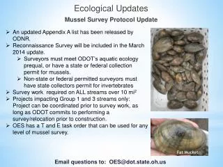
Level 1 Ecological Survey Report Unionid Mussels Listing Status (State and/or Federal) Impacts write-up Additional Information box Species Name (common and scientific) If a listed species of mussel (shell material or live mussel) is found within or adjacent to the project area, it will also have to be discussed in the Listed Species section. The preparer can reference between the sections to minimize repetition. USFWS has announced a list of streams that may have populations of federally listed mussels. No collecting of live mussels is permitted in these streams without a federal permit. Unionid mussels should be surveyed for in any perennial stream large enough to support mussels (generally over 5 square mile drainage)
Level 1 Ecological Survey Report Unionid Mussels • Additional Information Box should include the following: • General discussion on population composition, age classes, in-stream location, and habitats used by live mussels. • The condition of dead shells: • Fresh dead – periostracum intact, nacre still shiny, portions of the hinge may still be present • Dead – periostractum mostly intact, nacre dull, no protein or soft parts present • Weathered dead – very worn, periostracum nearly gone, nacre gone or very dull, shell may be fractured. • Discuss any listed mussels in the appropriate Listed Species table.
Level 1 Ecological Survey Report Federally Listed Species • For each species with known ranges that includes the project county(ies), include the following: • A brief life history synopsis, focusing on habitat requirements • Records within a mile (or within 5 miles for IB captures, and 10 miles for hibernacula) • Distance to nearest Bald Eagle nesting activity • If the species was found within the project area (IF YES, CALL OES FIRST!!!) • If critical habitat was found within the project area (IF YES, CALL OES FIRST!!!) • If suitable habitat was found within the project area • Impacts to the suitable habitat • For Indiana bat, also summarize the information from the Bat Habitat Worksheet. • Include any other pertinent information in the Additional Information box (including date of surveys for listed species).
Level 1 Ecological Survey Report State Listed Species • For each species with records within a mile of the project (or that were found within or directly adjacent to the project area) • A brief life history synopsis, focusing on habitat requirements • Distance of record from project area • If the species was found within the project area • If suitable habitat was found within the project area • Impacts to the suitable habitat • If a federal species record is located within a mile, reference between the Federal and State species tables to minimize repetition. • Include the dates of any species specific surveys in the Additional Information box, and any other pertinent information.
Level 1 Ecological Survey Report Appendices • Put an “x” next to what is included in the appendices. • The maps/photos/plans/forms that have a red “x” beside them are required. • The maps/photos/plans/forms that have a blue “x” are required if the resource exists in the study area, or if available.
Mapping • USGS 7.5” Topographic Map • Must be clearly labeled with the correct USGS Quad map name and project name • Map must use standard quad scale. A close-up map of the project area can also be included if detail is needed. • Clearly mark entire project area on map • County maps or other types of mapping can make finding a project area easier when there are not many identifying characteristics on the topographic map. • Resources map shows location of ecological resources within the project area • Show locations of streams and wetlands • Show locations of suitable roosting habitat for IB.
MOA Photos and Photo Log • Photo log for bridge replacement projects should consist of the following. • Photos from roadway taken through the bridge from both directions on the roadway. • Photos of the upstream segment and downstream segment of the stream from the bridge. • Photos of the bridge from the stream from upstream and downstream. • A photo of each quadrant of the project area. • A photo/photos of potentially impacted wetlands • Representative photos of Indiana bat roosting habitat within the project area. • Photographs of all potential maternity roost trees. • Photo of any rare species or freshwater mussel shells found within or adjacent to the project area. • Photo logs of long projects should contain representative photos of impacted habitats, including culvert replacement areas, Indiana bat habitat trees, impacted terrestrial habitats, and wetlands that may be impacted by the project. TAKE AS MANY PHOTOS AS NECESSARY TO DOCUMENT THE PROJECT AREA
MOA Photos and Photo Log Continued. • Photos must be in color. • Photos, especially digital photos and photos that are copied must be clear. • Photos should be 3” x 5” or 4” x 6”. Panoramic photos can be used to show a larger area if needed. • Each photo should have a caption explaining the photo (eg. Walnut Creek upstream of the bridge). NO SNOW PICTURES!!!!
Plan Sheets • Although not required to process the MOA, they offer good information and are sometimes needed for field reviews. • Can also be used for the photo log. • Plan and profile sheets are the most informative. • Cross Sections are useful to determine wetland impacts. • Culvert details are used to quantify stream impacts. • It is helpful to have the trees that will be removed marked on the plans.
Plan Sheet Example • Shows trees to be removed. • Shows possible parking areas and work pads.
Forms • If project will impact a stream, a QHEI or HHEI form is required • If a project will impact a wetland, a routine wetland delineation form and the ORAM form are required • For projects that will impact suitable IB habitat, the Indiana Bat Habitat Characterization Worksheet is required. • A NHDB check is required for ALL PROJECTS
General MOA Coordination Timeframes • Review by OES in 15 working days, if supplemental field work is not required. • Agencies have 30 days to review the submissions. They can request more time if needed. • Generally, OES returns comments within a few days of receipt, unless there is an issue with the comments. • Additional information will be requested for incomplete packages. A 15 working day review time will begin again after the new information is received. ODOT-OES coordinates ALL projects with the Agencies.
Field Work • If project is an LPA project that is not let by ODOT, any further field work is usually done by a pre-qualified consultant • If a project is an LPA project or an ODOT project let by ODOT, any further field work may be done by OES or pre-qualified consultant, as determined on a case-by-case basis.
Level 1 Report Submission • Consultant submits reports to the appropriate ODOT district. • ODOT is now coordinating MOA projects electronically, so OES will need one hard copy, and the district will post an electronic copy for submission to the agencies • No additional copies will be needed for State Scenic Rivers • One additional hard copy will be needed for projects within 1,000 feet of a National Scenic River.