Scientific Consensus on Mapping the Oregon Territorial Seafloor
180 likes | 294 Vues
This document outlines the consensus statement from the OPAC meeting held on March 17, 2006, in Tillamook, emphasizing the importance of mapping the Oregon territorial seafloor. It distinguishes what the statement entails and its limitations, noting that it does not cover the Exclusive Economic Zone (EEZ). The document discusses the current state of mapping, the need for detailed geographical data, and the role of various organizations, including NOAA and Oregon State University, in seafloor mapping. Insights on technical requirements and future applications are also provided.

Scientific Consensus on Mapping the Oregon Territorial Seafloor
E N D
Presentation Transcript
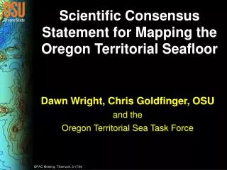
Scientific Consensus Statement for Mapping the Oregon Territorial Seafloor Dawn Wright, Chris Goldfinger, OSU and the Oregon Territorial Sea Task Force OPAC Meeting, Tillamook, 3/17/06
Territorial Sea, not the EEZ NOAA Coastal Services Center
Isn’t it already mapped? Could you find your way to every town on this map? Goldfinger et al., OSU Active Tectonics Lab
Ocean Thematic Layers Graphic courtesy of Christina Massel, Steve Miller, Scripps
Details, Details… 100 m 10 m California Dept. of Fish & Game, Moss Landing Marine Labs
An Example of Required Detail: Siletz Oregon Department of Fish & Wildlife, Marine Resources Program
An Example of Required Detail: Seal Rock Oregon Department of Fish & Wildlife, Marine Resources Program
Seafloor Mapping: How and What? Multibeam Single Beam Images courtesy of NOAA and UNH
Topo/Bathy is the Fundamental Base “Layer” USGS Cascades Volcano Observatory
Study Area Image courtesy of Dan Fornari, Woods Hole Oceanographic Institution