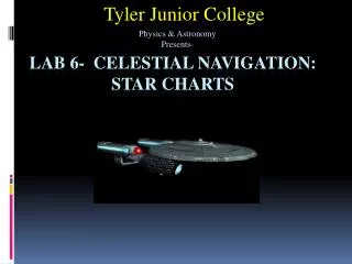
Physics 1404 Lab 3- Space Celestial Navigation
Tyler Junior College. Physics & Astronomy Presents-. Physics 1404 Lab 3- Space Celestial Navigation. Finding Points on Earth. Greenwich, England (London). Line of LATITUDE-measures North and South. Line of LONGITUDE or MERIDIAN- measure East and West. Prime Meridian. Longitude.

Physics 1404 Lab 3- Space Celestial Navigation
E N D
Presentation Transcript
Tyler Junior College Physics & Astronomy Presents- Physics 1404Lab 3- Space Celestial Navigation
Finding Points on Earth Greenwich, England (London) Line of LATITUDE-measures North and South Line of LONGITUDE or MERIDIAN- measure East and West Prime Meridian
Longitude Tyler Texas is 95° 16’ 56.4” W ° West ° East Longitude WEST 0° Longitude EAST Prime Meridian
Latitude North Pole (90°N) Tyler Texas is 32° 20’ 2.58” N FOR THE LAB THE LATITUDE IS: 30°N ! North Latitude Equator (0°) South Latitude South Pole (90°S)
Tyler Junior College: 95°W 30°N Thursday Greenwich England 0°Longitude Tyler Texas Wednesday Prime Meridian: Longitude starts here. International Date Line: The beginning and end of a day.
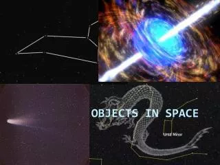
Celestial Coordinates • When we look up at the sky, there are also space & time references. • Earth Celestial • Latitude Declination (dec.) • Equator Celestial Equator • North Pole Celestial North Pole • Longitude Right Ascension (R.A.)
Celestial Sphere* * The Celestial Sphere is not real. It is concept based on the ancient idea that the world was the center of the universe and that celestial objects were attached the rotating sphere.
Other Celestial Terms • Ecliptic-The path the Sun takes as it travels across the sky. • Zenith-Point directly overhead. • Horizon-points where the sky meet the Earth. • Azimuth (Bearing)-measure of the points on the horizon measured from Celestial North in degrees. • Meridian-Imaginary line from North to South running through you Zenith. Planets and stars transit (pass through) it.
Other Celestial Terms • Altitude- Angle, in Degree ( ° ) in which a celestial object lies above the horizon (mostly the Southern horizon). • Elevation-Altitude
Celestial Terms 135° 0° 90° 270° 180° Azimuth Bearings
Azimuth Directions • Direction Azimuth (Bearing) • North 0° (360 °) • Northeast 45 ° • East 90 ° • ESE 112.5 ° • Southeast 135 ° • SSE 157.5° • South 180 ° • Southwest 225 ° • West 270 ° • Northwest 315 °
Celestial Latitude-Declination Stars above the Celestial Equator Have a Positive Declination. (dec. = +XX°) Stars below the Celestial Equator have a Negative Declination. (dec. = -XX°)
The Meridian Semicircle = 180° 90° 100° 80° 70° 110° 120° 60° 130° 50° 140° 40° 150° 30° 160° 170° 20° 180° 10° 00°
Declination 2 North Star, Polaris is very close to the North Celestial Pole. 90° +40° 100° +50° 80° +30° Celestial Equator 70° +20° 110° +60° 120° +70° 60° +10° 50° 0° 130° +80° 40° -10° 140° +90° 30° -20° 150° +80° 20° -30° 160° +70° 10° -40° 170° +60° 180° +50° 0° -50° Stars that are above +50° dec. are Circumpolar; they appear throughout the night. Stars greater than -50° dec. below Celestial Equator are NOT visible. Latitude 40° N
Declination 3 +40° 0° 90° 50° 270° -50° Stars that pass at the Zenith ( +40°)will rise 40° north of East (50° azimuth) and will set 40° north of West (310°) of azimuth. 310° Stars with dec =0°,those on the celestial equator rise at 90° of azimuth (EAST) and set at 270° of azimuth (WEST).
Declination of Major Stars • Star Name(s) Constellation dec. • Vega (α Lyra) Lyra + 38° 47’ 1” • Altair (α Aquila) Aquila + 8° 52’ 6” • Deneb (α Cygnus) Cygnus +45° 16’ 49” • Mizar (ζ Ursa Ma) Ursa Major +54° 55’ 31” • Antares (α Scorpio) Scorpio -26° 25’ 55” • Polaris (α Ursa Mi) Ursa Minor +89° 15’ 51” • Arcturus (α Bootës) Bootës +19° 10’ 56”
Measuring Declination θ DECLINOMETER –An Astrolabe (Crude Sextant)
The Astrolabe England 1388
Declinometer • How to measure declination with a Declinometer*: • 1. Sight the star through the straw. • 2. With one hand press the string against the protractor. • Read the angle measure to nearest degree from the “90°” mark. (Angle θ in degrees-This is the Altitude or Elevation) • dec. = Altitude- (90°-latitude) • Tyler’s Latitude is 32°N. • If θ =25° then dec. = 25°-(90°-32°) =25°-58° = • -33° • The star is 33° below Celestial Equator. • * THIS WORKS ONLY IF THE STAR IS ON YOUR MERIDIAN.
Declination Application • If you measure the North Star (Polaris) you would know you latitude. This is what ancient sailors did.
Celestial Longitude-Right ascension (R.A.) • Right Ascension is the East-West coordinate systems for the celestial sphere. The Celestial Prime Meridian. • I t is measured in a system similar to time, i.e. Hrs, Min, and sec. (00h 00m 00s). • The point of 00h 00m 00s is the point on the Sun’s northward path (Ecliptic) as it crosses the celestial equator (0° dec.) on about March 21th of each year known as the Vernal Equinox. • The star ω Pisces lines on this line (up/down). • R.A. run Eastward around the celestial sphere.
Right Ascension 2 (See SFA Chart 3) Sept. 8, 2010, stars with R.A. of ≈ 19h 10m 55s will past over Tyler’s Meridian at 8pm.
Right Ascension of Major Stars • Star Name(s) Constellation R.A. • Vega (α Lyra) Lyra 18h 36m 56s • Altair (α Aquila) Aquila 19h 58m 47s • Deneb (α Cygnus) Cygnus 20h 41m 26s • Mizar (ζ Ursa Ma) Ursa Major 13h 23m 56s • Antares (α Scorpio) Scorpio 16h 29m 24s • Polaris (α Ursa Mi) Ursa Minor 02h 31m 49s • Arcturus (α Bootës) Bootës 14h 15m 40s
Lab 3 Celestial Navigation- Time and Space The End