Download
1 / 23
230 likes | 395 Vues
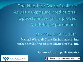
The Need for More Realistic Aquatic Exposure Predictions: Opportunities for Improved Modeling Approaches CLA-Rise, April 11, 2014. Michael Winchell, Stone Environmental, Inc. Nathan Snyder, Waterborne Environmental, Inc. Sponsored by Crop Life America. Outline. Background and Objectives

E N D
The Need for More Realistic Aquatic Exposure Predictions: Opportunities for Improved Modeling Approaches CLA-Rise, April 11, 2014 Michael Winchell, Stone Environmental, Inc. Nathan Snyder, Waterborne Environmental, Inc. Sponsored by Crop Life America
Outline • Background and Objectives • Desirable Characteristics in Drinking Water / Ecological Watershed Modeling • Current and Potential Modeling Approaches • Model Comparison Matrix • Example Model Applications • Summary and Conclusions • Next Steps and Discussion
Background • Current modeling approaches to assess drinking water and ecological risk from pesticides undergoing new registrations or re-registrations are conservative and designed to provide point estimates of risk. • There are models currently available that: • Provide flexibility to model actual drinking water watershed dynamics and incorporate spatial and agronomic variability. • Are fast, efficient, and may be used across a range of chemicals and geography. • New tools being developed at US EPA (Surface Water Concentration Calculator and Spatial Aquatic Model) may address some of the shortcomings of currently available modeling options.
Background (continued) • Based on a recent publication in JAFC (Winchell and Snyder, 2014): • In 50% of the modeling/monitoring comparisons, model predictions were more than 229 times greater than the observations • In 25% of the comparisons, model predictions were more than 4,500 times greater than the observations.
Objectives • Critically review: • The current modeling framework utilized by US EPA • Review and compare the capabilities of tools for use in regulatory modeling • Make recommendations regarding: • Modeling approach(es) or capabilities to provide realistic, yet still protective, predictions of concentrations of pesticides in surface drinking water sources
Required Watershed Characteristics and Model Processes • Watershed and receiving water characteristics • Drainage area to normal capacity ratio • Storage capacity to surface water area • Water body types (static, flowing) • Accurate representation of pesticide use (rates, timing, spatial distribution) • Watershed Heterogeneity: • Land-use (mixture of labeled, unlabeled crop, and non-agricultural land) • Soil and weather • Agronomic practices • BMPs (buffers, contour cropping, terraces, grass waterways) • Watershed scale drift assumptions, proximity to water bodies in larger systems • Environmental fate representation that may vary by soil
FIRST and Index Reservoir • EPA Tier I drinking water exposure model • Uses basic chemical parameters (e.g., half-life in soil) and pesticide label application information. • Estimates peak values (acute) and long-term average concentrations (chronic) of pesticides in drinking water. • Assumes up to 8% Runoff • Utilizes the same drift, PCA, and scenario assumptions as Tier II • No variability for soil, weather • Index Reservoir • Based on Shipman, IL • 172.8 ha Watershed, draining to a 5.3ha reservoir that is 2.7m deep
PRZM/EXAMS and Index Reservoir • EPA Tier II drinking water exposure model • PRZM model of runoff/erosion processes and EXAMS model of water body processes, coupled using user friendly shells (PE5 or EXPRESS) • Standard scenarios representing high vulnerability crop/soil/weather combinations • Environmental fate including soil/aquatic degradation, sorption, volatilization processes • Single soil, weather, cropping for watershed • Percent crop area (PCA)assumptions used to scale results based on assumed area receiving applications
WARP and WARP-CB • The United States Geological Survey Watershed Regressions for Pesticides (WARP) model. • Designed to predict percentiles of annual maximum atrazine concentration in flowing water bodies. • Originally developed based on a statistical analysis of atrazine monitoring data and has since been adopted for use with other pesticides through incorporation of a surface water mobility index. • Built on robust monitoring datasets; however, because it is not physically based, it is unable to provide important functions such as the simulation of alternative Best Management Practices. • Limited testing on pesticides for target crops with a smaller geographic extent than corn.
SWAT (Soil and Water Assessment Tool) • Watershed‐scale, continuous, physically‐based, semi‐distributed model used in a broad range of hydrologic and water quality applications • Strength in simulating the water quality impact of alternative management practices including tillage practices, buffers and grassed waterways, and pesticide application practices. • Pesticide transport modeling with SWAT has included assessments of pesticides in both static and flowing water bodies. • Can be implemented using readily available data in place of extensive site‐specific calibration for use in aquatic pesticide concentration predictions in complex watersheds.
PRZM-Hybrid • The PRZM‐Hybrid approach utilizes spatially explicit high‐resolution NEXRAD radar rainfall data, additional meteorology data, field‐scale soil properties from the US national SSURGO database, and spatially explicit land use data as input data to model daily watershed runoff concentrations. • Growing Degree Day (GDD) and soil workability routines developed to estimate application timing. • Synthetic hydrograph determination using time of concentration and estimated travel time. • Methodology developed as a tool to fill in the gaps between monitoring data but broader uses are appropriate
Comparison Matrix • The five modeling approaches were evaluated based on 9 categories of criteria, seven of which are summarized here: • Environmental Fate • System Hydrology • Soil • Cropping • Weather • Application and Drift • Transport Processes
Summary of Modeling Approach Comparison • SWAT and PRZM-Hybrid best meet the criteria that were established for watershed scale exposure modeling.
Example, PRZM-Hybrid • More accurate rainfall, soils, crop, and agronomic practice inputs result in good agreement between observed and simulated pesticide concentrations.
Example, SWAT • Modeling drinking water or ecological exposure in larger, complex watersheds (e.g., California Delta) requires approaches that: • Represent the landscape heterogeneity • Account for hydrologic routing of water and pesticide Soils Landuse
Example, SWAT • For flowing water body segments within and surrounding the species critical habitat, observed maximum concentrations were compared with modeled 90th percentile concentrations. • Modeled concentrations were within the same order of magnitude as monitoring data for a variety of water body types, from major rivers to small sloughs.
Summary and Conclusions • Severalcurrently available models (SWAT or PRZM-Hybrid) have the ability to represent more complex and realistic hydrology, soil, weather, and application technologies than is possible with the models currently used by EPA. • US EPA scientists and pesticide registrants have evaluated the use of watershed modeling approaches in the past, and because many of the tools have matured, a similar effort should be explored again. • Regardless of the model platform, achieving more realistic model predictions will require incorporating accurate assumptions for inputs, particularly pesticide use intensity. • There is opportunity to include more spatial and temporal sophistication in exposure modeling with minimal additional dedication of time and resource to completing assessments.