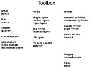
Spatial Analyst Toolbox
Spatial Analyst Toolbox. Lecture 17. Conditional Density Distance Generalization Ground Water Interpolation. Spatial Analyst Tool Sets. Local Math Reclass Surface Zonal. Spatial Analyst Tools work with Raster Data.


Spatial Analyst Toolbox
E N D
Presentation Transcript
Spatial Analyst Toolbox Lecture 17
Conditional Density Distance Generalization Ground Water Interpolation Spatial Analyst Tool Sets
Local Math Reclass Surface Zonal
Spatial Analyst Tools work with Raster Data • Spatial Analyst Tools calculate an output value for your specific location (cell). • You need to know three things to calculate an output value: • The value of your specified location (cell) • The manipulation of the operator or function • Which other cell locations and their values to include in your calculations.
Types of Functions • Local • Local functions rely on the value in a single cell of a raster database in order to produce an output raster value. • E.g. Sin • Focal • Focal functions rely on the value in a single cell and the cells surrounding it, defined as a neighborhood, in order to produce an output raster value. • E.g. Mean
Zonal • Zonal functions rely on the value in a single cell and cells in a zone that is defined in the calculation to produce an output raster value. • The zone is not necessarily contiguous with the first cell, and each zone may be unique. • E.g. Mean
Global • Global functions calculate an output data set where a calculation is done at each cell location, taking input for the calculation from various input raster datasets. • There are two groups of global functions: • Euclidean distance global functions • Weighted distance global functions • Application • Application functions are functions that are designed to produce an output for a specific purpose. • E.g. Stream networks or watershed deliniation
Interpolation Toolset • Estimates values that you don’t have by using values that you do have. • E.g. County temperatures are measured at a few specific locations, but you can predict the temperature at any point in the county . • Kriging • IDW (Inverse Distance Weighting) • Spline Interpolation
Kriging, IDW and Spline Interpolation • Each of these tools takes a set of points and produces a raster that estimates a value for each cell in the raster. • Each of these tools uses a different algorithm, and will return different results. • Try different methods and see which makes sense for the data that you have.
Each cell has three important values for interpolation. • X and Y value location • Z value data • E.g. precipitation • The estimation is based on the value at the known points. • It’s best to have evenly distributed sample points. • The more points and more distributed the points, the more accurate the estimation.
Activating Spatial Analyst Extension License • If the Spatial Analyst Extension is not activated: • Tools • Extensions • Check Extensions to activate the License
Important Issues • To do spatial analysis: • Can’t use Join or Relate to link tables. • The Data must be added to the attribute table in the shapefile.