Automated Data Collection and Distance Calculation using Sound Travel Techniques
160 likes | 280 Vues
This lecture delves into the methodology behind automated data collection and distance calculation through sound travel. Key components include the use of accurate timepieces, the ability to capture distant sound signals, and understanding sound travel speed (750 miles/hour). The lecture contrasts GPS satellite positioning with soundhouse techniques, exploring the factors affecting distance measurements such as satellite clock errors and Dilution of Precision (DOP). Emphasis will be placed on the impact of geometry on accuracy in both 2D and 3D measurements during sound-based data collection.

Automated Data Collection and Distance Calculation using Sound Travel Techniques
E N D
Presentation Transcript
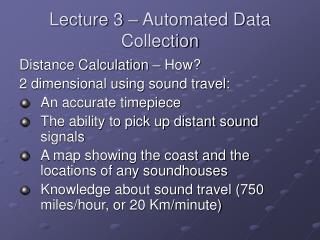
Lecture 3 – Automated Data Collection Distance Calculation – How? 2 dimensional using sound travel: • An accurate timepiece • The ability to pick up distant sound signals • A map showing the coast and the locations of any soundhouses • Knowledge about sound travel (750 miles/hour, or 20 Km/minute)
Suppose: • S1 has a sound house • Sound house emits a blast each minute • Objective – To determine the distance of your vessel at V.
How it works Measuring Distance By Measuring Time • Known locations of GPS satellites • Knowledge of signal travel speed (300000 Km/Sec) • Accurate clocks on GPS satellites and GPS receivers Then distances from GPS receiver to several satellites can be calculated and can be used to compute receiver’s position
Soundhouse VS NAVSTAR • 3D VS 2D • Dynamic VS Static • Radio Waves VS Sound • Auto VS Manual
From 2D to 3D La From one satellite (a), we could compute the circle where x locates.
From 2D to 3D (cont.) Candidate 1 for x La Circle Candidate 2 for x Lb Circle
Factors Affecting When and How to Collect Data Major factors that relate to the accuracy of GPS measurements are: • satellite clock errors • ephemeris errors • receiver errors • ionosphere errors • troposphere errors • multipath errors
Dilution of Precision (DOP) • High DOP values can magnify the other errors • DOP values can be monitored during data collection and excessive DOP values can be masked out • DOP values can be predicated • Differential correction can not help with data collected with inappropriate DOP values
Position Accuracy and DOP The quality (accuracy) of fix is depend on a number of factors, including • the number of satellites in view, and • their geometry, or arrangement, in the sky.
How DOP can affect accuracy? Figure 2-7. Area in which “x” might reside, given satellite positions “a” and “b.” The shaded figure indicates the area that contains the actual location sought.
Actually, what is DOP? DOP – sometimes referred to as GDOP (Geometric Dilution of Precision), is a number which is a measure of the quality you might expect from a position measurement of the GPS system based solely on the geometric arrangement of the satellites and the receiver being used for the measurement.
Different DOPs • GDOP (Geometric Dilution Of Precision); Overall-accuracy; 3D-coordinates and time • PDOP (Positional Dilution Of Precision) ; Position accuracy; 3D-coordinates • HDOP (Horizontal Dilution Of Precision); horizontal accuracy; 2D-coordinates • VDOP (Vertical Dilution Of Precision); vertical accuracy; height • TDOP (Time Dilution Of Precision); time accuracy; time