“Forest & Mining”
“Forest & Mining”. Using applications of GIS a study on “ Odisha forest issues with development of mines activity and to maintain their boundary to prohibit unauthorized encroachment” Manas Ranjan Swain Vinod . P.G .

“Forest & Mining”
E N D
Presentation Transcript
“Forest & Mining” Using applications of GIS a study on “Odisha forest issues with development of mines activity and to maintain their boundary to prohibit unauthorized encroachment”ManasRanjan SwainVinod. P.G
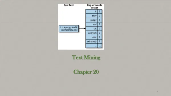
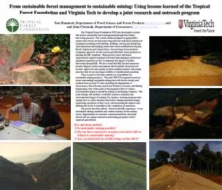
This paper is basically a study on mining in forest covered area and its issues and potentials, which deals with how the GIS can be brought to an open platform especially with a customization for the states forest departments. This will be an information system as well as safe guarding our green lines from the mining unauthorized encroachments. With a combination of various data designed and placed so beautifully that a forest officer can operate and identify the result on ground. Introduction
Forest Map of Odisha State. Total Area of State:15.57 Million.Ha Forest Area: 58136.87 Sq.Km This is 37.34% of the state’s total geographical area.
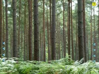
Kendujhar District of Odisha Forest Covered Area A virgin Forest Area Till 2006 near about 10052.551 Ha of forest land are in use for Mining activity.
Forest Area Diverted for Non-Forest Use Forest Area Granted for Mining Forest Area after Mining Development
Critical Land Features • Example of forest granted for mining in a very dense and stiff hill slope. • How could a forest officer measure or sure about the cleared forest area during their inspection? • In this case conventional survey methods will take 10 to 15 days for any out put.
2005 2010
Present Scenario • To track and monitor a mining activity & its Boundary… • Lease and Broken Pillars marked with Geo-Coordinate. • Authenticated Land use map. (2D Map). • GPS
Forest Area Diversion. • Valid Statutory Clearances. • Necessity and justification of the project. • Production ratio affecting surrounding forest habitat. • Proposed Land Use pattern justification with reference to Ore Body Modeling. • Existing Sanctuaries, Animal Corridor etc. • Impact on Flora and Fauna of the area.
Concept Satellite Picture Satellite-Imagery Processed in GIS Toposheet - SOI
Base Map Base Map in 3D Ref:Toposheet Base Map in 2D
Ready for ground inspection Mines data added and processed in GIS Uploaded
Conclusion • There is immense pressure on forest department to maintain the authenticity and integrity of forests and in the same time they have to justify the diverted forest for non forest use for our economic growth. • With a well managed data base in GIS environment we can manage our forest with a scientifically validated decision. • Time has came to utilize the modern technology available with us to safe guard the nature from the impact of rapid industrialization.