Download

1 / 16
160 likes | 280 Vues
EXPLORING LINKAGES BETWEEN PLANT-AVAILABLE SOIL MOISTURE, VEGETATION PHENOLOGY AND CONVECTIVE INITIATION By Julian Brimelow and John Hanesiak.

E N D
EXPLORING LINKAGES BETWEEN PLANT-AVAILABLE SOIL MOISTURE, VEGETATION PHENOLOGY AND CONVECTIVE INITIATION By Julian Brimelow and John Hanesiak
“The sensitivity of the synoptically forced convection to soil and vegetative processes including transpiration indicates that detailed representation of land surface processes should be included in weather forecasting models, particularly for severe storm forecasting where local-scale information is important”. Holt et al. (2006)
SCIENCE QUESTIONS UNSTABLE 2008: Theme II 2.1) Is there a noticeable difference in storm initiation between wet and dry areas over the cropped region? 2.2) Is there a noticeable gradient of surface and boundary layer water vapour across the major wet/dry areas, and how do these evolve? 2.3) Are mesoscale circulations detectable in the vicinity of boundaries between wet and dry areas? If so, how do they influence storm initiation?
HYPOTHESIS “Modification of the local thermodynamics, [by the underlying land surface] causing changes in the LCL, and CAPE,…can have important consequences regarding the location and timing of convection initiation” Georgescu et al. (2003)
Sensitivity of convection to near surface T and q MSE = gz + CpT + Lq Must increase T by ~2.5 °C to increase MSE by same amount as 1°C increase in q • CAPE is very sensitive to Δq CIN, however, more sensitive to surface ΔT Crook (1996)
PRIMARY CAUSES OF LAND-ATMOSPHERE FEEDBACKS • Soil moisture • Vegetation • Orography • Land use
SOIL MOISTURE “The role of soil moisture in ABL development involves a complex interaction of surface and atmospheric processes”. Ek and Holtslag (2003)
Findell and Eltahir (2003): The propensity of the atmosphere to support convection is not only dependent on the surface and energy budgets, but also on the structure of the low-level temperature and moisture profiles in the early morning.
Energy Balance: Crop vs. Bare Ground Energy Balance: Crop vs. Forest
VEGETATION Strong and Smith (2001)
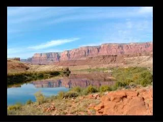
UNSTABLE PROJECT AREA Calgary
TOOLS Mobile Atmospheric Research System (MARS)
METHODOLOGY • Phase 1: • Document the spatial and temporal evolution of the plant-available moisture in the root zone (PAW) using crop model and in-situ observations • Document the spatial and temporal evolution of the NDVI • Create an inventory of wet versus dry areas, and tight PAW/NDVI gradients • Phase 2: • For each day, classify synoptic-scale forcing as weak, moderate or strong, using objective guidelines • For each day, characterize structure of the boundary layer in morning • Phase 3: • Use mesonet, mobile mesonet, MARS, Doppler radar and aircraft data to create an inventory of meso. boundaries • Conduct transects across regions of contrasting PAW • Use high resolution VIS satellite images to create archive of those boundaries associated with deep, moist convection • Determine whether boundaries are associated with gradients in PAW
Phase 4: • Quantify CG flash density over wet vs. dry areas, and near PAW gradients • Use radar data to quantify storm intensity and properties over wet and dry areas • Use radar data to document any changes in storm structure and intensity when transitioning from wet to dry PAW and vice versa • Phase 5: • Document cloud base height (from ceilometer) over wet and dry areas • Compare with cloud-base height derived using sfc. and mixed-layer parcels • Phase 6: • Search for lagged correlations between PAW and NDVI and CG lightning (also apply Granger’s causality test) • Search for lagged correlations between PAW and NDVI and storm strength as determined from radar data • Search for possible connections between storm initiation zones and gradients between wet and dry PAW


![Koepke et al., [1997] Kaufman and Tanre [1997] Levy et al., [2004] Remer et al., [2006]](https://cdn2.slideserve.com/3945504/slide1-dt.jpg)