Download
1 / 31
330 likes | 477 Vues
Spatial data infrastructure for the cross- border region Centrope Follow-up project Centrope MAP Part III On behalf of the Planungsgemeinschaft Ost (PGO), Vienna, 2005. DI Manfred Schrenk & Mag. Timo von Wirth Multimedia plan .at – Vienna. Agenda Workshop I 10 :00 Welcome Keynotes:

E N D
Spatial data infrastructure for the cross-border region CentropeFollow-up project Centrope MAP Part III On behalf of the Planungsgemeinschaft Ost (PGO), Vienna, 2005 DI Manfred Schrenk & Mag. Timo von Wirth Multimediaplan.at – Vienna
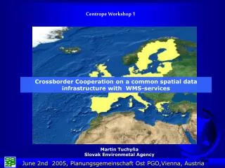
Agenda Workshop I • 10:00 • Welcome Keynotes: • DI Walter Pozarek, PGO – DI Manfred Schrenk, Multimediaplan.at • 10:15 • Short introduction round („who is who“) - First comments on the project background • 10:20 • Presentation 1: Follow-up project CENTROPE MAP First results, technical issues, WMS service exchange, further common steps DI Manfred Schrenk & Mag. Timo von Wirth, MULTIMEDIAPLAN.AT • 10:50 • Discussion session, Project Comments 11:00 • Presentation 2: The webportal Geoland.at by the Austrian federal states DI Thomas Zalka, Burgenland GIS
Agenda Workshop I • 11:30 • Presentation 3: WMS services of Jihomoravsky kraj [CZ] • Ing. Roman Vrba, Jihomoravsky kraj • 12:00 • Discussion round – WMS service exchange • 12:15 • Break • 12:45 • Presentation 4: WMS services of the SAZP, Bratislava, [SK] Ing. Martin Tuchyna 13:15 • Discussion and Conclusions 14:00 • End of workshop
Overview • Background/ Motivation • Project steps • Technical aspects • Outlook/ Perspectives
Centrope Region – Characteristics I • Cross border region with enormous economic development potential, Centrope within Top 5 of dynamic European regions • Common planning and common cross-border information exchange will increase • Common cross-border project development and the need for a consistent spatial data basis are essential • Digital Spatial data infrastructure is seen as crucial location factor and planning basis
Centrope Region – Characteristics II • „European Region Centrope“ comprises of: • Jihomoravsky(South Moravia) and Jihocesky (South Bohemia)[CZ] • The districts (Kraje) Bratislavsky and Trnavsky[SK] • The Komitate (Megyek) Moson-Györ-Sopron and Vas[HU] • The „Vienna Region“ including the Austrian states Burgenland, Lower Austria and Vienna[AT] • Definition should not be seen as strictly limited to this borders in longterm, as further regions stated interest in cooperations.
Overall project goals • Build / Improve „(Geo-) information infrastructure“ • Public sector information basis for stronger cooperation within the cross-border region CENTROPE • In terms of regional developement, planning, improved location competitiveness and quality of life • Ensure a prosperous common future developement • Positive contribution to „Building a sustainable European region“ • Major task of Centrope_Map is to make geoinformation infrastructure sustainably accessible
Work packages Project phase III • Further extension of spatial data sources • Consulting on external purchase of „Centrope“ Satelite image • Integration and harmonisation of further spatial data • Corine Land Cover data 2000 for Austria • Macon data update for Czech republic, Slovakia and Hungary • Teleatlas street data for Burgenland and Lower Austria • a.o. • Integration of further statistical data as accessible • Development and Implementation of a Web Map Server and Client Solution for displaying of OGC WMS services • Consulting and communication on regionwide data exchange mechanisms • Increasing cross-border cooperation and communication on spatial planning data issues (workshops, information dissemination)
Dual project approach Project phase III Centrope data collection - PGO Data integrated in PGO WMS service Original geodata on DVD www Burgen- land Lower- Austria Vienna Map image data in client Original geodata with use limitations WMS CZ WMS AT WMS EU Contractors WMS HU WMS SK Centrally stored original data Distributed Server data
Background/ Motivation • Project steps • Technical aspects • Outlook/ Perspectives
Centrope MAP – Data DVD • Full release Nr. 3.0 will be published end of first half 2005 and will then include: • Corine Land Cover 2000 Data for AT, CZ, SK and HU in full coverage • with up to 44 single land use classes • Update of Macon data for CZ, SK and HU (Admin., Code, Name changes) • Teleatlas street data for Burgenland • Updated Highway file for Austria provided by Noegis • Centrope region Satelite image – Landsat ETM, 15m resolution • (to be integrated ~ 20th June)
CORINE LAND COVER 2000 DATA provided by EEA • Corine land cover 2000 (CLC2000) is essential part of the European Commission programme to COoRdinate INformation on the Environment (CORINE). • All vector features digitised from an interpretation of satellite images (IMAGE2000 project) of the scale 1:100 000. 150 m positional accuracy (according to CLC specifications) • CLC2000 data is available for 3 levels of detail. Level3 comprises of 44 classes such as: Natural grasslands, Mixed forest, Airports, Road and rail networks and associated land, Continuous urban fabric, a.o. (Source: EEA) • Full vector coverage now for all 4 Centrope coutries. Austrian data is fully integrated. • Data can be overlayed with all other Centrope spatial information • Free data access to raw data (.shp/.dbf) for registered expert customers and non-commercial use
Background/ Motivation • Project steps • Technical aspects • Outlook/ Perspectives
Web Map Services • System independent use of geo data is often not possible due to incompatible data and software project formats • Large amount of working steps for data conversion, integration and reproduction of data • No adequate method of updating stored data from other institutions. • Web-Map-Service-Specification (WMS-Specification) by Open Geospatial Consortium (OGC) • Standards and procedures for the use of distributed spatial data from distributed data sources over the internet • Generate maps with the exchange of shared services from different sources and different software systems • Original vector data is not accessible and is updated by data owner on location.
Web Map Services • Spatially referrenced maps, dynamically generated from image files of the original data itself • OGC-compliant WMS fulfills the standards stated by the Open Geospatial Consortium and • guarantee „interoperability“: WMS can communicate and interact with different Server products as well as with different Viewing Clients to generate the map image • WMS – Requests • OGC-compliant WMS offer three core functions/ requests • GetCapabilities • GetMap • GetFeatureInfo
GetCapabilities Request The core „functions“ and „capabilities“ of the addressed WMS Server are transferred and contain the Version of the related OGC Standard but also supported data formats, available layers, a.o.Information returns in form of a XML-Document to requesting user • GetMap Request Is defined by WMS Client for map generation Requests map content (layers) in specific style and spatial reference format from the different data source servers Answer to the GetMap request = georeferenced Image file (png/jpg/tif) • GetFeatureInfo Request Asks server for additional information on displayed map data Answer to the GetFeatureInfo request = sending attribute data connected to displayed geodata set
Interoperability and Standards with online GIS: Visualization: Open GIS Web Map Service (WMS) Data access and attributes: Web Feature Service (WFS) Data exchange: Geographic Markup Language (GML) Data presentation and styles: Styled Layer Descriptor (SLD) Metadata: ISO metadata standard 19115 Centrope MAP – Map Server Test data for external requests: http://deegree.centropemap.multimediaplan.kosnet.com/deegree2/wms/wms?SERVICE=WMS&VERSION=1.1.1&REQUEST=GetCapabilities
Background/ Motivation • Project steps • Technical aspects • Outlook/ Perspectives
Future Worksteps/ Modules • Intensify communication and exchange with all regions from four participating countries (planners and GIS/data experts) • Agreements on direct data exchange between regions as long as national/ European solutions are not found • Visualization of Metadata in Metadata Catalogue (Preview) • Comprehensive metadata describtion of current data • Establish monitoring system with permanent data collection according to defined indicator list • Connect to similar national and international WMS initiatives (e.g. Inspire, Geoland.at)
Thank you for your attention! DI Manfred SchrenkMag. Timo von Wirth multimediaplan.at Baumgasse 28 A-1020 Wien schrenk@multimediaplan.at tvw@multimediaplan.at www.multimediaplan.at