Download
1 / 51
510 likes | 528 Vues
Explore the changing patterns of extreme weather in the Pacific Northwest based on peer-reviewed literature and the latest modeling research. Topics include heavy precipitation, windstorms, drought, and more.

E N D
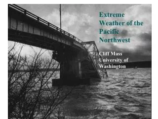
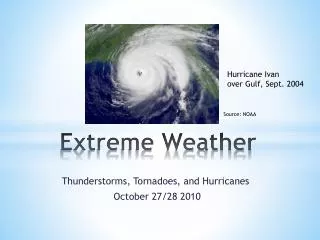
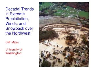
Extreme Weather Trends over the Pacific Northwest Cliff Mass Department of Atmospheric Sciences University of Washington Northwest Climate Conference September 2014
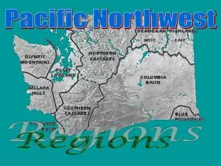
There is a lot of interest and contradictory information about changes in the frequency of extreme weather over the Pacific Northwest • Heavier rain? • More flooding? • Heat waves • Stronger windstorms? • More drought? • Collapsing snowpack?
This talk will provide a fresh view based on peer-reviewed literature and the latest modeling research .
Trends of 7-day extreme: 1931-963 and 1-day extremes were similar • Kunkel, Andsager, and Easterling, J. of Climate, 1999 Little trend in the NW. Suggesting of small increases in western WA and decreases in western Oregon (tail indicates significant at 5% level)
Are there trends in major precipitation events? • Examined top 20, 40, 60 two-day precipitation events at stations along the coast for 1950-2008.
Trends on Unregulated Rivers1950-2009: Max Annual Daily Discharge
What will happen to extreme precipitation over the Northwest under global warming? To get the answer must answer another question: What will happen to atmospheric rivers under global warming?
One Answer Changes in wintertime atmospheric rivers along the North American west coast in CMIP5 climate models Michael D. Warner, Clifford F. Mass, Eric Salathé, Jr. Geophysical Research Letters (in review)
What do the latest CMIP climate models says about changes in atmospheric rivers?
Integrated Water Vapor Flux Extreme (99%) Mean
Precipitation (offshore) 1970-1990 2070-2099
Results • Winter-mean precipitation along the West Coast increases by 11-18% while precipitation on extreme atmospheric river days increases by 15-39% . • The frequency of days above the historical 99th percentile threshold in water vapor flux increases as much as 290% by the end of this century.
Other Results from Mike Warner’s Thesis There is a shift of heavier precipitation events to earlier in the season 10-model winter mean (October-March) climatology of AR events defined by historical (1970-1999) 99th percentile IVT and averaged over the northwest coast. Red (2070-99)) and blue (1970-99) NCEP reanalysis events are represented in black solid line.
Northwest Windstorms • Will there be more of them? • Will they become more intense? The Inauguration Day Storm 1993
Northwest Windstorms • The answer appears to be no. There will not be an increasing trend. • But first, what has been the trend over the past half-century?
West Coast windstorm trend since 1950 • Increasing number of major windstorms from northern Oregon into southern BC • Decreasing numbers to the south.
Seattle City Light sponsored study • Researchers: Bri Dotson, Eric Salathe, Guillaume Mauger, Rick Steed, Me • Looked at dynamically downscaled (WRF) runs driven by global climate models. • And looked at wind trends in CMIP5 climate models.
Number of times per year above the 90 percentile wind speed for 1970-2000 (DJF) Just offshore of Washington Coast No Trend
Raw CMIP5 models are all over the place! HADGEM Model
Why SHOULD we expect Northwest windstorms to change? • Their energy source is the jet stream and the strong horizontal temperature gradients associated with it. • Most global climate models suggest that the temperature gradients will weaken at low levels as the Arctic heats up more than the poles. • But the temperature gradient increases in upper troposphere.
Little change in the integrated temperature gradient in the lower troposphere • Thus, only small changes in the jet and windstorms that derive their energy from it. 850 hPa total wind for the contemporary (blue) and end of century (red) periods. From Warner et al., (2015)
Difference (small everywhere) Particularly small over the Northwest and the Gulf of Alaska
Hurricanes hitting the Northwest? Forget it, even a warmed eastern Pacific will be far too cold.
Northwest heat waves? • A very complex story with our mountains and land/water contrasts. • True heat waves only occur over the western, populous side of the region when there is offshore (easterly) flow. • Matt Brewer, a UW Ph.D. candidate has done several papers on heat waves.
The cool eastern Pacific protects the west side from extreme heat most of the summer: this will not change
And recent decadal trends and most coupled climate models suggest the eastern Pacific will warm up less and slower than most locations Change in Winter Surface Air Temperature (°C) for 1979-2008
But there is something else. Could the mesoscale meteorology of the region work AGAINST heat waves? • Most models indicate more warming over land than water. • Might the greater heating cause more pressure falls over land and thus larger onshore pressure gradients. • Could this bring in MORE cool air and mitigate the warming?
Major New Finding (Matt Brewer, next talk)Might strong easterly flow events decline under global warming?
Dynamically Downscaled CCSM3 climate model (using WRF at 12-km)
Could fewer offshore flow events reduce the potential for regional heat waves?
Critical need for understanding changes in NW extremes under global warmingHigh-resolution century-long dynamically downscaled climate runs.
A substantial deficiency and opportunity • Downscale 10-20 CMIP5 climate models using a mesoscale model (WRF) • Must get to 12-km or less. Needs bias correction and statistical post-processing • Can not be done efficiently on distributed computing on folks pcs…need big machines. • Computer resources are available. Mainly people time. • Can the community come together to do this?
Conclusions • Under global warming there is the potential for stronger atmospheric river events, and thus flooding near major rivers. • No reason to expect major Northwest windstorms to become more frequent or intense. • The region will warm slowly during the next century, but changes in extremes may be moderated due to the Pacific and our terrain.