Download
1 / 12
120 likes | 252 Vues
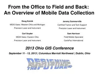
From the Office to Field and Back: An Overview of Mobile Data Collection. Doug Kotnik MGIS Sales: Western Ohio and Michigan Precision Laser and Instrument. Jeremy Summerville Certified Trainer and Tech Support Precision Laser and Instrument. Carl Snyder MGIS Sales: Eastern Ohio

E N D
From the Office to Field and Back: An Overview of Mobile Data Collection Doug Kotnik MGIS Sales: Western Ohio and Michigan Precision Laser and Instrument Jeremy Summerville Certified Trainer and Tech Support Precision Laser and Instrument Carl Snyder MGIS Sales: Eastern Ohio Precision Laser and Instrument Sam Harrison Field Mobile Specialist CartoPac International 2013 Ohio GIS Conference September 11 - 13, 2013 | Columbus Marriott Northwest | Dublin, Ohio
Agenda • Introductions • Things to consider when choosing a field data collection solution • Comparison of field data collection solutions • GeoJot • TerraFlex demo • ArcMobile demo • CartoPac demo • Question and Answer • Hands on time
Things To Consider… • Why Integrate Handheld Devices into a Field Data Collections Program? • Lose the paper! • More consistent, More accurate data • Automated workflow, less chance of lost data • Integrate External Devices (barcode scanners, pictures, range finders) • Efficiency
Things To Consider… • Why Integrate Handheld Devices into a Field Data Collections Program? • What accuracy do I require? • High Accuracy or close enough • Mapping grade accuracy: 4” – 20 meter • Vertical accuracy
Things To Consider… • What type of devices should I use? • Data Collectors, Smart Phones, IPads, Cell Phones, Tablet • Accuracy • Cost • Durability • Usability (screen size, battery life, weight)
Things To Consider… • Who will be collecting the data? • Experienced GIS staff, non-technical field staff, the public • Single User vs Enterprise
Things To Consider… • Who will be collecting the data? • Experienced GIS staff, non-technical field staff, the public • Single User vs Enterprise • What environment will you be collecting in? • Urban vs Remote
Things To Consider… • Who will be collecting the data? • Experienced GIS staff, non-technical field staff, the public • Single User vs Enterprise • What environment will you be collecting in? • Urban vs Remote • Where is your data going? Who will be consuming it? • Updating mature existing databases • Exported in various formats to multiple users
Things To Consider… • Cost!!! • Software / Hardware costs • Hardware / Software maintenance • Overhead and Support • On-site vs Cloud • Technical Support and Development
GeoJot A Picture CAN Be Worth More than a 1000 words; it could Literally Save you Time AND Money! Thursday 2:35pm - 3:05pmDublin Room I & II John Puente - Ohio Department of Transportation