Download
1 / 55
570 likes | 671 Vues
Explore the concepts and basis of swell waves, their properties, and wave spectra analysis in marine and oceanography research.

E N D
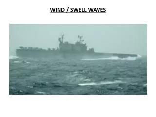
SWELL WAVES : concepts and basis Jean-Michel Lefèvre Meteo-France Marine and Oceanography Jean-Michel.Lefevre@meteo.fr Aknowledgement to Jaak Monbaliu from UKL for having provided some of the material Wind Wave and Storm Surge workshop-Halifax 16-20/06/03 Wind Wave and Storm Surge Workshop Halifax 16-20/06/03
from Chapron et al., presented at the ASAR calibration review, ESEC 10-11 Sept. 2002 Spatio-temporal analysis Look filters Bright targets only on one look Azimuth Variation of backscatter intensity with short duration within the integration time Expected correlation to only apply on long duration patterns (longer waves) integration time Wind Wave and Storm Surge Workshop Halifax 16-20/06/03
ASAR level 2b products, from Chapron et al. External wind direction information used (ECMWF), requires minimum wind speed, not high wind speeds (<20 kts) Wind Wave and Storm Surge Workshop Halifax 16-20/06/03
1-day altimeter sampling (from Queffeulou) Wind Wave and Storm Surge Workshop Halifax 16-20/06/03
SWIMSAT Project, Hauser et al., submitted to ESA in 2002, • Real aperture radar system at Ku-band (13.6 GHz) • scanning in incidence (0 à 10° every 2°), Conical scanning of 360°(in azimuth) • Nadir look : similar use as an altimeter (wind/Hs) • Off-nadir look : estimation directional wave spectrum (complement SAR) • 50-70 m wavelength for wind sea; minimum detectable wave height of 1 m for swell Better than SAR for detecting shortest waves (SAR limited to long waves Above 150-200 m wavelength) but much lower resolution (SAR: 5x10 km) • Angle of incidence combination • various spatial scales (50x50 km; 90x90 km) • access to other parameters (wave slopes) Wind Wave and Storm Surge Workshop Halifax 16-20/06/03
Swell measurements • In situ • Buoys • Platforms • Sea bed (Pressure gauges) • Remote sensed • Ground: Coastal radars or sky-wave radars (HF) • Ship : X-band navigation radars • Air-Plane : Microwave radars • Satellite : Microwave, SAR (Ku and C bands) – RAR (Ku band) Wind Wave and Storm Surge Workshop Halifax 16-20/06/03
how to define a swell ? • Waves travelling out of their generation area waves travelling faster than the wind speed : C> U. cos(-) • C is the phase speed • U is the 10m wind speed • is the wave direction • is the wind direction Wind Wave and Storm Surge Workshop Halifax 16-20/06/03
Swell properties • A swell has a low stepness and a high wave age, C/U (>1) Relatively small interactions with other wave components and with the wind Linear wave theory « well » appropriate to describe swell Wind Wave and Storm Surge Workshop Halifax 16-20/06/03
Linear wave theory air-water boundary interaction a) coupled wind waves b) forced waves c) free waves (Dean & Dalrymple, 1991; their fig 3.4) Wind Wave and Storm Surge Workshop Halifax 16-20/06/03
SUMMARY boundary value problem specification for periodic water waves (Dean & Dalrymple, 1991; their fig 3.7) Wind Wave and Storm Surge Workshop Halifax 16-20/06/03
progressive linear wave Wind Wave and Storm Surge Workshop Halifax 16-20/06/03
shallow water waves deep water waves Wind Wave and Storm Surge Workshop Halifax 16-20/06/03
asymptotes to hyperbolic functions (Dean & Dalrymple, 1991; their fig 3.12) Wind Wave and Storm Surge Workshop Halifax 16-20/06/03
Two waves superposition Many waves superposition Time series of displacement (from Massel figure 3.2) Wind Wave and Storm Surge Workshop Halifax 16-20/06/03
from Massel figure 1.3 Wind Wave and Storm Surge Workshop Halifax 16-20/06/03
Determination of wave spectraFourier Analysis For a time-interval t to t + T where = 2/T, b0 is zero and a0 is the mean of the record Wind Wave and Storm Surge Workshop Halifax 16-20/06/03
in the complex domain The covariance function its Fourier transform = power spectrum Wind Wave and Storm Surge Workshop Halifax 16-20/06/03
analytical expressions PIERSON-MOSKOWITZ SPECTRUM JONSWAP SPECTRUM Wind Wave and Storm Surge Workshop Halifax 16-20/06/03
JONSWAP experiment Wind Wave and Storm Surge Workshop Halifax 16-20/06/03
Type of spectra • amplitude in function of frequency • energy in function of frequency • energy density in function of frequency • directional spectra • Shape of the spectrum • broad • narrow • single peaked • double peaked Wind Wave and Storm Surge Workshop Halifax 16-20/06/03
DIRECTIONNAL WAVE SPECTRA WIND SEA CASES Wind Wave and Storm Surge Workshop Halifax 16-20/06/03
DIRECTIONNAL WAVE SPECTRA SWELL CASES Wind Wave and Storm Surge Workshop Halifax 16-20/06/03
DIRECTIONNAL WAVE SPECTRA CROSS SEAS Wind Wave and Storm Surge Workshop Halifax 16-20/06/03
Comparison between wave spectra: with a cut-off of 0.1 Hz; Long=282 deg;lat=-26 deg May 3, at 6:00 Wind Wave and Storm Surge Workshop Halifax 16-20/06/03
Wave statistics Hp : average of the largest pN waves (N is the number of waves, p > 1) H1/3 : average of the highest third of the waves significant wave height Hmax : maximum wave height Wind Wave and Storm Surge Workshop Halifax 16-20/06/03
narrow banded spectrum for the swell • large number of sinusoids, but statistically independent • frequencies near a common value The result is a Rayleigh distribution for the wave heights: wave height exceeded by n waves out of a total N: Wind Wave and Storm Surge Workshop Halifax 16-20/06/03
wave heights • significant wave height • maximum wave height • mean wave height wave periods • zero upcrossing or downcrossing • mean wave period • peak period Wind Wave and Storm Surge Workshop Halifax 16-20/06/03
Partition 2 Partition 3 Partition 4 Partition 1 Partitionning of the wave spectrum For each partition, mean parameters are computed (energy, direction, frequency) Wind Wave and Storm Surge Workshop Halifax 16-20/06/03
Existing tools Wind Wave and Storm Surge Workshop Halifax 16-20/06/03
Great circle track • All ocean waves move along great circle tracks. • A great circle is the shortest distance between two points on a sphere. • When swell travels great distances over ocean, the great circle track may by markedly different than a straight line on your specific map projection. • One needs to know the track to estimate the distance from the incoming swell and the time of arrival! Wind Wave and Storm Surge Workshop Halifax 16-20/06/03
Swell track Nb: Ceci n’est pas une image instantanée, 10 jours de mesures ont été utilisés. Wind Wave and Storm Surge Workshop Halifax 16-20/06/03
The distance D over a great circle track betweenen two points can be calculated from the following formula, knowing the coordinates of the departure point (LAT1,LON1) et arrival point (LAT2,LON2). • D=Rcos-1 ((sinLAT1sinLAT2)+(cosLAT1cosLAT2cos(LON1-LON2)) • Where R is the Earth’s radius. The angle C of the starting track from a meridian is given by: • C=tan-1 (sin(LON1-LON2)/(cosLAT1tanLAT2-sinLAT1cos(LON1-LON2)) Wind Wave and Storm Surge Workshop Halifax 16-20/06/03
Swell decay • The main factors for swell decay are: • angular dispersion • - It depends on the width of the generating area • longitudinal dispersion (difficult to estimate manually) • - It depends on the shape of the spectrum • other factors such as whitecaping, non-linear wave-wave interactions, opposite winds may have small impact compared to the above factorssince the swell’steepness is small.However, since swell may travel over very long distances, the wave-wave interaction can shift the wave spectrum (see Lavrenov book) and. Also because the earth is a sphere, swell can collect energy from other the generation area far from it!!! (see Lavrenov book) Wind Wave and Storm Surge Workshop Halifax 16-20/06/03
ANGULAR AND LONGITUDINAL DISPERSION 3 2 1 1+2+3+… Wind Wave and Storm Surge Workshop Halifax 16-20/06/03
Dispersive waves in deep water Cg is depends on wave lenght Generation area Swell area Swell decay. At a fixe point, far from the generation area, the SWH is progressively increasing due to the superposition of the incoming wave components while the significant wave period is decreasing, just after the first components arrived (their is first a jump in the period): longitudinal dispersion. Wind Wave and Storm Surge Workshop Halifax 16-20/06/03
Angular dispersion calculation Angular dispersion factor (%) for swell energy (not wave height!) example : Due to angular dispersion, a 6 m swell should reduce to 0,2½ x 6 2,7 m at a distance of 3X in the initial wind direction. Wind Wave and Storm Surge Workshop Halifax 16-20/06/03
How do wave models perform for predicting swell • Different physics and numerics : long time integration + numerical approximations (propagation scheme + wave spectrum discretisation may lead to significant errors) Intercomparison study using several wave models (WAM, WW3,VAG) with same winds Wind Wave and Storm Surge Workshop Halifax 16-20/06/03
Areas of interest • East Coast of US – (wind sea dominant) • West Coast of US (swell + wind sea) • European Coast (swell + wind sea) • Tropics –Hawaii (swell dominant in winter) • Mediterranean sea (see Ardhuin et al.) Wind Wave and Storm Surge Workshop Halifax 16-20/06/03
Hawaii area, february 2002 MF VAG/MF ECMWF VAG1/ECMWF Oper. Hind. ECMWF WAM/ECMWF VAG2/ECMWF VAG3/ECMWF NCEP WW3/NCEP WAM/ECMWF WW3/ECMWF Wind Wave and Storm Surge Workshop Halifax 16-20/06/03
US East coast, february 2002 Wind Wave and Storm Surge Workshop Halifax 16-20/06/03
First results • For high swell events, dissipation term is important. • For weak and moderate swell having travelled over long distances, no significant differences where found with the various models in term of SWH. • But periods must be also checked. Keys for model improvements Wind Wave and Storm Surge Workshop Halifax 16-20/06/03
How improving swell forecast in theCaribbean sea ? Wind Wave and Storm Surge Workshop Halifax 16-20/06/03
How to improve swell forecast in the Caribbean sea ? Nesting high resolution wave models (0.1°) to deal with the Caribbean’s island channels. Wind Wave and Storm Surge Workshop Halifax 16-20/06/03
Modèle VAG – Domaine : Globe Spatiale resolution 1°x1° - Max 102h, 4 runs per day Wind Wave and Storm Surge Workshop Halifax 16-20/06/03
Over seas territoriesHurricane wave model implementation for the Caribbean's islands Wind Wave and Storm Surge Workshop Halifax 16-20/06/03