Download
1 / 19
200 likes | 433 Vues
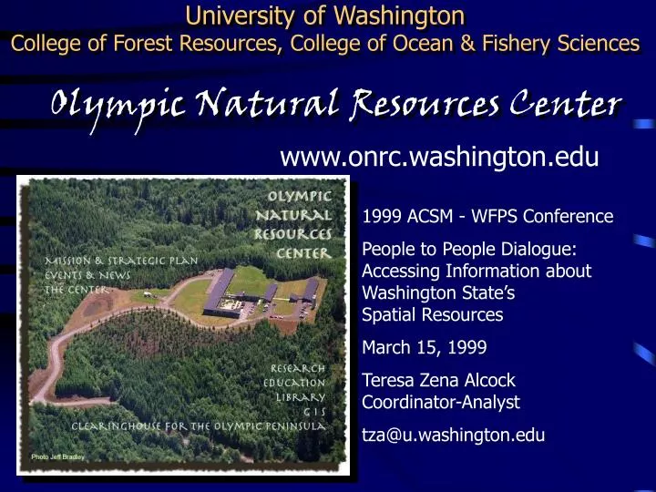
University of Washington College of Forest Resources, College of Ocean & Fishery Sciences. Olympic Natural Resources Center. www.onrc.washington.edu. 1999 ACSM - WFPS Conference People to People Dialogue: Accessing Information about Washington State’s Spatial Resources March 15, 1999

E N D
University of WashingtonCollege of Forest Resources, College of Ocean & Fishery Sciences Olympic Natural Resources Center www.onrc.washington.edu 1999 ACSM - WFPS Conference People to People Dialogue:Accessing Information about Washington State’sSpatial Resources March 15, 1999 Teresa Zena AlcockCoordinator-Analyst tza@u.washington.edu
University of WashingtonCollege of Forest Resources, College of Ocean & Fishery Sciences Olympic Natural Resources Center The mission of the Olympic Natural Resources Center is to conduct research and education on natural resource management practices which integrate ecological and economic values.
Olympic Natural Resources Center Strategic Priorities Forestry Program Active Management of Riparian Areas & Watersheds Threatened & Endangered Species Stand & Landscape Management for Biodiversity Long Term Soil & Site Productivity Marine Program Understanding Estuaries Marine - Terrestrial Interactions Shellfish Enhancement Partnerships with Grays Harbor College & Peninsula College
Olympic Natural Resources Center GIS Program Goals • Regional Information Coordination • Analysis & Tech Support • Education • Laboratory for GIS
Clearinghouse for the Olympic Peninsula ONRC Clearinghouse a pioneer regional information resourcein the
Clearinghouse for the Olympic Peninsula Clearinghouse Team Dr. David L. PetersonUSGS Forest and Rangeland Ecosystem Science Center,College of Forest Resources, University of Washington Dr. Nicholas ChrismanDepartment of Geography, University of Washington Robert A. Norheim, GIS AnalystUSGS Forest and Rangeland Ecosystem Science Center,College of Forest Resources, University of Washington Teresa Zena Alcock, GIS Coordinator-Analyst, ONRC Ella Elman, Alan Carter Mortimer,Metadata Specialists
Clearinghouse for the Olympic Peninsula C-House Team Approach Initiaterelationshipswith potential contributors Inventory geospatialand biological data sets Draft metadata records,interviewcontributors Review, training, and update agreement,deliver meta-database product to contributor
Clearinghouse for the Olympic Peninsula Challenges with Solutions Initiating relationships with contributors Contributors choose theirown contributions ! Contributors are sensitiveabout sharing information proprietary data free metadata does not implyfree data use of metadata does not imply authorization of use of data sensitive data
Clearinghouse for the Olympic Peninsula Challenges with Solutions Draft metadata records, interview contributors Our C-House Team is a catalyst ! Metadata is overwhelming and complex to even start ! We create your initialmeta-database No time for metadata Standards are too complex We translate and discover how you can *best use* the standards Software is difficult to use We use a tool that works for youand train your staff
Clearinghouse for the Olympic Peninsula Challenges with Solutions Regional Clearinghouse development Dealing with diversity Listening to partners’ needs builds trust Some won’t contribute until they see their neighbors online Quinault Tribe & other private forest landowners Smaller, local partners appreciate local contact ONRC is “out there with ‘em”
Clearinghouse for the Olympic Peninsula Our approach is working! Some ONRC Clearinghouse Partners: Olympic National Forest Olympic National Park Olympic Coast Nat’l Marine Sanctuary Clallam County, Mason County, Pacific County USFWS: Willapa Refuge Grays Harbor Regional Planning Thurston Regional Planning The Evergreen State College Ducks Unlimited Makah Tribe Lower Elwha Klallam Tribe Jamestown S’Klallam Tribe Rayonier Timberlands, Inc. Merrill & Ring Pysht Tree Farm The Wilderness Society Willapa Alliance Olympic Peninsula Research Coordinating Group University of Washington
Putting Olympic Peninsula University of WashingtonOlympic Natural Resources CenterWinter Science Conference February 1999 On The Map
Major Themes of the Conference Two Days of Olympic Peninsula GIS! Thursday, February 4, 1999 GIS Infrastructure & Education Friday, February 5, 1999 Olympic Peninsula GIS Applications
GIS Infrastructure & Education Speakers, Day I Nancy Tosta, KeynoteDirector, Puget Sound Regional Council Jeff HolmWA Dept of Info Svcs and Coordinator,WA Geographic Information Council Chris BradberryGIS Instructor, Grays Harbor College Karen DvornichWA Coop Fish & Wildlife Unit GAP AnalysisProject and National Director, Nature MappingProject
Day I : GIS Infrastructure & Education Theme Zones Data Policies keywords: ACCESS, COSTRECOVERY, STANDARDS,FORMATS GIS Educationkeywords: WORLD WIDEWEB, GRAYS HARBORCOLLEGE GIS, EDUCATINGPOLICY MAKERS,CERTIFICATION
Olympic Peninsula GIS Applications Speakers, Day II David Peterson, KeynoteUSGS Field Station Leader,UW College of Forest Resources John MarzluffProfessor, UW College of Forest Resources Roger HoffmanGIS Specialist, Olympic National Park Wendy Gerstel & Anne HeinitzWA State Department of Natural Resources,Geology Division Randy McIntoshNorthwest IndianFisheries Commission Penelope EckertGIS Manager,Foster WheelerEnvironmentalCompany
Day II : Olympic Peninsula GIS Applications Theme Zones Models & OtherApproaches:keywords =Multi-AgencyCooperation Rick Fletcher’sMarine Database:keyword =HELP! Bob Carl’s “Chasing Bunnies”keywords =*ACCURATE BASEMAPS*
Clearinghouse for the Olympic Peninsula Why should Surveyors bother with metadata? Users(including Surveyors)need reliable,accurate data FGDC metadata content includes: • horizontal and vertical positional accuracy reporting • projection systems, coordinate reference systems, datum specs • attribute accuracy reporting Data producers(including Surveyors)create reliable,accurate data Surveying and mapping firms and agencies can “advertise” the quality of their work by reporting accuracy in FGDC-compliant metadata
Thank you ACSM, WFPS, PLSO, LSAW So you get +/- 1 cmaccuracies, eh? Tell us about it! www.onrc.washington.edu