Download
1 / 18
180 likes | 373 Vues
Weights of Evidence Modeling in Archeology, Rocky Mountain National Park. Dr. David M. Diggs and Dr. Robert H. Brunswig School of Social Science College of Humanities and Social Sciences University of Northern Colorado Greeley, Colorado. Project Goals.

E N D
Weights of Evidence Modeling in Archeology, Rocky Mountain National Park Dr. David M. Diggs and Dr. Robert H. Brunswig School of Social Science College of Humanities and Social Sciences University of Northern Colorado Greeley, Colorado
Project Goals • Identify Native American “Sacred Sites and Features” in Rocky Mountain National Park, CO (RMNP). • Model the known occurrence of sacred sites/features in RMNP using GIS AND other sources of information. • Use ArcSDM (Spatial Data Modeler) and the Weights-of-Evidence technique to predict the occurrence of sacred sites and features in RMNP.
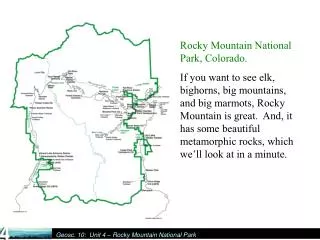
Archeological Sites in RMNP • Over 1,000 archeological sites in RMNP. • Approx. 29% of RMNP has been surveyed. • Over 400 prehistoric and early historic sites. • 31 sites and feature cluster sites (183 features) were identified as having well-established or highly probable Native American religious or ritual components
System-wide Archeological Inventory Program (SAIP) 1998-2002 source: http://www.nps.gov/romo/resources/history/prehistoric.html In 2000, a long-term research program was initiated in the Park and its surrounding mountain region to identify and study archeological features thought associated with Native American ceremonial practices and attempt to reconstruct models of their hypothesized relationships with their ancient cultural and environmental-topographic landscapes.
Sacred Sites Specific locations with archeological evidence of Native American religious practices are defined here as constituting sacred sites. Sacred circles for meditation, prayer, ritual, and spirit contact Prayer Circle on Glacial Erratic Boulder Feature Lichen-Dated to AD 900
Model variables explored Statistical significance of variables tested with Kolmogorov-Smirnov (K-S) or chi-square tests. Not used in final model
Cost Distance from Pre-Historic/Historic Trails Sacred Landmarks Visibility
Weights-of-Evidence Method • ArcSDM (Spatial Data Modeler) extension provides techniques to combine two or more evidential themes for the generation of a response theme (Sawatzky etal. 2004). Includes weights of evidence, logistic regression, fuzzy logic and neural network analysis capabilities. • Weights of evidence was initially developed for mapping mineral potential (Raines, Bonham-Carter, Kemp 2000). Also been applied to archeological site prediction in California (see Hansen 2000 and Hansen et al. 2002). • WOE evaluates the spatial distribution of known “events” relative to multi- and/or binary map patterns. • Calculates weights of spatial association (W+ and W-) between an Evidence Layer and a Training Point Set. • The weights (W+ and W-) can be used to reclassify and generalize an evidence layer. • Evidential themes can then be combined to create a response theme. This includes a posterior probability—the chances that we will find similar features/sites in each cell of the grid theme (in our case the chances that we would find sacred sites).
Final Weights Table W+ (positive weight): 0 to .5 Mildly Predictive .5 to 1.0 Moderately Predictive 1.0 to 2.0 Strongly Predictive > 2.0 Extremely Predictive Agterber and Cheng Test showed variables were independent of one another. This is a required condition of the WOE method.
Posterior Probability of finding sacred Features (with trails) within .5 sq. km. Posterior Probability of finding sacred Features (without trails) within .5 sq. km.
So what does this mean? Relative certainty of the Posterior Probability.
Recommended survey sites in the Never Summer Range, RMNP Recommended future survey sites in RMNP
Conclusions* • WOE may overestimate probability of an event. • Posterior Probability #s: think in terms of relative favorability, not exact probabilistic maps. • Weights-of-Evidence (WOE) can be a useful tool for exploration of data, and ideas. The generalization of maps into binary maps can involve both objective and subjective methods. • WOE was an important contributing factor in the selection of future survey sites. HOWEVER, other sources of knowledge were equally valuable. * ArcSDM / Spatial Data Modeler 9.2 version available as ArcScript at: http://arcscripts.esri.com 9.3 version at: http://www.ige.unicamp.br/sdm/default_e.htm
Acknowledgments. The authors would like to acknowledge funding support for this project by Rocky Mountain National Park (the National Park Service) and the University of Northern Colorado's Sponsored Programs Office. We would also like to particularly acknowledge the very important contributions to this project by Dr. Bill Butler, Rocky Mountain National Park archeologist, and our consultants from the Northern Ute, Southern Ute, Ute Mountain, and Northern Arapaho tribes. We would also like to recognize our energetic field crew, Cody Dalpra, Louise Elinoff, Tom Lux and Dr. Steve Cassells, our lichenometry expert. Author Information Dr. David M. Diggs Campus Box 115 Geography Program College of Humanities and Social Sciences Univ. of Northern Colorado Greeley, CO 80639 ph.970-351-1113 Fax 970-351-2890 david.diggs@unco.edu Dr. Robert Brunswig Director, School of Social Science College of Humanities and Social Sciences Univ. of Northern Colorado Greeley, CO 80639 ph.970-351-2138 Fax 970-351-1527 robert.brunswig@unco.edu
References Brunswig, Robert H. 2003. Archeological, Ethnographic, and Historic Investigations of the5LR7095 Rock Feature Complex Site, Rocky Mountain NationalPark, North Central Colorado: Report to Rocky Mountain National Park, National Park Service, Estes Park, Colorado. Department of Anthropology, University of Northern Colorado, Greeley. _____. 2005. Prehistoric, Protohistoric, and Early Historic Native American Archeology of Rocky Mountain National Park: Volume 1-Final Report of Systemwide Archaeological Inventory Program Investigations by the University of Northern Colorado (1998-2002). Prepared for the National Park Service; Rocky Mountain National Park. Anthropology Program, University of Northern Colorado, Greeley. Brunswig, Robert, David M. Diggs, and Christine Montgomery. 2009. Native American Lives and Sacred Landscapes in Rocky Mountain National Park. Prepared Under: Cooperative Agreement: 1443-CA-1248-007. Anthropology Program, University of Northern Colorado, Greeley. Brunswig, Robert, Sally McBeth, and Louise Elinoff. 2009. Re-Enfranchising Native Peoples in the Southern Rocky Mountains: Integrated Contributions of Archaeological and Ethnographic Studies on Federal Lands. In Post-Colonial Perspectives in Archaeology, edited by Peter Bikoulis, D. Lacroix, and M. Pueramaki-Brown, pages 55-69. Chacmool Archaeological Association, Calgary, Canada. Bonham-Cart, Graeme F. 1994. Geographic Information Systems for Geoscientists. Tarrytown, New York, Pergamon Press, Elsevier Sciences, Inc. Butler, William. 2007. Personal communication. Diggs, David and R. H. Brunswig. 2006. Modeling Native American Sacred Sites in Rocky Mountain National Park. In Proceedings of the Twenty-Sixth Annual ESRI International User Conference (web publication at http://gis.esri.com/library/userconf/proc06/papers/abstracts/a2243.html) ESRI, San Diego. Duncan, Clifford H. and J. A. Goss. 2000. Consultancy Report on Traditional Ute Sites in Rocky Mountain National Park (August 22, 23, and 24 2000). Report on file, Rocky Mountain National Park, Estes Park, Colorado. Hansen, David T. 2000. Describing GIS Applications: Spatial Statistics and Weights of Evidence Extension to ArcView in the Analysis of the Distribution of Archaeology Sites in the Landscape. Proceedings of the 20th Annual ESRI International Users Conference. San Diego. Hansen, David T., G. J. West, B. Simpson, and P.Welch. 2002. Modeling Spatial Uncertainty in the Analysis of Archeological Site Distribution. Proceedings of the 22nd Annual ESRI International Users Conference. San Diego. Lux, Thomas. 2005. Ancient Trails at Rocky Mountain National Park. M.A. Thesis, Denver, Colorado, Department of Anthropology, University of Denver. Mihalasky, Mark J. 2001. Mineral Potential Modeling of Gold and Silver Mineralization in the Nevada Great Basin: A GIS-Based Analysis Using Weights of Evidence. Open–File Report: 01-291. U.S. Dept. of Interior, U.S Geological Survey, Washington, D.C.
Raines, Gary L. 2009a. Spatial Data Modeler. ArcScript available at: http://arcscripts.esri.com/details.asp?dbid=15341 Last accessed 4/6/2009. Raines, Gary L. 2009b. Spatial Data Modeler for ArcGIS 9.3 ArcScript available at: http://www.ige.unicamp.br/sdm/default_e.htm Last accessed 4/10/2009 Raines, Gary L., G.F. Bonham-Carter, and L. Kemp. 2000. Predictive Probabilistic Modeling Using ArcView GIS. ArcUser. April-June: 45-48. Rohe, Christopher M. 2003a. Final Report on the Development of Predictive Models for Rocky Mountain National Park: Report to Rocky Mountain National Park. Department of Anthropology, University of Northern Colorado, Greeley. _____. 2003b. Reading the Landscape: A Location Model for Prehistoric Sites in Rocky Mountain National Park. M.A. Thesis. University of Arkansas, Department of Anthropology, Fayetteville. _____. 2004. Use of the Simple Weighting Method in Modeling Prehistoric Site Locations in Rocky Mountain National Park. In Ancient and Historic Lifeways of North America’s Rocky Mountains: Proceedings of the 2003 Rocky Mountain Anthropological Conference, edited by Robert H. Brunswig and William B. Butler, pp. 425-452. Department of Anthropology, University of Northern Colorado, Greeley. Sawatzky, D.L., G.L. Raines, G.F. Bonham-Carter, and C.G. Looney, C.G. 2004 ARCSDM3.1: ArcMAP extension for spatial data modeling using weights of evidence, logistic regression, fuzzy logic and neural network analysis. http://www.ige.unicamp.br/sdm/ArcSDM31/default_e.htm