Download
1 / 24
240 likes | 335 Vues
Learn about storing data for 1D, 2D, and 3D models of rivers, estuaries, and seas using Delft3D. Explore features like numerical simulation models, GIS integration, and netCDF/CF support for operational systems. Discover how Delft3D is utilized globally for various applications like hydrodynamics, morphology, and ecology.

E N D
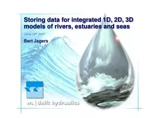
Storing data for integrated 1D, 2D, 3D models of rivers, estuaries and seas June 12th 2007 Bert Jagers
general intro Delft Hydraulics Independent research foundation • since 1927 • about 300 people • research and expert advise projects worldwide: Europe, Asia (Japan, Hong Kong, Singapore, China, Middle East, …), Africa (Egypt, South Africa, …), America (USA, Panama, …), Australia • numerical simulation models and operational systems
modelling system 1 Delft3D: Windows & Linux, parallel • Characteristics: 2D or 3D curvilinear model • Multi-domain (multi-tile), sigma- or z-layer • Application areas: ocean, sea, coast, estuary, river • Hydrodynamics, waves, meteorological forcing • Morphodynamics, stratigraphy • Ecology, water quality Many users around the world: research institutes, universities, and consultants
Delft3D from global scale modelling … Aceh earthquake, Dec ‘04
… and long time scales … 50 – 1000 years
… via storm surge predictions … Typhoon Frankie Vietnam (’96)
… to detailed engineering studies … 10 m – 10 km, 1 hour – 10 years Dubai
netCDF/CF issues Curvilinear, multi-tile, clipped coordinates Staggered Arikawa-C style scheme: storing restart data versus generic output
netCDF/CF issues Local features: weirs, dykes, dams, bridges, … Staggered Arikawa-C style scheme: data located at cell centres, cell interfaces and some at the original grid points
GIS integration preprocessing: grid generation data interpolation feature mapping
GIS integration postprocessing online visualisation netCDF support by GIS systems (ArcGIS 9.2) will it be CF aware?
German part Dutch part netCDF/CF issues regional models: 1) use coordinate systems of local data providers (grid mapping) & keep track of coordinate system used throughout modelling system 2) use global coordinates (like netCDF/CF) & use GIS for the projections (keep track of accuracy for local detailed models!) deal with vertical datums Dutch NAP = Belgian TAW + 2.32 m
netCDF/CF issues Generalised sigma, mixed sigma-z-coordinates: extra vertical coordinate options Aggregation table: data provided on irregular “subgrid”
modelling system 2 SOBEK : Windows & Linux • Characteristics: integrated 2D & 1D (open channel & sewer) • Multi-domain (multi-tile) • Application areas: river, rural, urban • Hydrology, hydrodynamics, groundwater • Morphodynamics, real-time control • Emissions, ecology, water quality Many users around the world: research institutes, universities, and consultants
1D channels and levees 2D plains overlap with Delft3D applications flooding, shallow lakes, …
regional scale applications albufera lake melbourne
flood early warning systems from meteo data to flood prediction (as local as realistically possible) operational aspects: 24 hours, 7 days per week distributed data access
netCDF/CF issues Again • Multi-tile, staggered scheme • Regional models, coordinate systems, GIS integration Additional • Combined 1D-2D, cross-sections • Naming conventions (water level in pipe = sea_surface_height_above_geoid?)
netCDF/CF issues How to store unstructured grids and the associated data? finite volume approach: distinguish volumes & fluxes multiple associated GIS expressable one grid one topology data location sets Why not use the same approach for LRG?
the end Questions? bert.jagers@wldelft.nl