Download
1 / 22
220 likes | 368 Vues
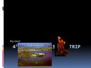
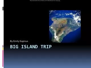
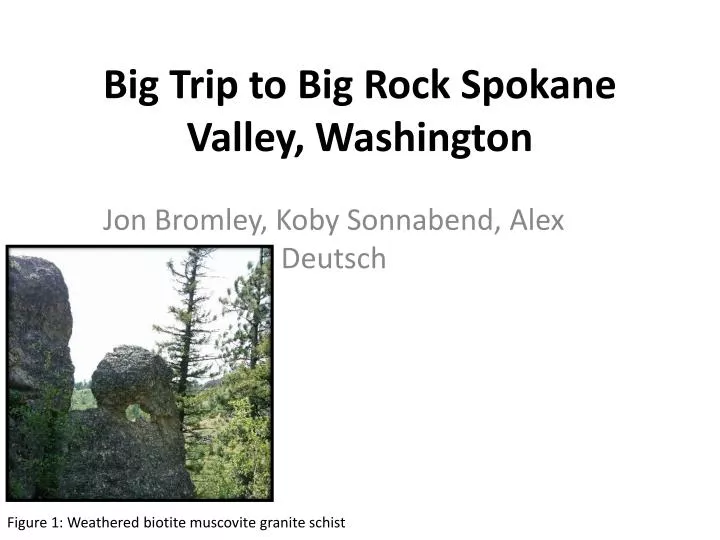
Big Trip to Big Rock Spokane Valley, Washington. Jon Bromley, Koby Sonnabend, Alex Deutsch. Figure 1: Weathered biotite muscovite granite schist. Introduction.

E N D
Big Trip to Big Rock Spokane Valley, Washington Jon Bromley, Koby Sonnabend, Alex Deutsch Figure 1: Weathered biotite muscovite granite schist
Introduction On Saturday the 24th of May our group set out to Big Rock at 12:30 pm and the purpose of our field trip to Big Rock was to observe the rocks, take samplesand photos for a virtual field trip. At Big Rock There are very large rocks sticking into the air, over a hundred feet in two outcrops. Figure 2: view of outcrop 4 from the west
History of the Area This conservation area contains well over 1,450 acres of land that is some of the most distinct in the Spokane area. The land was declared a conservation area in 1966 and was established to protect wildlife, native plants, and recreation. A major landmark of this conservation area is the distinct outcrops commonly referred to as Big Rock. These outcrops were the ones that our trips attention was directed towards.
The outcrops and the conservation area of the Dishman Hills are believed to belong to the Prichard Formation Undivided which is the oldest formation in the Belt Supergroupdating back to the Precambrian (Griggs A.B,1973).
Directions Big Rocks’ outcrop location can be accessed from two different trail heads. 1.) Iller Creek Trail Head, 9001 E Holman Rd. Spokane WA 99206 2.)Steven Creek Trail Head, S. Stevens Creek Rd. Spokane WA 99223 Our group used the S. Stevens Creek trailhead as the location for beginning our hike. Figure 3:Map showing route used by group
Site Location Our group viewed a total of 5 outcrops on our trip. Taking us through the NW 1/4 of Section 18 onto the SE 1/4 of Section 7 to the center then out of the NW 1/4 of that same section in the T24N, R44E within the Spokane SE 7.5-Minute Quadrangle (Figure 4).
BR-4 BR-3 Pretty View BR-5 BR-2 BR-1 Start of Hike Figure 4: Map of site location (Derkey, 1999)
The Rocks: BR-1 • Located about .3 miles up from the Steven’s Creek Hiking Trail head. • This outcrop is a light to medium gray color. Crystals of quartz, feldspar and biotite are about 1-2 mm in length. This outcrop is foliated and is weathered well. • We believe this outcrop is a quartz feldspar paragneiss. • It appears to be tilted at about 20-30 degrees dipping to the NW. Figure 5: Quartz feldspar paragneiss
The Rocks: BR-2 • Located ~200 feet north of BR-1and ~70 feet higher in elevation. • Light to medium dark color, fine to medium grained biotite muscovite granite. • Has K-feldspar & plagioclase as well as small amounts of grey quartz • This outcrop is well weathered and even shows rounded weathering of bedrock suggesting spheroidal weathering. Figure 6: Biotite-muscovite granite
The Rocks: BR-3 • This outcrop is light to medium gray in color. • well over 100 feet tall. • well foliated with fractures throughout and weathering. • the outcrop is made up of granite with biotite, muscovite, grey quartz crystals 1-3 mm and small amounts of sillimanitewith foliation and few garnets. Figure 7: View of outcrop 3 a biotite-muscovite granite from the west looking east.
Showing the foliation of BR-3 • You can see the sillimanitein the granite layers Figure 8: Well foliated layers of Cambrian biotite muscovite granite with sillimanite, plagioclase and grey quartz (Griggs A.B,1973)
The Rocks: BR-4 • The outcrop is the largest outcrop in size, over 100 feet high and over 100 feet in diameter; this outcrop is very large. • The outcrop shows fractures as well as weathering. Figure 9: View of outcrop of BR-4; biotite muscovite granite
With goodfoliation at the bottom of the outcrop; yet foliation isn't visible above 50 feet, leading usto believe this is a schist. • The mineral composition is identical to BR-3. Figure 10: view of BR-4 from the west looking east; biotite muscovite granite 130 feet tall from north side, 200 feet tall from south side
Figure 11: View from BR-4 standing about 50-60ft tall, looking NW towards BR-5 BR-5
The Rocks: BR-5 • BR-5 is a site composed of two features. • One feature; the large boulder stands about 10-15ft tall and is about 8ft wide. • Consists of foliated, coarse grained granite mica schist seen near the bottom of outcrops BR3, BR-4. Same mineral patterns with more garnets and plagioclase. Figure 11: boulder of biotite muscovite granite schist
Image of a unique weathering pattern on BR-5. • This portion of BR-5 is made of mica granite schist that is identical to what the large boulder from the previous slide was composed of. Figure 12: View of outcrop BR-5; mica granite schist boulder on the right and mica granite schist outcrop on the left.
Figure 13: closer look at physical weathering of biotite muscovite granite schist
Concluding Thoughts From when we started we moved from quartz feldspar paragneiss to a biotite muscovite granite schist. Throughout the whole trip there were the similar mineral patterns; white to grey quartz, k-feldspar, plagioclase, sillimanite, biotite, muscovite, with some weathered hornblende found on the ground and few garnets.
A very interesting hike with interesting terrain, a definite change in scenery for hikes that you normally see in Spokane. There isn't normally 100+ foot outcrops of rock that aren't basalt in this area. Werecommend anyone to go there and explore, you know where it is, how to get there, history of the conservation area and a summary of the geology of the outcrops.
Our last stop was a pretty view, here are pictures of that view. Figure 14: Looking north east towards Spokane Valley, from last point on site location map
Figure 15: panoramic view south towards the Palouse from last point on site location map
References • PUBLISHED AND IN-PROGRESS 7.5-MINUTE QUADRANGLES IN WASHINGTON BY NAME (n.d.): n. pag. Http://quimpergeology.org. Washington State Department of Resources, Nov. 2010. Web. 7 June 2014. <http://quimpergeology.org/ger24kmappingstatus.pdf>. Spokane Southeast: Derkey and others, 1999, DGER OFR 99-6 • "Dishman Hills Conservancy - About Us." Dishman Hills Conservancy - About Us. Dishman Hills Conservancy, n.d. Web. 7 June 2014. <http://www.dishmanhills.org/Default.aspx?pageId=1054136>. • "Google Maps." Google Maps. Google, 2014. Web. 7 June 2014. <https://www.google.com/maps/%4047.5584216%2C-117.260569%2C13z>. • Griggs, A.B., 1973, Geologic map of the Spokane quadrangle, Washington, Idaho, and Montana: U.S. Geological Survey Miscellaneous Investigations Series Map, I-768, 1 sheet, scale 1:250,000, (Reprinted 1981) [http://ngmdb.usgs.gov/ Prodesc/proddesc_9548.htm]