Download

1 / 270
2.7k likes | 2.91k Vues
United States History to 1877. Review. Which body of water was the gateway to the west?. Ohio River. Which body of water located in the Midwest would you find inland port cities?. The Great Lakes.

E N D
Which body of water located in the Midwest would you find inland port cities? The Great Lakes
Which body of water provided the French and Spanish with exploration routes to Mexico and other parts of America? Gulf of Mexico
Which body of water was a highway for explorers, early settlers, and later immigrants? Atlantic Ocean
Which body of water was explored by Lewis and Clark? Columbia River
Which body of water forms the border between Mexico and the United States? Rio Grande
Which two bodies of water were transportation arteries for industrial and farm products? Mississippi and Missouri Rivers
Which bodies of water was have allowed the United States access to other areas of the world? Atlantic and Pacific Oceans
How do bodies of water create links to other areas? Support trade, transportation, and settlement
Which geographical region has broad lowlands and many excellent harbors? Coastal Plain
Which geographical region is located along the Atlantic Ocean and Gulf of Mexico? Coastal Plain
Which geographical region has rolling flat lands with many rivers? Interior Lowlands
Which geographical region has broad river valleys and grassy hills? Interior Lowlands
Which geographical region is located west of the Coastal Plain? Appalachian Mountains
Which geographical region has the oldest mountain range in North America? Appalachian Mountains
Which geographical region extends from eastern Canada to western Alabama? Appalachian Mountains
Which geographical region has eroded mountains? Appalachian Mountains
Which geographical region is wrapped around the Hudson Bay and shaped like a horseshoe? Canadian Shield
Which geographical region has hills worn by erosion and hundreds of lakes carved by glaciers? Canadian Shield
Which geographical region is located west the Appalachian Mountains and east of the Great Plains? Interior Lowlands
Which geographical region is located west of the Interior Lowlands and east of the Rocky Mountains? Great Plains
Which geographical region has flat land that gradually increases in elevation westward? Great Plains
Which geographical region consist of grasslands? Great Plains
Which geographical region is located west of the Great Plains and east of the Basin and Range? Rocky Mountains
Which geographical region has rugged mountains stretching from Alaska almost to Mexico? Rocky Mountains
Which geographical region contains the Continental Divide? Rocky Mountains
Which geographical region consist of high elevations? Rocky Mountains
Which geographical region is located west of the Rocky Mountains and east of the Sierra Nevadas and the Cascades? Basin and Range
Which geographical region is consist of Death Valley? Basin and Range
What is the lowest point in North America? Death Valley
Which geographical region contains isolated mountain ranges? Basin and Range
Which geographical region has rugged mountains along the Pacific Coast? Coastal Range
Which geographical region contains fertile valleys? Coastal Range
Which geographical region stretches from California to Canada? Coastal Range
Which American Indian group inhabited present day Alaska and Northern Canada? Inuit
Which American Indian group lived in freezing temperatures? Inuit
Which American Indian group inhabited the Pacific Northwest Coast? Kwakiutl
Which American Indian group lived in a rainy mild climate? Kwakiutl
Which American Indian group lived in the heavily forested Northeast? Iroquois
How did geography and climate impact how American Indian groups met their basic needs? Shelter was made of resources found in their environment.
What are some examples of resources used by Native Americans to build their shelter? Sod, stones, animal skins, and wood.
Which American Indian group inhabited present-day New Mexico and Arizona? Pueblo
Which American Indian group inhabited desert areas and areas bordering cliffs and mountains? Pueblo
Which American Indian group inhabited the interior of the United States characterized by dry grasslands? Lakota
Which American Indian group inhabited the Eastern Woodlands? Iroquois
Name the American Indian group for each location on the map.
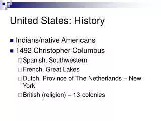
What economic reasons motivated explorers? Gold, natural resources, and trade