BASIC CONVECTION
BASIC CONVECTION. By: Ken Harding NWS ABR. Who am I?. NWS meteorologist – 20 years Private pilot – 13 years In Aberdeen since 1996. What do I talk about?. I know a lot about: The NWS Aviation weather TAF/METAR ARTCC Weather Support I know a little about: ASOS

BASIC CONVECTION
E N D
Presentation Transcript
BASIC CONVECTION By: Ken Harding NWS ABR
Who am I? • NWS meteorologist – 20 years • Private pilot – 13 years • In Aberdeen since 1996
What do I talk about? • I know a lot about: • The NWS • Aviation weather • TAF/METAR • ARTCC Weather Support • I know a little about: • ASOS • Aviation Weather Center Products • I’d like to learn from you: • Weather concerns • ‘War stories’
Subject Overview • What is Convection • Initiating Convection • Some “Rules of Thumb”
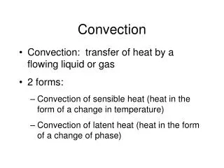
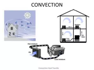
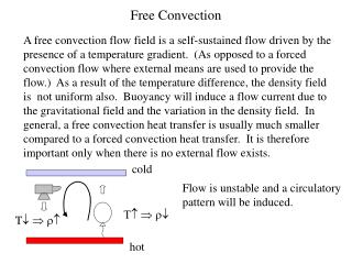
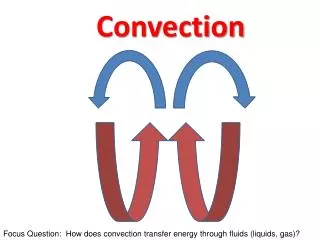
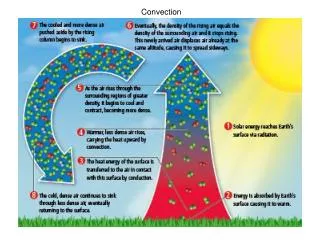
What is Convection? • The transport of heat (and moisture) by the movement of a fluid. • In meteorology, describes vertical transport of heat/moisture... • by updrafts/downdrafts • in an unstable atmosphere
Convection • Air in the free atmosphere will continue rising… • until it reaches a level where it is no longer buoyant. • The more unstable the atmosphere… • the greater the convection.
Initiating Convection • Atmospheric stability • Is determined by the way temperature varies with altitude • The ‘stability’ of a layer of air… • is the resistance to vertical displacement. • “Unstable” air promotes convection • “Stable” air inhibits convection
Altering Stability Three ways to decrease stability: Upper Level Cooling Low Level Warming Increase in Atmospheric Moisture
Air Mass Boundaries • Are ‘Favored’ areas for convection and Thunderstorm growth • Often subtle differences between air masses… • have large impacts on convection.
Air Mass Boundaries • Types • Fronts • Dry lines • Sea-Breeze fronts (Lake Breeze?) • Convergence Zone
“Triggering” Mechanism • Starts the convection • Low pressure systems • Fronts • Thunderstorm ‘outflow boundaries’ • Orographic lift
An upper low gives cooling aloft This reduces stability Surface lows give low-level convergence this supplies ‘Lift’ from below Low Pressure Systems
Fronts • Provide lift - Convection is likely • if air is unstable Cold Air
Thunderstorm Outflow Boundaries • Colliding outflow boundaries often provide lift for additional convection.
If cumulus tops are ‘crisp’ and ‘well defined’... the cloud will continue to grow. Rules of Thumb for Convection - 1
If cumulus tops are ‘ragged’ and ‘ill-defined’... the cloud willnot continue to grow. Rules of Thumb for Convection - 2
Rules of Thumb for Convection - 3 • The taller the cloud.. • The stronger the convection, and… • The greater likelihood of turbulence • The greater likelihood of micro/down bursts
Convection Vs Turbulence Strength of Convection Type of Turbulence Cloud Type Fair Wx Cu Lgt Chop Weak Towering Cu (Tcu) Mod chop Mod Turbc Moderate Tcu and Cb Sev Chop Sev Turbc Strong Pilot reports in thunderstorms indicate +/- 4000 fpm UDDF
Convective Turbulence • Avoid convective turbulence by flying above cloud tops… When possible. Smooth Ride Bumpy Ride
Weak Convection ? Normal Approach Affects of Convection • No problem • Except sometimes
Rules of Thumb forConvective Turbulence • Expect light turbulence in areas where dust devils are occurring. • Expect light/Mod turbulence under areas of developing cumulus clouds. • Thermals rarely exceed 10,000 feet AGL without forming clouds.
Rules of Thumb forConvective Turbulence • Expect moderate turbulence… • in areas where extreme heating and low humidity are expected or.. • where exceptionally large dust devils are occurring. • In areas of Virga
Convection vs. Icing • Convective clouds tend towards clear icing • Moderately growing cumulus can have mod/svr clear/mixed icing • If the cloud is raining, it has supercooled water – clear icing • Supercooled water can extend to great heights (>20,000 ft AGL) and temps < -15 C.
A thunderstorm is never as bad on the inside as it appears from the outside…it’s worse.
Convective SIGMETS • For Severe Thunderstorms (50 Kts, ¾” hail, tornadoes) • Embedded Thunderstorms • Lines of Thunderstorms • Over 40% coverage in an area > 3000 mi2 of VIP level 4 Thunderstoms.
Lightning Facts • About 100 strikes per second worldwide • Carries approximately 100,000,000 Volts • Bolts over 110 miles long have been measured • Both negative and positive lightning • 50,000 degrees C. • Approximately 1” in diameter