Download
1 / 27
280 likes | 305 Vues
Explore the interaction between the atmosphere and ocean, driven by uneven solar heating and Earth's rotation. Learn about atmospheric circulation generating wind patterns and storms, with a focus on the 2005 Atlantic Hurricane Season. Understand the composition of the atmosphere and how heat is transferred across latitudes, maintaining Earth's thermal equilibrium. Gain insights into factors influencing global air circulation and the impact of solar energy variations with latitude and seasons. Join us on a journey through Earth's atmospheric dynamics.

E N D
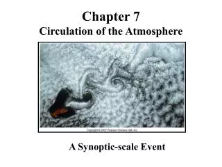
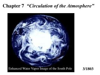
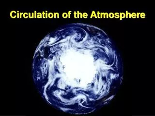
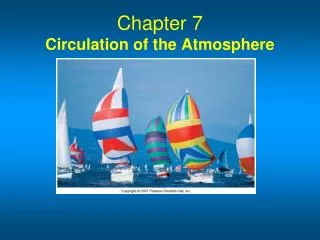
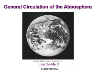
Oceanography An Invitation to Marine Science, 7th Tom Garrison Chapter 8 Circulation of the Atmosphere
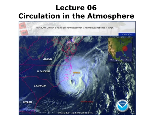
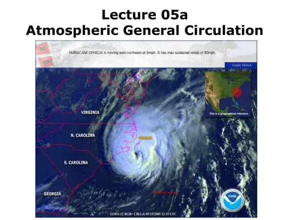
Chapter 8 Study Plan • The Atmosphere and Ocean Interact with Each Other • The Atmosphere Is Composed Mainly of Nitrogen, Oxygen, and Water Vapor • The Atmosphere Moves in Response to Uneven Solar Heating and Earth’s Rotation • Atmospheric Circulation Generates Large-Scale Surface Wind Patterns • Storms Are Variations in Large-Scale Atmospheric Circulation • The Atlantic Hurricane Season of 2005 Was the Most Destructive Ever Recorded
Chapter 8 Main Concepts • Earth’s ocean and atmosphere are unevenly heated by the sun—more solar energy is absorbed near the equator than near the poles. The atmosphere moves in response to this difference in heating. • Moving objects tend to move to the right of their initial course in the northern hemisphere (and to the left in the southern). This tendency is called the Coriolis effect. • The atmosphere circulates in six large circuits (three in each hemisphere). These atmospheric circulation cells are driven by differential heating and their direction of movement is influenced by the Coriolis effect. • Storms are variations in large-scale atmospheric circulation. Storms can form between two air masses (frontal storms) or within one air mass (tropical cyclones). • The ocean does not boil in the topics or freeze solid at the poles largely because the circulating atmosphere moves heat to high latitudes. Additionally, tropical cyclones act as “safety valves,” flinging solar energy (in the form of the latent heat of evaporation) poleward from the tropics.
What are some properties of the atmosphere? The lower atmosphere is a fairly homogeneous mixture of gases. Water vapor occupies up to 4% of the volume of the atmosphere. The density of air is influenced by temperature and water content. (right) Ascending air cools as it expands. Cooler air can hold less water, so water vapor condenses into tiny droplets - clouds. Descending air warms as it compresses – the droplets (clouds) evaporate. The Atmosphere Is Composed Mainly of Nitrogen, Oxygen, and Water Vapor
Atmospheric circulation is powered by sunlight. Since Earth is in thermal equilibrium, what assumption can be made about the input and output of heat on Earth? (above) An estimate of the heat budget for Earth. On an average day, about half of the solar energy arriving at the upper atmosphere is absorbed at Earth’s surface. Light (short-wave) energy absorbed at the surface is converted into heat. Heat leaves Earth as infrared (long-wave) radiation. Since input equals output over long periods of time, the heat budget is balanced. The Atmosphere Moves in Response to Uneven Solar Heating and Earth’s Rotation
The Solar Heating of Earth Varies with Latitude How solar energy input varies with latitude. Equal amounts of sunlight are spread over a greater surface area near the poles than in the tropics. Ice near the poles reflects much of the energy that reaches the surface there.
Earth as a whole is in thermal equilibrium, but different latitudes are not. (top left) The average annual incoming solar radiation (red line) absorbed by Earth is shown along with the average annual infrared radiation (blue line) emitted by Earth. Note that polar latitudes lose more heat to space than they gain, and tropical latitudes gain more heat than they lose. Only at about 38° N and 38° S latitudes does the amount of radiation received equal the amount lost. Since the area of heat gained (orange area) equals the area of heat lost (blue areas), Earth’s total heat budget is balanced. What factors govern the global circulation of air? Uneven solar heating The Coriolis effect (bottom left) The ocean does not boil away near the equator or freeze solid near the poles because heat is transferred by winds and ocean currents from equatorial to polar regions. The Solar Heating of Earth Varies with Latitude
The Solar Heating of Earth Also Varies with the Seasons The seasons are caused by variations in the amount of incoming solar energy as Earth makes its annual rotation around the sun on an axis tilted by 23 ½°. During the Northern Hemisphere winter, the Southern Hemisphere is tilted toward the sun and the Northern Hemisphere receives less light and heat. During the Northern Hemisphere summer, the situation is reversed.
Winter (Northern Hemisphere tilts away from sun) 23½° To Polaris Spring (sun aims directly at equator) Summer (Northern Hemisphere tilts toward sun) Fall (sun aims directly at equator) Stepped Art Fig. 8-6, p. 206
Earth’s Uneven Solar Heating Results in Large-Scale Atmospheric Circulation A convection current forms in a room when air flows from a hot radiator to a cold window and back. Air warms, expands, becomes less dense, and rises over the radiator. Air cools, contracts, becomes more dense, and falls near the cold glass window.
Earth’s Uneven Solar Heating Results in Large-Scale Atmospheric Circulation • The Coriolis effect is the observed deflection of a moving object, caused by the moving frame of reference on the spinning Earth. • How does this apply to the atmosphere? • As air warms, expands, and rises at the equator, it moves toward the pole, but instead of traveling in a straight path, the air is deflected eastward. • In the Northern Hemisphere air turns to the right. • In the Southern Hemisphere air turns to the left.
(above-left) Sketch of the thought experiment in the text, showing that Buffalo travels a shorter path on the rotating Earth each day then Quito does. (above-right) A continuation of the thought experiment. A look at Earth from above the North Pole shows that Buffalo and Quito move at different velocities. The Coriolis Effect Deflects the Path of Moving Objects
The Coriolis Effect Deflects the Path of Moving Objects The final step in the experiment. As observed from space, cannonball 1 (shot northward) and cannonball 2 (shot southward) move as we might expect; that is, they travel straight away from the cannons and fall to Earth. Observed from the ground, however, cannonball 1 veers slightly east and cannonball 2 veers slightly west of their intended targets. The effect depends on the observer’s frame of reference.
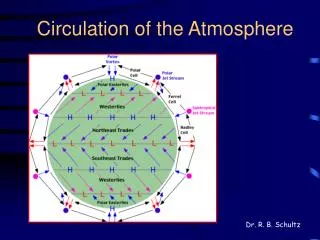
The Coriolis Effect Influences the Movement of Air in Atmospheric Circulation Cells Global air circulation as described in the six-cell circulation model. Air rises at the equator and falls at the poles, but instead of one great circuit in each hemisphere from equator to pole, there are three in each hemisphere. Note the influence of the Coriolis effect on wind direction. The circulation show here is idea – that is, a long-term average of wind flow.
The Coriolis Effect Influences the Movement of Air in Atmospheric Circulation Cells • A large circuit of air is called an atmospheric circulation cell. • Three cells exist in each hemisphere. • Hadley cells are tropical cells found on each side of the equator. • Ferrel cells are found at the mid-latitudes. • Polar cells are found near the poles. • What are some of the wind patterns found between and within cells? • Doldrums are calm equatorial areas where two Hadley cells converge • Horse latitudes are areas between Hadley and Ferrel cells. • Trade winds are surface winds of Hadley cells. • Westerlies are surface winds of Ferrel cells.
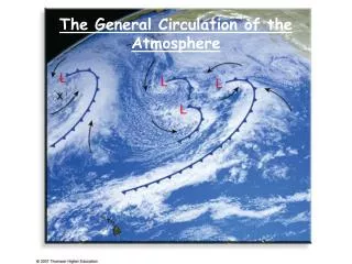
Cell Circulation Centers on the Meteorological (Not Geographical) Equator Winds over the Pacific Ocean on September 20-21, 1996. Wind speed increases as colors change from blue-purple to yellow-orange, with the strongest winds at 20 meters per second (45 mph). Wind direction is shown by the small white arrows. The measurements were made with a NASA radar scatterometer aboard Japan’s Advanced Earth Orbiting Satellite, launched 16 August 1996. The scatterometer measures and analyzes the backscatter (reflection) of high frequency radar pulses from small wind-caused ripples on the sea surface. Note the Hawai’ian islands in the midst of the persistent northeast trade winds, the vigorous westerlies driving toward western Canada, a large extra-tropical cyclone east of New Zealand, and the last remnants of a tropical cyclone off the coast of Japan. Although instantaneous views such as this one depart substantially from wind flow predicted in the six-cell model, the average wind flow over many years looks remarkable like what we would expect from the model.
Monsoons Are Wind Patterns That Change with the Seasons • Monsoons are patterns of wind circulation that change with the season. Areas with monsoons generally have dry winters and wet summers. • Sea breeze is cool air from over the water moving toward land. Sea breezes occur after sunrise. • Land breezes occur after sunset when air warmed by the land blows toward the water.
Monsoons Are Wind Patterns That Change with the Seasons A monsoon is a pattern of wind circulation that changes with the season. (The word monsoon is derived from mausim, the Arabic word for season). Locations where monsoons occur typically have wet summers and dry winters. (left) Monsoon patterns. During the monsoon circulations of January (a) and July (b), surface winds are deflected to the right in the Northern Hemisphere and to the left in the Southern Hemisphere. (c) Detail of summer Asian monsoon, showing location of Cherrapunji, India, one f the world’s wettest places. Rainfall amounts there can exceed 10 meters (425 inches) per year!
Sea Breezes and Land Breezes Arise from Uneven Surface Heating The flow of air in coastal regions during stable weather conditions. (a) In the afternoon, the land is warmer than the ocean surface, and the warm air rising from the land is replaced by an onshore sea breeze. (b) At night, as the land cools, the air over the ocean is now warmer than the air over the land. The ocean air rises. Air flows offshore to replace it, generating an offshore flow (a land breeze).
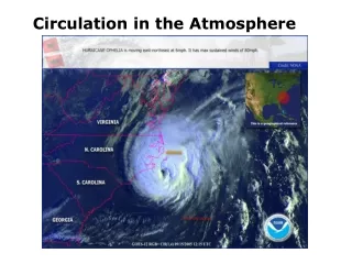
Storms Are Variations in Large-Scale Atmospheric Circulation • Storms are regional are regional atmospheric disturbances. Storms have high winds and most have precipitation. • Tropical cyclones occur in tropical regions. These storms can cause millions of dollars worth of damage and endanger life. • Extra-tropical cyclones occur in Ferrel cells, and are winter weather disturbances. These storms can also cause extensive damage. • Both types of storms are cyclones, orrotating masses of low-pressure air.
Extra-tropical Cyclones Form between Two Air Masses (a) The genesis and early development of an extra-tropical cyclone in the Northern Hemisphere (b) How precipitation develops in an extra-tropical cyclone. These relationships between two contrasting air masses are responsible for nearly all the storms generated in the polar frontal zone and thus responsible for the high rainfall within these belts and the decreased salinities of surface waters below.
Tropical Cyclones Form in One Air Mass The internal structure of a mature tropical cyclone, or hurricane. (The vertical dimension is exaggerated in this model of a hurricane.)
Tropical Cyclones Form in One Air Mass The dynamics of a tropical cyclone, showing the influence of the Coriolis effect. Note that the storm turns the “wrong” way (that is, counterclockwise) in the Northern Hemisphere, but for the “right” reasons.
N Equator Air starts moving toward a zone of low pressure and veers off course to right Core of tropical cyclone rotating to the left, or counterclockwise Air starts moving toward a zone of low pressure and veers off course to right Stepped Art Fig. 8-25, p. 220
Tropical Cyclones Form in One Air Mass The tracks of tropical cyclones. The breeding grounds of tropical cyclones are shown as orange-shaded areas. The storms follow curving paths: First they move westward with the trade winds. Then they either die over land or turn eastward until they lose power over the cooler ocean of mid-latitudes. Cyclones are not spawned over the South Atlantic or the southeast Pacific because their waters are too chilly; nor in the still air - the doldrums - within a few degrees of the equator.
Chapter 8 in Perspective In this chapter you learned that Earth and ocean are in continuous contact, and that conditions in one are certain to influence conditions in the other. The interaction of ocean and atmosphere moderates surface temperatures, shapes Earth’s weather and climate, and creates most of the sea’s waves and currents. The atmosphere responds to uneven solar heating by flowing in three great circulating cells over each hemisphere. This circulation of air is responsible for about two-thirds of the heat transfer from tropical to polar regions. The flow of air within these cells is influenced by Earth’s rotation. To observers on the surface, Earth’s rotation causes moving air (or any moving mass) in the Northern Hemisphere to curve to the right of its initial path, and in the Southern Hemisphere to the left. The apparent curvature of path is known as the Coriolis effect. Uneven flow of air within cells is one cause of the atmospheric changes we call weather. Large storms are spinning areas of unstable air that occur between or within air masses. Extra-tropical cyclones originate at the boundary between air masses; tropical cyclones, the most powerful of Earth’s atmospheric storms, occur within a single humid air mass. The immense energy of tropical cyclones is derived from water’s latent heat of vaporization. In the next chapter you will learn how movement of the atmosphere can cause movement of ocean water. Wind blowing over the ocean creates surface currents, and deep currents form when the ocean surface is warmed or cooled as the seasons change. Currents join with the atmosphere to form a giant heat engine that moves energy from regions of excess (tropics) to regions of scarcity (poles). This energy keeps the tropical seas from boiling away and the polar ocean from freezing solid in its basins. The ocean’s surface currents are governed by some of the principles you’ve learned here – the Coriolis effect and uneven solar heating continue to be important concepts in our discussion. Taken together, an understanding of air and water circulation is at the heart of physical oceanography.