Climate Variety in Canada: Factors and Impacts
Explore the factors that contribute to Canada's diverse climate conditions and the impact they have on temperatures and precipitation. Learn about latitude, ocean currents, air masses, wind systems, and the Coriolis effect.

Climate Variety in Canada: Factors and Impacts
E N D
Presentation Transcript
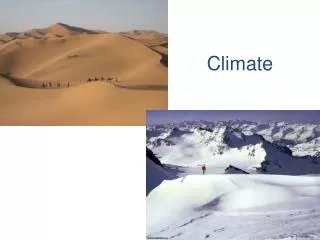
Why does Canada have so much climatic variety? Average Annual Temperature: Alert, Nunavut (Ellesmere Island) : -18°C Pelee Island, Ontario: 9°C Yellowknife, NWT: -5°C Four Basic Facts: 1. Canada extends for a great distance from north to south 2. Different elevations produce different climate conditions 3. Coastal regions have different climates from inland regions 4. Wind and pressure systems move weather conditions from one part of the country to another
Weather vs. Climate Weather: Day to day condition of the atmosphere, - short term – 5 to 7 days- small area - cities- difficult to predict – 5 day forecast Ex. Temperature, humidity, precipitation, wind speed, cloud cover, air pressure. Climate: Patterns of weather which have occurred over a long period of time - long term - years- large areas – countries, continents, the globe - easy to predict – summer, winter etc Ex. continental climate, maritime climate, arid climate.
30 140 25 130 Climate Graph 20 120 110 15 100 10 5 90 Precip (mm) Temp. (oC) 0 80 -5 70 -10 60 50 -15 -20 40 -25 30 -30 20 -35 10 -40 0 J F M A M J J A S O N D Months
Vancouver is further north than Toronto yet it is warmer and wetter in winter. • Montreal is just a little bit north of Toronto yet it is much colder in winter • Why? • Factors that affect Climate: • LatitudeOcean CurrentsWinds and Air MassesElevation (Altitude)ReliefNear Water
Solar energy delivered by sunlight varies with latitude - Intensity. • At higher latitudes (ie. north pole), the solar energy is less concentrated, spread over a larger surface area….cooler • At lower latitudes (ie. equator), the solar energy is more concentrated, spread over a smaller surface… warmer. 1. Latitude
Latitude cont’d Your position on the Earth determines the amount of Solar Radiation (solar energy) This is Intensity
SEASONS The earth is always at a 23.5 degree tilt. The northern hemisphere changes from being tilted toward the sun (summer) to being tilted away from it (winter) – Duration. Summer Solstice- most direct sunlight at most northern point from equator. Days are longer. June 21-22. Winter Solstice- most direct sunlight at most southern point from equator. Days are shorter. December 22-23 Latitude (cont’d)
http://www.fourmilab.to/cgi-bin/uncgi/Earth Take a moment, and be Amazed, by the following website…This site shows what the Earth looks like at THIS MINUTEfrom different perspectives (from the moon, the sun, night side, map view)Hint: Think about how our earth is tilted at this time of year...
Warm and cold pockets or streams (currents) of water that move throughout the ocean. • If a cold ocean current passes by, it will cool the surrounding air. • If a warm ocean current passes by, it will warm the surrounding air. • Ocean currents affect precipitation 2. Ocean Currents
Average Temperatures in Winter - the lines are called Isotherms. Compare Toronto to Rome.
A large volume of air with almost the same temperature and moisture throughout. An air mass takes climate conditions from one place to another. • Eg. An air mass originating from the Arctic is cold and dry. It moves southward and is carried by the westerly winds, bringing cold dry air across Canada. • Front: The boundary between two air masses with different temperature and and moisture content. • WARM FRONT – the leading edge of a warm air mass • COLD FRONT – the leading edge of a cold air mass 3. Winds and Air Masses
Air Masses, which have specific Pressure and Temperature characteristics are what effects our climate. Wow, Temperature, pressure, wind - it’s all connected!
The weight of air – Air Pressure. Low Pressure- associated with warm air that has expanded and is rising. High Pressure - associated with cold air that has contracted and is falling. Winds move from High pressure to Low pressure - See Hadley cell.
The movement of air from an area of High Pressure to Low Pressure • Winds are created by differences in air pressure. Around the world there are belts of low and high pressure. As they move around each other, they create a well-established pattern of prevailing winds that blow from West to East in Canada. • Prevailing winds - Winds that blow in almost constant direction at these latitudes. In Canada, the prevailing winds blow from west to east. These are called “westerlies” and move air masses that affect our climate. Winds – cont’d
Why do the winds not simply blow directly north and south between these belts? • Winds are affected by the rotation of the earth. • This is called theCORIOLIS EFFECT. • Instead of winds moving in one straight north/south line they are deflected to the right in the NORTHERN Hemisphere and to the LEFT in the SOUTHERN HEMISPHERE. • This is due to the rotation of the earth (eastward). • Hence, we have “westerlies” instead of “northerlies”! Winds (cont’d)
Winds (coriolis effect) The earth rotates eastward. This force changes the expected path of the wind.
Elevation:refers to how high or low we are on the earth’s surface. The earth’s surface is our source of heat. The sun heats the earth and in turn the earth heats us. • Air heats up, becomes less dense, rises, air pressure drops, air expands, andheat is lost…Now it will COOL…until it condenses. • Rate of Temperature Drop BEFORE condensation: • 1 degree celsius / 100 meters • Rate of Temperature Drop AFTER condensation:0.6 degrees celsius / 100 meters 4. Elevation (Altitude)
Relief: refers to differences in elevation caused by features on the landscape, for example, a mountain range is type of relief. Even a small barrier like a building can cause a temperature difference. Mountain ranges act as barriers to the movement of air masses. They also cause precipitation to occur (called Relief or Orographic Precipitation) 5. Relief
Moderating Effect: • Water heats up and cools down more slowly than land. • In the summer, wind blowing from the water will be cool. • In the winter, wind blowing from the water will be warmer. • Places near large water bodies are MODERATE - they do not get as cool or as warm as others • Maritime: Warmer and Wetter • Continental: Cooler and Dryer 6. Effect of Large Bodies of Water
Weather Maps: (Monday, Jan. 5, 2009) Use of Icons Note: The Westerlies push the weather systems . Location of the Jet Stream, Cold and Warm Fronts, High and Low Pressure