Future in GIS for Creating Common Interest Community Maps
Explore the future of GIS, goals, problems, solutions, and outcomes in mapping Common Interest Communities. Discuss GIS tips, tools, and software advancements. Find out how to identify encumbrances, boundaries, and associations within HOAs.

Future in GIS for Creating Common Interest Community Maps
E N D
Presentation Transcript
Creating Common Interest Community Maps Jeffery J. Jensen, PE UNLV College of Civil Engineering
Outline • Future in GIS • Goals • Problems • Solutions • Outcome/Results • Discuss various GIS tips along the way
Future in GIS • Continue Growth in Web Services • ArcIMS and ArcMap • MapGuide and AutoCAD (not there) • Web Map Services (WMS) • MapServer by UMN • ArcMap and AutoCAD Map connections • Google Map/Earth – KML • “To release is to choose” Hristo Deshev • Ongoing development cycle
Future – ArcIMS and ArcMap • www.esri.com/imssites • Must publish ArcIMS services through the web • Where 2.0 Video: Google/ESRI Keynote http://radar.oreilly.com/archives/2008/05/where-20-video-googleesri-keyn.html
Goals • Help identify all encumbrances on a parcel • Deeds, Plats and Title Reports • Covenants, Conditions and Restrictions (CC&Rs) • Bylaws of the Homeowners Associations • Identify boundaries of Common Interest Communities • Master Homeowners Association, Sub-associations
The Players • Ombudsman’s Office • Secretary of State • Business License • Neighborhood Services • Property Managers • Public Works • Recorders and Assessors • Enforcement • Realtors
Problems - Tabular • No Common Names or ID • Plat – Subdivision Map • SOS Entity Name • Developer’s marketing name of neighborhood • Business License, DBA • NV Real Estate Division (RED) • Realtors, MLS • Disconnected Databases • No common relate field between databases
Problems - Spatial • No Physical Address • Plat Map = HOA Boundary • Not Always • One HOA but Many Subdivision Units • Master Association and Sub
Solutions - Tabular • Create Index • GLVAR • MLS database • AssocName, Subdivision1, Subdivision2 fields • NVSOS.gov • Business Entity Search • SOS Entity# (Corporation#), URL, Resident Agents Address fields • Standarized ID – SOS Entity#
Solutions - Spatial • Sub-associations Polygon Layer • Create using Assessor Parcels and MLS, SOS and RED databases • Subdivision – dissolve based on ADTYPE and/or PCLSUBD • Master Associations • Create by dissolving Sub-association Polygon Layer • RED database has Excel spreadsheet relating Parent to Child • GLVAR • MLS database • Create point layer using Lat/Long • APN field, join with Assessor Parcels point layer • Address Matching with SCL
Solutions – Creation & Edits • Option 1: Tabular • use ArcMap geoprocessing tools (dissolve) to generate HOA boundaries • APNs change – need AOPARCHILD.TXT (pedigree of parcel creation) • ArcMap Bugs – “to release is to choose” • Option 2: Spatial • ArcMap edit session, copy/paste parcel features from Assessor layer • Recommend, being used by City of Henderson
Solutions – Spatial, Create Index • Clark County Recorder • CC&Rs • Bylaws?? • PDF index • Adobe Acrobat
Recorder – CC&Rs • Metadata • Custom Properties • Acrobat Professional (convert TIFF to PDF, OCR, Metadata) • EXIFTOOL • Verypdf • Windows PowerShell • Search • Windows Desktop Search • Google Desktop Search
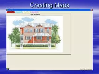
Publish HOA Maps • Google Map • Safe Software FME • Convert Shapefiles to kml • Zonums.com/shp2kml.html • Issues when building many polygons
Outcome/Results • Can Be Done • Create subassociation boundaries • Master HOAs • Dissolve Subassociations • hyperlink Recorder’s CC&R TIFF images • Need a Better Solution • Bylaws • Must contact each HOA, no central database • Getdocsnow.com
Questions Jeffery J. Jensen, PE UNLV College of Civil Engineering jefferyjjensen@gmail.com mobile: 702-327-9294