Download

1 / 38
380 likes | 496 Vues
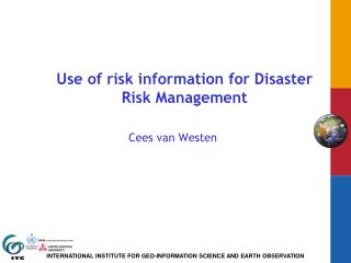
Use of risk information for spatial planning. Cees van Westen. Risk reducing measures - non-structural. Non-structural measures

E N D
Use of risk information for spatial planning Cees van Westen
Risk reducing measures- non-structural Non-structural measures refer to policies, awareness, knowledge development, public commitment, and methods and operating practices, including participatory mechanisms and the provision of information, which can reduce risk and related impacts. • Legal regulation • Direct government intervention • Economic incentives • Information/awareness/organisation • Preparedness measures
Non-structural measures (Source: Living with Risk, UN 2004)
Non-structural measures (cont.) (Source: Living with Risk, UN 2004)
Non-structural measures (cont.) (Source: Living with Risk, UN 2004)
LEGAL REGULATION • Macro-zoning • national and regional • Indicative • Micro-zoning • detailed local land use maps • legally binding • Zoning • macro zoning – national • meso – regional • micro – local • Open space controls • Building permits • Building codes
ZONING • Used to regulate the activities of the private sector by placing locational restrictions and minimum standards on specific types of land uses and activities. • What could take place where (development-oriented) • What could NOT take place where (restrictive) • Potential measure for controlling risk areas
OPEN SPACE CONTROLS (multiple use of space) • Agricultural lands, parks and other types of open spaces can play an important role in helping mitigate the effect of natural disasters • Open spaces may serve to mitigate disasters while sometimes even providing some economic return
BUILDING PERMITS A building permit can be used to: • regulate the type of land-use/activity • control the location of the building • control the structure of the building
BUILDING CODES • establish minimum standards of design, construction and materials to avoid ollapse under conditions of severe physical stress (natural hazards) • Together with land-use controls often a very effective local level instrument for disaster prevention and mitigation • Standards for the repair or rehabilitation of older structures could serve as a supplementary means of improving the safety of existing structures
Public awareness Newsletters Folk media Campaigns Billboards/posters Workshops
Spatial planning …. • core element of spatial planning is to prepare and make decisions about future land use: • Regional planning: settling the spatial or physical structure and development as an integrated part of a formalised planning system of a state. Sets a framework for decisions on land use taken at the local level within land-use planning of the municipalities. Scale from 1:50 000 to 1:100 000. • Land-use planning: local/municipal level to guide land and resource uses. The main instrument of land-use planning is zoning or zoning ordinances, respectively. Land-use planning normally consists of two stages with specific planning instruments on each of these: first, a general or preparatory land-use plan (scale from 1:5,000 to 1:50,000) for a whole municipality and second, a detailed land-use plan for small part of it, mostly legally binding (scale 1:500 to 1:5000).
The benefits of spatial planning (UNECE, 2008) • Economic benefits: • Providing more stability and confidence for investment; • Identifying land in appropriate locations to meet the need for economic development; • Ensuring that land for development is well placed in relation to the transport network and the labour force; • Promoting environmental quality in both urban and rural areas, which can then create more favourable conditions for investment and development; • Identifying development that meets the needs of local communities; • Promoting regeneration and renewal; • Making decisions in a more efficient and consistent way. • Social benefits: • Considering the needs of the local communities in policy development; • Improving accessibility when considering the location of new development; • Supporting the provision of local facilities where they are lacking; • Promoting the re-use of vacant and derelict land, particularly where it has a negative impact on quality of life and economic development potential; and • Aiding the creation and maintenance of pleasant, healthy and safe environments. • Environmental benefits: • Promoting regeneration and the appropriate use of land, buildings and infrastructure; • Promoting the use of previously developed (“brownfield”) land and minimizing development on “greenfield” land; • Conserving important environmental, historic and cultural assets; • Addressing potential environmental risks (e.g. flooding, air quality); • Protecting and enhancing areas for recreation and natural heritage; • Promoting access to developments by all modes of transport (e.g. walking, cycling and public transport), not just by car; • Encouraging energy efficiency in the layout and design of development.
Local planning • Creation of policies at local/municipal level to guide land and resources uses inside the administrative borders of a municipality that is in charge of the task (“urban planning” sometimes used as a synonym) • Main instrument is zoning or zoning ordinances respectively • Land-use planning is situated below the regional planning level and consists normally of two stages: • First a general or preparatory land-use plan (scale 1:5,000 to 50,000) for the whole municipality and • Second, a detailed land-use plan for a small part of it, mostly legally binding (scale 1:500 to 1:5,000)
Planning: the new map of a country • The New Map of the Netherlands presents a comprehensive picture of the plans. • Netherlands Institute of Housing and Planning (Nirov) collects all the development plans • From local authorities, provincial councils, water boards and government departments. • Bring together thousands of plans in one place and make them available to all on our website http://www.nirov.nl/Home/Projecten/De_Nieuwe_Kaart/Website.aspx
Even in NL many houses are planned in risk areas Change of dyke breach doesn’t play a large role with constructors Risk of flooding for 500,000 planned houses ISL 2004
Planning example : Austria • “hazard zone maps”(“Gefahrenzonenkarte”) within the “hazard zonation plan” (“Gefahrenzonenplan”) • The forest act (“Forstrecht”) from 1975 (BGBl. Nr. 440/1975) is the basis for hazard zonation planning in view of torrents and avalanches. • The implementation is regulated by a decree (“Verordnung des Bundesministeriums für Land‐ und Forstwirtschaft, 1976“, BGBl. Nr.436/1976; Bundesministerium für Land‐ und Forstwirtschaft, 1976). • Hazard zonation for flooding is regulated within the guidelines for protection against water. There hazard areas for a recurrence period of 30 years (HQ 30) and for a recurrence period of 100 years (HQ 100) are described. The event threshold or design event is determined by series of measurements. • Landslides: Geological Survey of Austria, the GEORIOS‐system • Large differences between different federal states
Example : Dresden Agreed objectives: • Urban: no flood risk > 1 in 100 years till 2018 (damage potential 10 Mio €) • Rural: no flood risk > 1 in 25 years till 2018 (damage potential 10 Mio €) Planning • State government pays dikes for densely populated areas (13 Mio. €) • City of Dresden pays retrofitting of buildings (89 objects, € 77,000) • City of Dresden invests in mobile dams (€ 500,000), protecting week points (street passages etc.) • City of Dresden links further building permissions with additional requirements • Water management authority will monitor the outcome of the measures
Natural disaster and spatial planning in Europe • Current prevention of disaster risks is often fragmented, among others, between civil protection and spatial planning. • Funding and implementation of mitigation, preparedness, response and recovery measures are disconnected in many cases. • Effectiveness and efficiency of measures play rarely a role. • Lack of coordination of activities between authorities involved makes institutional settings vulnerable. • This calls for more flexibility and better coordination of response strategies by integrating the disaster cycle.
The planningsystem Source: own figure
European scale planning (example flood) • Water does not stick to national boundaries. EU member states have agreed therefore to the European Water Framework Directive (EWFD). • The goal of this directive is to ensure that the quality of the surface water and groundwater in Europe reaches a high standard (‘good ecological status’) by the year 2015. • European Guidelines for Flood risk • Identification: Define a preliminary flood risk judgment, in order to define which areas have a potential flood risk; • Mapping of flood hazard and flood risk, to be finished before 22/12/2013; • MOVIE: EU activities in flood risk management
Findings from Research “Natural Hazards, Risk and Spatial Planning in Europe” • Dealing with hazards in Europe concentrates mainly on hazard assessment • Less attention is paid to vulnerability. • Risk assessment is carried out by different sectoral planning authorities • Risk assessment is hardly done by spatial planning authorities • Spatial planning is usually an end-user of hazard related information • 2. Spatial planning only plays a minor role in risk management • 3. Many promising examples how spatial planning can contribute to risk management.
Environmental Impact Assessment • Environmental Impact Assessment (EIA) is the process of identifying, predicting, evaluating and mitigating the biophysical, social, and other relevant effects of development proposals prior to major decisions being taken and commitments made. • EIA mainly takes place at project level. • The purpose of an EIA is to ensure that the development options under consideration are environmentally sound and sustainable, and that any environmental consequences are recognized early in the project cycle and taken into account in project design.
Strategic Environmental Assessment (SEA) • Strategic Environmental Assessment (SEA) is an iterative and participatory process that helps planners and decision-makers to assess the environmental, social and economic impacts of proposed Policy, Plan or Programme (PPP) initiatives and its alternatives at the earliest appropriate stage of decision making. • SEA can help to ensure that sustainability issues are integrated into higher, strategic levels of decision-making, prior to the identification and design of individual projects. • SEA is therefore an important tool to ensure that hazard and disaster risk are incorporated in the policy and planning process
Example SEA: the Delta Commission • Movie • “climate resilient “ planning of the Netherlands the Delta Commission has established the Delta programme.
Flood hazard: Return period: 5 years (± 1) Flood impact force: 10 kPaPa Debris flow hazard: Return period: 10 years (± 5) Impact force: 20 KPa Snow avalanche hazard: Return period: 25 years (± 15) Impact force: 50 KPa For chalets 1 Uncertainty 0.5 Vulnerability A C 0 B 0 10 20 30 35 Impact pressure (Kpa)
A small problem to discuss: • The municipality is considering to make a holiday park for winter tourism, with 100 chalets (wooden houses) in the area. They have to select the best location. • Calculate the risk in the areas A, B, and C and express that in percentage of chalets that could be destroyed annually (you don’t have to consider the uncertainties).
A small problem to discuss: • In which of the three possible selected areas would the population at risk be the highest, considering that the chalets have 5 persons each and are used for skiing holidays only. • For which of the 3 alternative locations (A.B,C) would you advise the municipality to construct the holiday park? Indicate why. • If you would have to design risk reduction measures, which measures would you suggest and for which hazard would you do that to have the optimal result in risk reduction? • When you also include the uncertainty in the process, which aspects of the risk calculation that you have answered in question 5a would have the highest uncertainty?
A small problem to discuss: • The municipality is considering to make a holiday park for winter tourism, with 100 chalets (wooden houses) in the area. They have to select the best location. • Calculate the risk in the areas A, B, and C and express that in percentage of chalets that could be destroyed annually (you don’t have to consider the uncertainties).
A small problem to discuss: • In which of the three possible selected areas would the population at risk be the highest, considering that the chalets have 5 persons each and are used for skiing holidays only. Answer: • They are used only in winter and flood and debrisflows happen in summer, so we need only to look at the effect of snow avalanches. A has 4 chalets , B 0 and C also 0. So only in case of A, there is an avalanche risk to people, which is 4*5 = 20 people at risk annually • For which of the 3 alternative locations (A.B,C) would you advise the municipality to construct the holiday park? Indicate why. Answer: • We would select option C because this is only exposed to flood hazards, which are less than the other two, and the total risk is also lower. The maximum losses that would happen in area A and B would be total. All 100 chalets can be totally destroyed in both areas.
A small problem to discuss: • If you would have to design risk reduction measures, which measures would you suggest and for which hazard would you do that to have the optimal result in risk reduction? Answer: • The best would be to construct flood protection, in the form of a dike that would protect the flood plain. It would make area C safe. However, if you construct debris flows remedial works in B, this area would also be of the same risk level as C. In A we would need to construct snow avalanche protection, and debrid flow protection which would be very costly. • When you also include the uncertainty in the process, which aspects of the risk calculation that you have answered in question 5a would have the highest uncertainty? Answer: • The vulnerability has a large uncertainty, especially for the moderate impact pressure, and might actually be considerable lower for the lower impact pressure. So in the case of flooding the damage might be less. In the case of debris flows the damage might be much higher. • Also the uncertainty in return periods plays a role, especially for the snow avalanches and the debridflows.
Course evaluation • Separate evaluation forms for: • Lectures • Practicals • One of you should submit these