Airports
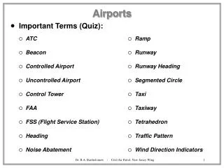
Airports. Important Terms (Quiz):. ATC Beacon Controlled Airport Uncontrolled Airport Control Tower FAA FSS (Flight Service Station) Heading Noise Abatement. Ramp Runway Runway Heading Segmented Circle Taxi Taxiway Tetrahedron Traffic Pattern Wind Direction Indicators.

Airports
E N D
Presentation Transcript
Airports • Important Terms (Quiz): • ATC • Beacon • Controlled Airport • Uncontrolled Airport • Control Tower • FAA • FSS (Flight Service Station) • Heading • Noise Abatement • Ramp • Runway • Runway Heading • Segmented Circle • Taxi • Taxiway • Tetrahedron • Traffic Pattern • Wind Direction Indicators Dr. R.A. Bartholomew - Civil Air Patrol, New Jersey Wing
Airports • The Flight Profile • The general profile followed by ALL airplane flights: * indicated aircraft stopped • A - Preflight Inspection • B - Taxi as directed • C - STOP for final systems check • D - Takeoff • E - Climb as directed • F - Cruise as filed • G - Descent • H - Approach-to-Landing • I - Landing • J - STOP, then Taxi to Parking as directed • K - STOP, then follow Shut Down procedures Dr. R.A. Bartholomew - Civil Air Patrol, New Jersey Wing
Airports • Airport Traffic Patterns • Airports have a pre-defined traffic pattern for arriving and departing airplanes • Separated arriving/departing airplanes for safety • Allows Pilots to plan their approach/departure routes • Will be similar, but not identical at all controlled airports • Wind direction will require changes Dr. R.A. Bartholomew - Civil Air Patrol, New Jersey Wing
Airports • Runway Markings • VFR Runway - Centerline (single dashed),and magnetic bearing markings only • The ‘0’ on the end of the bearing is dropped • Parallel runways add L (Left), C (Center), and R (Right) to the numbers • Non-Precision Instrument - as VFR,+ Threshold markings • Precision Instrument Runway - all above, + Side Stripes, Touchdown Zone, Aiming Point,Unusable Portion, Addition Distance Markings • Runway may only be visible at the last moments before touchdown Dr. R.A. Bartholomew - Civil Air Patrol, New Jersey Wing
22 Term Airports • Airport Signs • Style, Color and Content in 6 categories: • Mandatory Signs - Runway Intersection - do not cross without clearance • Location Signs - You are on Taxiway B • Direction Signs - Runway 22 this way • Information Signs - Boundary of RunwayProtected Area • Destination Signs - Terminal this way • Runway Distance Remaining Signs - 4000 feet remaining 4-22 B 4 Dr. R.A. Bartholomew - Civil Air Patrol, New Jersey Wing
Airports • Airport Lighting • Controlled by ATC, FSS or a Timer mechanism • Runway Edge - Normal WHITE , but 2nd half are AMBER on Instrument Runways • Threshold - GREEN marks start of landing portion • End of Runway - RED marks the end of the runway • REIL - WHITE STROBE marks each side of threshold • In Runway - • Touchdown Zone (TDZL) two rows of WHITE transverse light bars around the centerline • Runway Centerline (RCLS) WHITE flush, 50’ apart • Taxiway Turnoff GREEN flush • Taxiway - Normally BLUE sometimes green centerline • Beacons - Flashing colors identify airport type • Civilian = White/Green, Military = White/White/Green Dr. R.A. Bartholomew - Civil Air Patrol, New Jersey Wing
Airports • Approach Lighting • ALS (Approach Lighting System) - sequence of white lights which seem to flow towards the runway threshold • On Precision Instrument runways only • VASI (Visual Approach Slope Indicator) - system of lights, visible from 4 nm from the threshold which inform the pilot of above, on or below the correct glidepath for landing • 2 bar & 3 bar VASI - Red and White combinations indicate Above/On/Below slope • Tri-Color VASI - Amber=Above, Green=On, Red=Below slope • PLASI (Pulsating Approach Slope Indicator) - Pulsating White=Above, Steady White=On, Red=Slightly Below, Pulsating Red=Below slope • PAPI (Precision Approach Path Indicator) - Red and White combinations (left of runway) indicate Above/On/Below slope • Naval Aviators approaching a Carrier, ‘Fly the Ball’, another form on VASI Dr. R.A. Bartholomew - Civil Air Patrol, New Jersey Wing
Airports • Wind Direction Indicators • Wind Sock - orange cloth tapered tube which shows direction wind is FROM, and can indicate strength and gust conditions • Wind Tee - T shaped form which rotates freely and shows wind direction (points INTO wind) • Tetrahedron - Geometric form which rotates freely and shows wind direction (points INTO wind) • Segmented Circle - around wind indicator, may also include markers to show traffic pattern • Radio Communications at Airports • At Controlled Airports, controllers ‘control’ aircraft by means of radio communication, using specific frequencies and procedures • The Phonetic Alphabet - shorthand standard for spelling out words over a radio (we use the ICAO, and NATO standard) • e.g. Semper Vigilans • Sierra Echo Mike Papa Echo Romeo Victor India Golf India Lima Alpha November Sierra Dr. R.A. Bartholomew - Civil Air Patrol, New Jersey Wing
Aeronautical Charts • Important Terms (Quiz): • Cartography • Chart • Fix • Latitude • Longitude • Legend • Line of Position (LOP) • Map • Nautical Mile (6076’) • Projection • Relief • Sectional • Scale • Statute Mile (5280’) • Tick • WAC (1:1,000,000) Dr. R.A. Bartholomew - Civil Air Patrol, New Jersey Wing
Aeronautical Charts • Aeronautical ‘maps’ are known as Sectional Charts • They show a projection of the world using Lambert Conformal Conic Projection • Scale is 1:500,000 (1” = 8 statute miles) • Longitude and Latitude - a grid system used to define any position on a chart • Latitude (parallels) defines North-South from equator • Longitude (meridians) defines East-West from the Greenwich meridian Dr. R.A. Bartholomew - Civil Air Patrol, New Jersey Wing
Aeronautical Charts • Sectional Charts (for VFR) • All same scale of 1:500,000 (1” on chart = 8 statute miles) • US charts published every 6 months by NOAA (National Oceanographic and Atmospheric Administration) • Expiry date shown on chart • Each chart covers 8° of longitude by 4° of latitude • Each is named for a major city inside their area • Normally they contain additional information for Major Airports, including a more detailed (different scale) chart • The cover shows the color scale for terrain elevation, and the highest ground level in the chart’s coverage area • Large arrows show North/South orientation • Also describe Military Training Route (MTR) procedures • Give a simple Feet/Meters conversion scale Dr. R.A. Bartholomew - Civil Air Patrol, New Jersey Wing
Aeronautical Charts • The Legend and its Symbols • Legend shows all symbols used, and explains what they mean • Try to learn some of the major Airport ones: • Airports are shown 4 different ways, depending on the length of the runway, and if they are paved or not • Also, Airports are also shown in 2 different colors: Magenta=uncontrolledBlue=controlled • A star above the airport means it has a nighttime beacon • Airports are also shown with a ‘block of text’, such as: • 2175 L 24 122.9 • Which means, airport is 2175’ above sea level, it has lighting, it has a runway of 2400’, and an aeronautical advisory radio service (UNICOM) is available on 122.9 Mhz • You will also see ‘CT’ and another radio frequency for controlled airports • Also controlled airspace types and navigation information Dr. R.A. Bartholomew - Civil Air Patrol, New Jersey Wing
Aeronautical Charts • Airports Example: • What does the VFR sectional chart extract tell us about Nantucket Airport? • Now Try the Local Sectional Dr. R.A. Bartholomew - Civil Air Patrol, New Jersey Wing