Download
1 / 25
250 likes | 352 Vues
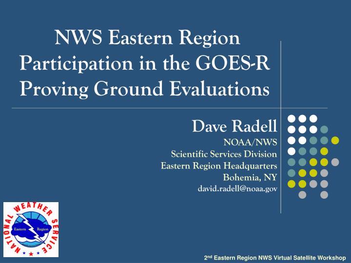
NWS Eastern Region Participation in the GOES-R Proving Ground Evaluations. Dave Radell NOAA/NWS Scientific Services Division Eastern Region Headquarters Bohemia, NY d avid.radell@noaa.gov. 2 nd Eastern Region NWS Virtual Satellite Workshop. Overview.

E N D
NWS Eastern Region Participation in the GOES-R Proving Ground Evaluations Dave Radell NOAA/NWS Scientific Services Division Eastern Region Headquarters Bohemia, NY david.radell@noaa.gov 2nd Eastern Region NWS Virtual Satellite Workshop
Overview • Eastern Region Satellite Priorities and evaluation approach • CIMSS Fog/Low Cloud Evaluations • CIMSS Convective Initiation Products Evaluations • AWIPS I/AWIPS II Transition • Summary
ER Satellite Priorities Support Five Regional COMET Partner Projects Coordinate Ongoing Evaluations: Supplement training, AWIPS data/display issues, etc. Identify New Products to Address Forecast Challenges: Convection, Aviation, Enhanced Short Term Focus (0-36 hr)
Regional COMET Partner Projects Sterling, VA (LWX): Development and evaluation of WES cases to investigate the use of pseudo-GLM products during warning operations at the Sterling WFO (University of Maryland, College Park) Mt. Holly, NJ (PHI): Fog research to operations using GOES-R(Kean University, NJ) Raleigh, NC (RAH):Towards improved anticipation of prolific lightning events in central North Carolina(NC State University)
Regional COMET Partner Projects Buffalo/Binghamton, NY (BUF/BGM): Using satellite imagery to improve monitoring and nowcasting of intense lake-effect snow bands Blacksburg, VA (*RNK): The utility of total lightning for warning of pulse-type thunderstorms within the Central Appalachian Mountains Region (Hobart and William Smith Colleges) (Virginia Tech) *Awarded for FY2013. Just starting.
ER Approach to New Product Evaluations • 1. Forecast Deficiency/Need/Interest Data Provider, ERH and Interested WFOs discussions. Developer feedback and evaluation results drive product expansion within ER. • 2. Data/AWIPS • Configuration • Product • Evaluation Data request, data format, and AWIPS 1 – 2 configuration. Product is evaluated in forecast operations. • 3. Product Use Training
ER Approach to New Product Evaluations • 1. Forecast Deficiency/Need/Interest Data Provider, ERH and Interested WFOs discussions. Satellite Feedback?????? • 2. Data/AWIPS • Configuration • Product • Evaluation Data request, data format, and AWIPS 1 – 2 configuration. Product is evaluated in forecast operations. • 3. Product Use Training
ER Approach to GOES-R Evaluations A twofold evaluation approach: • “Official” Product Evaluation • Signed Partner/Provider Agreement via NWS/OS & T • Definite period of evaluation • Forecaster feedback and short SOO summary “science” report • “Casual” Product Evaluation • No official Agreement • No set period of evaluation. WFO can “turn on/off” data from ER LDM. • Informal feedback between WFO, developers, ERH/SSD.
All Eastern Region Product Evaluations • UW Convective Initiation: CAE*, RAH*, RLX, GSP* MHX*, ERH* , RNK • UW Low Cloud/Fog:PHI*, GSP*, CTP • CIRA Low Cloud/Fog:BUF/BGM • CIRA WRFABI:RLX, CHS, PBZ • SPoRT RGB Air Mass: RAH Key: Official Evaluation, Casual Evaluation, * Evaluation Complete
CIMSS Fog/Low Cloud • February – August 2012 Evaluation Period for PHI, GSP • MVFR and IFR Probability, Cloud Thickness, Cloud Type • WFO PHI GOES-R COMET Project with Kean University (NJ) • Aviation forecast focus at both offices (PHL and CLT) • Formal survey and summary science write up
CIMSS Fog/Low Cloud AT KCLT...LATEST CIMMS GOES-R CLOUD DEPTH OVER KCLT WAS NEARLY 900 FEET. THIS SHOULD TAKE ABOUT TWO HOURS TO BURN OFF. AT KAVL AND KHKY...I EXPECT DENSE FOG WILL REMAIN ESTABLISHED THROUGH SUNRISE...THEN CLEARING TO VFR BETWEEN 14Z TO 15Z BASED ON CIMSS FOG THICKNESS PRODUCT. KAND MAY SEE MVFR FOG AROUND SUNRISE...LIKELY SOURCED FROM THE LAKE. SATELLITE SHOWS AN EXPANDING AREA OF STRATUS EAST OF I-85. KCLT MAY REMAIN UNDER THE EDGE OF THE STRATUS AND FOG THROUGH 14Z. ELSEWHERE...GROUND FOG IS POSSIBLE...BUT I WILL KEEP VIS P6SM AT THIS TIME. THE CIMSS GOES-R LOW CLOUD PROBABILITY PRODUCT IS SHOWING ABOUT A 60-70 PERCENT CHANCE THAT THESE CLOUDS ARE IN THE MVFR RANGE. Question: Should satellite data be incorporated into gridded mesoanalyses? (eg., RTMA)?
FLC Survey Results On a scale of 1-5, in the future, how likely are you to use the GOES-R FLC products when diagnosing FLC? In general, how were the GOES-R FLC products used in the forecast process? 1 is the most used, 4 the least used.
FLC Survey Results http://www.goes-r.gov/users/pg-activities-01.html
CIMSS Convective Initiation • Warm season 2011-2012: CAE, RAH, RLX, GSP, ERH • Products: CI, CTC, OT • Some use at WFO RLX for WRN Pilot Project • Expansion to WFO RNK in 2013 (COMET Project)
CI Survey Results What is your current position? Prior to this evaluation, what product training were you exposed to? Select all that apply. Under which convective scenarios did you find the CTC product most useful?
CIRA WRFABI • WFOs CHS and RLX casually evaluating (WRN Pilot Project) since summer 2012. PBZ on board for 2013. • Outgrowth of forecaster participation in HWT • Products: 6.95m, 7.34 m, 10.35 m, 3.9 m, VIS • Also used in sky cover grid forecasts. • “Formal” evaluations not yet underway.
CIRA WRFABI .NEAR TERM /THROUGH TONIGHT/...MID TO UPPER LEVEL ANTICYCLONE ENTRENCHED ACROSS THE AREA THIS AFTERNOON...AS CAN BE SEEN BY ANTICYCLONIC FLOW OF CIRRUS ON ALLOF THE SATELLITE CHANNELS. ALSO OF INTEREST IS THE PRONOUNCED MIDLEVEL DRYING SEEN ON THE 7.4 UM WATER VAPOR SOUNDER LOOP...WHICH AGREES WELL WITH THE NSSL WRF SIMULATED 7.4 UM IMAGERY. BOTH OF THESE FACTORS HAVE SUPPRESSED ALL CONVECTIVE ACTIVITY SO FAR THIS AFTERNOON...TO THE POINT WHERE WE DON'T EVEN HAVE ANY CU ACROSS THE CWA AT 3 PM...WHICH IS PRETTY UNUSUAL FOR JULY.
AWIPS-2 Transition • Challenges for non-operational data.* • Frequent builds • Appear to be several transition efforts. • We’ve put an informal “hold” on new • supplemental satellite data unless • AWIPS-II ready. • *We are currently maintaining TWO AWIPS systems! AWIPS I AWIPS II
AWIPS II in Eastern Region Baseline AWIPS2 Data are on SBN Customized AWIPS2 Data are on ER LDM
AWIPS II in Eastern Region NPP 3.7 m NPP 6.4 m
AWIPS II in Eastern Region Cloud Phase with PIREPS Prob. IFR with Ceiling/VISB
Summary • COMET project support, coordinating evaluations and identifying new forecast techniques/data are priorities. • Evaluation success within the region thus far. A small expansion or products for 2013 is underway. • AWIPS I/AWIPS II transition adds difficulty to the process of bringing in/using new data.