Download
1 / 72
730 likes | 861 Vues
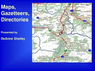
Maps, Gazetteers,Directories Presented by DeAnne Shelley. The Key Word here is Locate. How can Maps, Gazetteers and Directories (MGD) help us find our Ancestors?. Directories can help locate ancestors in larger towns and cities.

E N D
Maps, Gazetteers,Directories Presented by DeAnneShelley
The Key Word here is Locate How can Maps, Gazetteers and Directories (MGD) help us find our Ancestors? • Directories can help locate ancestors in larger towns and cities • Gazetteers can help locate ancestors in smaller towns • Maps can help locate surrounding towns and geography
These locations can then help us find other records about our ancestors such as • Census Records • Vital Records • Probate Records • Land Records
On the Internet On the Internet The Internet is Key to Finding MGDs How do we Find MGDs? • Research Outlines • FHLC • Do a Place Search • Look for M, G, or D in the Subject List • Internet
How do we get Research Outlines? • Purchase from SLFHL cost is minimal • FamilySearch Internet Site, free • Order from Church Distribution
invented 1876 Directories Why search Directories? • Were there directories before telephones? • Telephones were not widespread until after the 1930s. • Some Directories date back to the 1700s. • They were created for business purposes, but now serve as valuable research tools.
[See Reference book 973 E43c . This is an Index to the complete collection.] Directoriesp24 “The Family History Library has a comprehensive collection, City Directories of the United States, …” • This Collection includes 336 cities and regions from the late 1700s to 1935. • The pre-1860 city directories are on more than 6,000 microfiche. • Directories for 1861 to 1935 are on 1,118 microfilms...” There were many Directories before telephones.
Directories • A Little Math Shows that this Collection of City Directories contains over 100M names. • There are more directories for other countries • Your ancestor could be listed in one of them
What do Directories show? • Name, place of residence, and often the occupation of the resident.
This information can help: • Find nearby churches where family members may have been baptized, married, or buried. • Find when the family arrived or left, or when the father died • Find the family in a census – Census Indexes are not always accurate or available.
GAZETTEERS What is a Gazetteer? “A gazetteer is a list and description of places.... usually listed in alphabetical order similar to a dictionary.” – It is a Dictionary of Places
Gazetteers recommended by the U.S. Research Outline, p28-29 • Bullinger's Postal and Shippers Guide… since 1871 • American Places Dictionary • Omni Gazetteer of the U.S. Most comprehensive with 1.5M places • The National Gazetteer. Most useful – Towns as they were in 1884 – population as of 1880
Examples from National Gazetteer • Castle Rock, Mo. p.v. (post village) in Jackson tp., Osage co., 9 mi. S. of Jefferson City. Pop. 28. • Koeltztown, Mo., p.o., Osage co. Pop. 84 Other Gazetteers list towns as of 1797, 1834, 1853, & 1855
MAPS How can Maps help us find our Ancestors? • People usually traveled the path of least geographic resistance, following rivers and valleys & roads. • Before modern transportation people usually married someone from within a 20-mile radius of their home. • Maps can provide clues where to look next. • Use Google Earth for world research
Maps described in U.S. Outlinep36-38 • Plat Maps - maps of property boundaries • Ward Maps of major cities – census districts & political divisions of large cities • Topographic Maps – many USGS maps • Atlases • Historical Atlases – useful for finding places that no longer exist. • Township & County Boundaries • Land Ownership Maps
Go to familysearch.org, then click on How to Find Research Outlines on the Internet • Search • Research Helps • Sorted by Type • Research Outlines • All Research Outlines are listed in Alphabetical order
Directories From England Research Outline: • Directories Exist from 1760. • A link is given to the GENUKI web site where volunteers will search some directories for you free of charge.
Gazetteers From England Research Outline: • The place-names used in the FHLC are the names and spellings used in: The Imperial Gazetteer of England and Wales. This gazetteer lists place-names as they were in the 1860s. • In 1974, England realigned its county boundaries and renamed many counties. More county boundary changes were made in 1996. • County names in the FHLC are those used before 1974, with references made to new names.
Maps From England Research Outline: • Since 1800 the Ordnance Survey has been the major source of topographical maps. English, Welsh, Scottish, and Irish maps are available in high resolution. • Ordnance Survey Maps are available on the Internet by clicking on a link to their site.
From German Research Outline: • See #23 in Handout for Summary of valuable information found in Research Outlines for Germany. • Similar information is found in other Research Outlines.
From German Research Outline: Directories • Directories Begin in the 1700s. Most date from the 1830s to early 1900s. • Telephone Directories on the Internet
Regardless of the various jurisdictions a place may have been under at different times, all German places are listed in the FHLC by the jurisdictions used in the following reference: • Uetrecht, E. (Meyers commercial gazetteer of the German Empire). Ref book 943 E5mo • This book lists the names of places as they existed in Germany from 1871 to 1918. From German Research Outline: Gazetteers
From German Research Outline: Maps • Map of the German Empire, A detailed map of the German Empire as it existed 1871-1914. (Geography used in FHLC) • The Great V.A.G. Atlas, An Atlas of Germany with an index of cities and towns that make finding locations easy. • Westermann Atlas of World History, An excellent historical atlas.
Go to familysearch.org, then click on – Another great site is Cyndi’s List How to Find Other Key Genealogical Sites on the Internet that have MGDs • Search • Web Sites • Key Genealogical Sites (Road Map to the Best MGD Sites)