Download
1 / 21
220 likes | 521 Vues
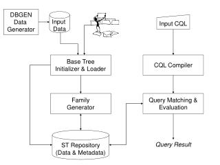
Data Input. How do I transfer the paper map data and attribute data to a format that is usable by the GIS software? Data input involves both locational (map) and attribute data. The data can originate from various sources: - paper maps - attribute data on paper

E N D
Data Input How do I transfer the paper map data and attribute data to a format that is usable by the GIS software? Data input involves both locational (map) and attribute data. The data can originate from various sources: - paper maps - attribute data on paper - other digital formats- databases (dBase), spreadsheets (excel), or ASCII files
Data input can become major “bottleneck” of GIS project - Can cost 80% or more of project - Labor intensive, tedious, error-prone - Constructing the GIS data can be so large that the project is never finished
The goal is to use the mode of data input that: - best translates the source data to electronic form - is fast - is easy to use - reduces cost - maximizes the accuracy required for the GIS project
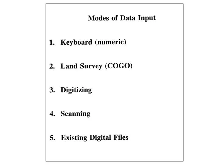
Keyboard entry: (the source data only exists on paper) - mainly attribute data - type data using keyboard - data can be entered directly into a GIS table, spreadsheet, or database table.
Land survey: - calculates coordinates on location (in the field) by measuring distances and angles, then entering the values into the software - process uses coordinate geometry (COGO) - process is used to draw legal documents ie. Parcel properties
Digitizing: Digitizing: A process that uses a device to extract spatial features from paper maps or photos to electronic GIS format Digitizing hardware: - table or tablet - grid of wires embedded in surface - grid generates a magnetic field that can be detected by a cursor - cursor is a small flat device that contains a wire cross hair - cursor keypad allows special GIS functions to allow faster data capture
Digitizing Operation: • Place map and tape to digitizing table • Control points captured. Control points are • reference points on the paper map in which • coordinates and map projection are known. • Minimum of 3 control points to digitize • Control point coordinates must be known or must • be easily identified (intersection of 2 roads) • Control points are used to transform the data • from the paper map to GIS electronic locations • More control points = better digitized results • Feature to digitize into spatial object determined • Cursor is placed along feature and the electronic • GIS spatial object is generated. C B A A
Two modes of digitizing: - point user identifies points to capture individually by pressing enter on cursor - stream points captured at set time intervals and/or movement of cursor Stream Point
Problems or Errors using Digitizing: - Paper maps can stretch/ shrink. Lose accuracy. - Paper maps meant to display information, not record locational (x,y) information. - Discrepancies across map sheets to digitize. (ie roads do not match when 2 maps digitized.) - User error such as overshoots, undershoots, or spikes Spike Undershoot Overshoot
To avoid or correct overshoots, undershoots, or spikes: -use clean function - “snap” to nodes After Before
A specialized type of digitizing is called: Tracing or “Heads-Up” digitizing - uses portions existing digital map layer to create a new layer (ie. Use existing road centerline to define a voting precinct polygon layer) - in the process, the existing digital file is opened in the GIS; the NEW spatial object is drawn (created) over the existing data layer
Paper map to trace Heads-Up digitizing example: Objective: to create voting precinct polygon, 4B, from the paper map showing precincts
Heads-Up digitizing Existing digital file= street center line The polygon is created by: examining the paper map showing voting precincts; determining the street line segments that comprise the precinct; then with your “Head up” looking at the computer screen, draw the polygon The result is a newly traced polygon showing voting precinct, 4B
Scanning: Automated method to extract data from maps & photographs The image to the left is a scanned image. The original photograph is placed in a scanning device; a photoelectric cell or “eye” passes over the photo or document and records any mark on the photo. The resulting data is stored in pixels or cells. Each cell may consist of a defined value. The scanned image is in Raster GIS format.
Satellite imagery maps can be easily scanned since the output is diplayed in pixels or cells. Detailed satellite image view Landsat satellite image
Automated scanning from raster to vector attempts to capture a certain data layer from the paper map, then convert the pixels or cells to points, lines, or polygons • Automated scanning of paper maps can cause • problems: • original map must be clean (no extra lines or • markings: ie. Paper wrinkles, coffee cup stains) • no additional data (map to left would scan and • convert to polygons much easier if only the • lines that comprised the parcels were present) Coffee cup stain
Another example of scanningAutomated scanning of paper maps can cause problems: -complex line work provides a greater chance of error -contour lines cannot be broken with text -feature recognition not easy (road versus 2 contour lines)
Scanning is useful: Scan & register the image Use heads-up digitizing to capture the spatial objects In this example, 1. The aerial was scanned & registered (control points were known). 2. Trace or heads-up digitize the river as a polygon
Existing digital files for data input - determine the digital files required - locate the digital files (internet web sites, etc) - import or translate the data into the GIS format - fastest method (if data imports/ translates well)
Which method of Data Input to use??: - amount of time & effort to capture data and edit errors resulting from the method - cost of method to capture the data - the required resultant data format - the accuracy (degree of error) required & the precision (number of decimals) required - is pre-existing digital data accurate enough for project?