Download
1 / 16
160 likes | 271 Vues
Vector Data Input. Chapter 4. Data. Buy or make - sources Base map - layers Standards – accuracy Metadata As bad as the worst component. Existing GIS Data. Federal Government Internet State Agencies Regional and local Framework data

E N D
Vector Data Input Chapter 4
Data • Buy or make - sources • Base map - layers • Standards – accuracy • Metadata • As bad as the worst component
Existing GIS Data • Federal Government • Internet • State Agencies • Regional and local • Framework data • geodetic control, orthoimagery, elevation, transportation, hydrography, governmental information, cadastral.
Existing GIS Data • US Public Data • US Geological Survey • US Bureau of the Census • State Public Data • Regional Public Data (Central TX) • Metropolitan Public Data (Austin) • GIS Data from Private Companies
US Geological Survey • National mapping and remotely sensed • Thematic data clearinghouse • Digital Line Graphs created from USGS quadrangles. • 1:24,000; 1:100,000; 1:2,000,000 • Hypsography (contour lines and spot elevations); hydrography, boundaries, transportation, PLSS data. • Land Use Land Cover (LULC) - Anderson
US Bureau of Census • TIGER – Topologically Integrated Geographic Encoding and Referencing • Each census. • Address geocoding • Legal and statistical (zip, census block) to link to census data • Roads, railroads, streams, water bodies, power lines and pipelines.
Statewide Public Data • See Appendix C of text • Texas Natural Resources Information System (TNRIS) • Texas Wetland Information Network (WetNet) • Texas Natural Resource Conservation Commission • Texas Parks and Wildlife Department • Texas Environmental Awareness Network
Regional and Local Public Data • University of Texas at Austin • College of Architecture • Community and Regional Planning • Austin and Central Texas
GIS Data fromPrivate Companies • ESRI • Geographic Data Technology • Library/Resources
Metadata • Information about information • Federal Standards • Software to assist • Federal Geographic Data Committee • Example: Texas Parks & Wildlife
Conversion of Existing Data • Direct translation • Arc/Info interchange files (.e00) • MGE and Microstation (.dgn) • AutoCAD (.dxf, .dwg) • shapefiles • Neutral format • Spatial Data Transfer Standard (SDTS) • Topological Vector Profile (TVP) • International Steering Committee for Global Mapping (ISCGM)
Remotely Sensed Data • Digital orthophotos (DOQs) • Satellite images
GPS Data • Library/Resources • Selective Availability • Differential correction • 3-5 meter
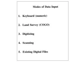
Digitizing • 0.001 inch accuracy • Snap tolerances • arcsnap • nodestrap • Intersect arcs • Duplicate arcs • On-screen or heads up digitizing
Scanning • Raster!!! • Coffee stains - notes • Colors • Digital Raster Graph (DRG) • Vectorization of raster files • Commercial maps
Geometric Transformation • Converting a digital map or an image from one coordinate system to another using a set of control points and transformation equations. • Different methods. • We won’t cover directly. • Root Mean Square Error (RMS)