Download
1 / 18
190 likes | 645 Vues
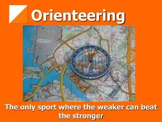
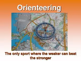
International Specification for Sprint Orienteering maps (ISSOM). Structure of the presentation History of ISSOM (development) Main approaches if ISSOM (goals) Lacks of ISSOM (intermediate stage) Experiences of ISSOM in urban areas, Switzerland Outlook of ISSOM Discussion / open questions.

E N D
International Specification for SprintOrienteering maps (ISSOM) Structure of the presentation • History of ISSOM (development) • Main approaches if ISSOM (goals) • Lacks of ISSOM (intermediate stage) • Experiences of ISSOM in urban areas, Switzerland • Outlook of ISSOM • Discussion / open questions 10th ICOM, Rapperswil
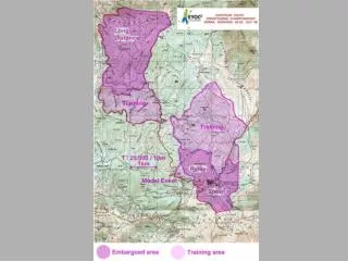
International Specification for SprintOrienteering maps (ISSOM) Introduction: History of ISSOM • August 2001: Decision of Extraordinary General Assembly of IOF to integrate Sprint Orienteering as new discipline in to the WOC • August 2001: Presentation of principles to generate specifications for maps (9th ICOM, Tampere FIN) coloring, bright colors for large areas (example) scale and contour interval relationship • February 2002, Presentation of a working draft “Int. specification for Orienteering maps in urban areas” No differentiation urban/forest ISSOM must cover all types of terrains 10th ICOM, Rapperswil
International Specification for SprintOrienteering maps (ISSOM) Introduction: History of ISSOM • May 2002, start collaboration with the map makers of WOC 2003 • July 2002, First application of the 1. Draft ISSOM in WC Lausanne, Switzerland (1. Test-Print; spot color print) 10th ICOM, Rapperswil
International Specification for SprintOrienteering maps (ISSOM) Introduction: History of ISSOM • 2. Test-Print; spot color print, regional event in Switzerland, Liestal • November 2002: Extraordinary MC-Meeting in Budapest: Discussion of the 1. Draft of ISSOM Lack of time for WOC 2003 Focusing on the definition and graphic implementation part, no application and generalization part. • Serie of test print of “Compo-City”10 Testprints 10th ICOM, Rapperswil
International Specification for SprintOrienteering maps (ISSOM) Introduction: History of ISSOM • February 2003: Ordinary MC-Meeting in Helsinki:Discussion of the 2. Draft of ISSOM, still many contradictory things Lack of time for WOC 2003 release of a final draft • March 2003: release of the final draft to make the specification available for map makers and elite runners for WOC preparations (5 months) • Pdf-document and Web-Version 10th ICOM, Rapperswil
International Specification for SprintOrienteering maps (ISSOM) Introduction: History of ISSOM • May 2003: application of the final draft of ISSOM for the 1. Swiss Sprint Orienteering Champion Ship; Mendrisio (3. Test-Print) • July 2003: regional event in Switzerland, Basel (4. Test-Print) • June – July 2003: Applications of the final draft ISSOM in different countries (Norway, Finland, Hungary etc.) • 5. August: Sprint final WOC 10th ICOM, Rapperswil
International Specification for SprintOrienteering maps (ISSOM) Main approaches of ISSOM • Focus on urban areas, because of WOC 2003 in Rapperswil and not mentioned very much in ISOM 2000 • Focus on the most important problem: passable an impassable features (walls, fences, private properties) • scale 1:4000 or 1:5000 • contour interval 2 m or 2.5 m 10th ICOM, Rapperswil
International Specification for SprintOrienteering maps (ISSOM) Main approaches of ISSOM • recommended map size A4, not larger than A3 • the map must show a clear picture of the main level of the terrain(example) • the minimum dimension of a feature shown in a map is 2 x 2 m. • An object smaller than 2 x 2 m can be shown if it is very visible or high. 10th ICOM, Rapperswil
International Specification for SprintOrienteering maps (ISSOM) A map with few well chosen features, will give a much better map, than a map cluttered with many insignificant features. (Eduard Imhof) 10th ICOM, Rapperswil
International Specification for SprintOrienteering maps (ISSOM) Main approaches of ISSOM • Represent barriers and passages • Graphic implementation: overemphasize impassable fences, wall black thick line (0.35mm) reduce graphically passable features gray line / thin line (<0.1mm) 10th ICOM, Rapperswil
International Specification for SprintOrienteering maps (ISSOM) Main approaches of ISSOM • Fairplay / Competition rules: declaring that impassable features are also forbidden to pass disqualifying competitors 10th ICOM, Rapperswil
International Specification for SprintOrienteering maps (ISSOM) Main approaches of ISSOM • Fairplay / Competition rules: declaring that impassable featuresare also forbidden to pass adapt this rule to all other features (water body, vegetation features) 10th ICOM, Rapperswil
International Specification for SprintOrienteering maps (ISSOM) Lacks of ISSOM • Contradictory things Content minimum dimension 2m x 2m for urban areas o.k. in forest vegetation patches of 2m x 2m! Undergrowth (green line screen) not suitable in urban areas Flowerbeds corresponds to undergrowth to be consequent, passable cliffs must be represented in gray … • Application of ISSOM in forest terrain • Optimize color setting no money for series of test prints (spot color prints) 10th ICOM, Rapperswil
International Specification for SprintOrienteering maps Experience of ISSOM in urban areas, Switzerland Strong cooperation between map maker and course setters is very important (open/close doors, gates, gaps) Course setters may not provoke unfair actions of the competitors (no legs over an im-passable wall/fence) 10th ICOM, Rapperswil
International Specification for SprintOrienteering maps Outlook of ISSOM • Collect experience of ISSOM applications • Present the final recommendation • Start Hearing of Federation • Present the ISSOM 10th ICOM, Rapperswil
International Specification for SprintOrienteering maps Experience of ISSOM in urban areas, Switzerland • All reasonable measures must be considered to prevent accidents with other human activities in urban areas such as traffic, pedestrians, spectators, etc. (Separate competitors, pedestrians and spectators by the use of a cordon (tape) in crowded areas.) 10th ICOM, Rapperswil
Coloring 10th ICOM, Rapperswil
Line width Classification: individual characteristics grouped into classes for comprehension and ease of representation Comprehension: 0.1 0.13 0.18 0.25 0.35 0.5mm 0.05 0.1 0.15 0.2 0.25 0.3 0.35 0.4 0.5 0.6 0.7 0.8 Not distinguishable = not comprehensive occurrence ISO-Norm 10th ICOM, Rapperswil