Download
1 / 7
70 likes | 152 Vues
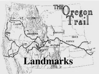
Identifying Landmarks and Relations in grounded route descriptions of IITK . ‘Smart Maps’. Project Presentation - mohit gupta & Shubham modi. Objective. “First level of spatial understanding for humans is by landmarks ” To create “ Smart Maps” that will:

E N D
Identifying Landmarks and Relations in grounded route descriptions of IITK ‘Smart Maps’ Project Presentation -mohitgupta & Shubhammodi
Objective • “First level of spatial understanding for humans is by landmarks” • To create “Smart Maps” that will: • Learn automatically from natural language • Compute not the shortest path but the most cognizable one. • Output the route in natural language
Steps to implement Route description to user OUTPUT Cost – Blend of distance as well as popularity of roads/landmarks TRAINING Mapping parsed output on the IITK Map graph Parsing and NLP Training Data
Steps to implementparsing and nlp Input Go straight for 5 minutes from SAC-crossing • PCFG and CKY Algorithm. • Using dependency parser for parsing and extraction of keywords. Output from Stanford Parser root(ROOT-0, Go-1)advmod(Go-1, straight-2)num(minutes-5, 5-4)prep_for(Go-1, minutes-5)prep_from(minutes-5, SAC-crossing-7) Extracting the keywords for further use.
Steps to implementsimulation Destination: Source: Airstrip Health-Center IIT-gate Hall-9 After entering IIT-gate, go straight for 1.2km. Take a left from the T-junction at Hall-2. Turn right after tennis-court and go straight for 100 m. Take a left from the T-junction. Follow the road and on reaching the T-junction, take a right. Go straight for 100 m and take the first left. Hall-9 will be on the right. From the airstrip, go straight and take the left before the NCC-Camp. Go straight till you reach Hall-3. Take the road oppossite to Hall-3 and go straight until you reach GH-1. Take right from GH-1 and go straight. Health-Center would be on your left. Route descriptions are fed in natural language, as a part of training Hall-2 IIT-GATE Keywords are extracted and input is chunked into simple instructions Tennis-Court T-Junction The path is mapped and the roads(edges) encountered are recorded T-Junction Now the user enters a source and a destination Hall-9 T-Junction
Steps to implementRoute description to user Searching input on the IITK graph. Concluding most effective route using modified minimum cost finding algorithm. User Input Source :Auditorium Destination : Hall-2 Output will be almost similar to description taken for training of data. Framing it into a human language. Output Go 100m straight till SAC-Circle. Take right from SAC-Circle. Go 200m straight till T-junction. Hall-2 is on your front.
Thank you! Please help us in collecting the corpus! Fill out the form @home.iitk.ac.in/~smodi/cs365/project/index.html