Download
1 / 19
200 likes | 392 Vues
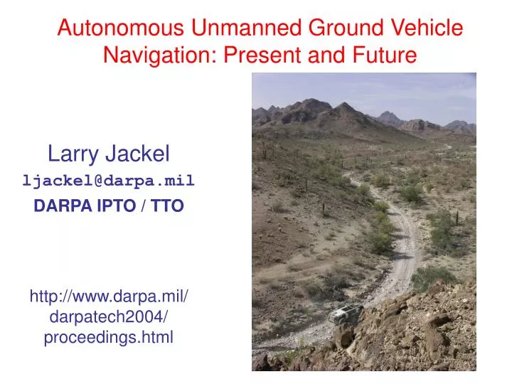
Autonomous Unmanned Ground Vehicle Navigation: Present and Future. Larry Jackel ljackel@darpa.mil DARPA IPTO / TTO http://www.darpa.mil/ darpatech2004/ proceedings.html. We want autonomous robotic ground vehicles that can:. Go from waypoint to waypoint autonomously without crashing

E N D
Autonomous Unmanned Ground Vehicle Navigation: Present and Future Larry Jackel ljackel@darpa.mil DARPA IPTO / TTO http://www.darpa.mil/darpatech2004/proceedings.html
We want autonomous robotic ground vehicles that can: • Go from waypoint to waypoint autonomously without crashing • Traverse rough terrain • Move fast Robotics has been developing slowly – DARPA Expectation: Machine learning can quicken the pace.
What we can do now • Traverse obstacle rich terrain slowly <1 meter/sec) • Use canned scripts to climb over pre-defined barriers • Automatically drive on highways without traffic • Teleoperate, but often with difficulty.
DARPA PerceptOR Program • 4-year program • concluded February, 2004 • Perception for off-road navigation • Mostly standard AI techniques • Un-rehearsed tests at government sites • AP Hill VA (Dec 2003) • Yuma, AZ (Feb 2004)
PerceptOR results • Reasonable behavior in simple, uncluttered environments • Considerably worse than human RC operation in cluttered environments • No learning from mistakes (ping-pong between obstacles) • Obstacle classification errors • e.g. can’t always tell compressible vegetation from rocks or stumps Near-sighted sensing gives poor path-planning
How autonomous navigation is done today • Sense the environment, usually with LADAR • Create a 3-D model of the space with solid and empty volume elements • Identify features in the environment: Ditches, Grass, Water, Rocks, Trees, Etc. • Create a 2-D map of safe areas (black) and dangerous areas (red) • Run a path planning algorithm to decide on the next move toward the goal, staying in the “black” areas • Move the vehicle • Repeat Tree Canopy Positive obstacle Overhang
Near-Sighted Behavior Goal Obstacles Vehicle
High Performance Autonomous Navigation Systems Already Exist
New approaches to autonomous navigation • Learned navigation • General rules of navigation • Learning from example • Reinforcement learning • One shot learning • Don’t repeat mistakes • Image Understanding • go beyond object recognition to be more like Ben • no longer have the excuse of inadequate compute power • Brute force vehicles ( E.g. CMU’s Spinner)
New DARPA program:Learning Applied to Ground Robots(LAGR) • 3 years • Each performer supplied with a simple robot • About 0.5 meters on a side • Simple differential drive steering • Sensor suite includes, stereo cameras, GPS, inertial navigation unit, proximity sensor, compass • On-board high-end Linux computer • Baseline PerceptOR code • Focus on learning
LAGR Competitions • ~Every month • Gov’t site(s) – code uploaded to gov’t robot • 3 runs / performer • Course length about 100 meters • Use knowledge gained in earlier runs in later runs • Data logs shared with all performers • ~Every 6 months • New training data gathered by Gov’t team • Performers shrink-wrap code learns new data on Gov’t computer • New navigation algorithms tested at Gov’t site
Code Sharing Performers may share source code • Credit must be given where credit is due Object code available from each performer • Logs of competition runs available to performers • Logs can be used as training data Go / No-Go Must meet speed metrics at 18 month milestone to stay in program: • 10% improvement over today’s state-of-the art
Encourage Image Understanding • Much of the course will be visible from the start but will be beyond stereo range • There will be cul-de-sacs • Much better performance will be possible if performers go beyond stereo and attempt to “visually” plan route • Possible strategy: Work in image plane representation, not map representation • Some Govt competitions will only allow monocular vision • Enhanced range info from optical flow, motion parallax? A Different Approach to Machine Vision
Port to Spinner • In 2nd Phase (18 -36 months) training data from Spinner will be supplied to performers • Best code will be tested on Spinner
End-to-End Learned Navigation(Includes learned feature extraction) • Yann LeCun – NYU • Netscale Technologies