Download
1 / 27
290 likes | 493 Vues
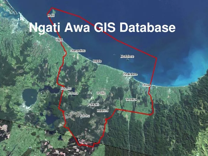
Ngati Awa GIS Database. Thanks to…. Stuart Halliday of Geospatial Solutions Ltd, Whakatane for creating the Database for Ngati Awa Bay of Plenty Regional Council Whakatane District Council. Presentation. About the Ngati Awa GIS Database How it was made How much it cost What it can do

E N D
Thanks to… • Stuart Halliday of Geospatial Solutions Ltd, Whakatane for creating the Database for Ngati Awa • Bay of Plenty Regional Council • Whakatane District Council
Presentation • About the Ngati Awa GIS Database • How it was made • How much it cost • What it can do • Protecting sensitive information and intellectual property • Reporting with maps
Ngati Awa GIS Database: Background • Created in 2005 by Te Runanga o Ngati Awa • Uses Arc Reader 9.3 • Now using Version 10: Total cost $40,000 • Most layers from local Councils, some purchased by Ngati Awa • Contributes to Ngati Awa consents, planning and diligence decisions
Ngati Awa Shared • Rolled out ‘lite’ version at 6 marae-based e-portals in the Ngati Awa Rohe • Lite versions prepared for and gifted to 5 neighbour iwi (Te Whanau a Te Ehutu, Te Whakatohea, Ngaiterangi, Ngati Whare and Ngaitai) with sponsorship from TPK
Uses Generates maps for use in: • Assessments of consent activities • Planning processes • Diligence tests for land proposed for purchase by Ngati Awa
Layers • Aerial photography • Topographical mapping • Hydro features • Maori Land • Ngati Awa Statutory Areas • Soil categories • Zones
Layers continued • Significant natural areas and Protected Natural Areas • Contaminated sites (PCP, dioxin) • Flood risk areas • Limited Valuation NZ data i.e. parcel boundaries and references to ratepayer • Waahi Tapu and Waahi Taonga o Ngati Awa • Archaeological sites (CINZAS, NZAA, EBOP, HPT)
Layers continued • Department of Conservation estate • Ngati Awa rohe moana • Mahinga mataitai and marine reserves • Rahui areas • Forestry and other land cover • Animal pest poisons sites • Maori reserves • Soil and Water Classifications
Consents Process • Desk top ‘site visit’ • Identifies sites of significance • Triggers consultation with Ngati Awa • Supports Ngati Awa recommended consent conditions and advice notes