Download
1 / 64
660 likes | 818 Vues
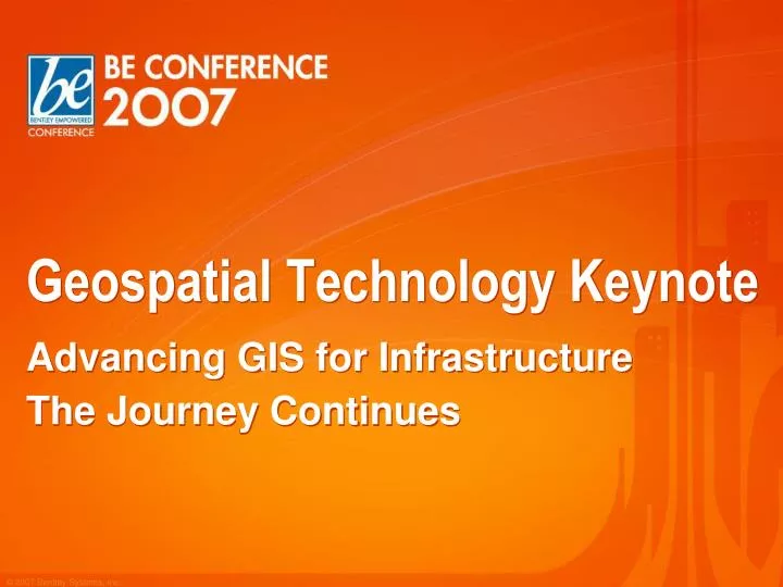
Geospatial Technology Keynote. Advancing GIS for Infrastructure The Journey Continues. Agenda. The Geospatial State of the Union Advancing GIS for Infrastructure Technology in Action Part 1 Break Technology in Action Part 2 Coming Attractions. Major Geospatial Development Centers.

E N D
Geospatial Technology Keynote Advancing GIS for Infrastructure The Journey Continues
Agenda • The Geospatial State of the Union • Advancing GIS for Infrastructure • Technology in Action Part 1 • Break • Technology in Action Part 2 • Coming Attractions
Major Geospatial Development Centers Leimen Quebec Watertown Atlanta Mumbai Austin Huntsville
Welcome to CADscript User Base Western Australia Albany Nautical Chart Fremantle Notre Dame TravelSmart 2007 Maryland Official Highway Map
Welcome sisNET User Base swbNetze GmbH & Co. KG
Geospatial Product Team Styli Camateros Vice President Civil & Geospatial Products • Development: • Donald Morissette • Director - Raster Products • Jean Papillon • Director - Geospatial Platform Products • Vonnie Smith • Director - Electric, Gas, Comms Products • Scott Gellis • Director - Water and Municipal Products • Dr. Martin Icking • Director - Multi-Utility Products Alain Lapierre Chief Product Architect Bob Mankowski Director – Product Management Cyndi Smith Director - Product Marketing BSW
Geospatial Product Team Bob Mankowski Director Product Management Francois Valois Geospatial Server and Connectors Nicolas Loubier Geo Web Publisher, CADscript, MAPscript Peter Klemm Bentley Water, Wastewater, Cadastre Mal Sharkey Haestad Stormwater Products Dr. Tom Walski Haestad Water and Sewer Products Keith Raymond Geospatial Extension, Bentley Map Jeff Bielefeld Technical Product Manager, GSX/Map Yves Boivin Raster Products Alfredo Contreras Bentley Electric, Expert Designer Jacques Bessette Communications Products
Milestones Since BE 2006 • Bentley named #2 in Worldwide GIS/Geospatial Software revenue by Daratech • Significant local governments joined the MLS program • Including the cities of Toronto, Montreal, Helsinki, Calgary, Edmonton • Bentley became a principal member of the OGC • Participated in the OWS-4 initiative • Ongoing implementation of OGC standards in products (WMS, WFS, GML, CityGML,…)
Milestones Since BE 2006 Released first industry application on the Industry Application Framework and XFM technology Bentley Electric Bentley Expert Designer Electric Soon to follow in 2007 Bentley Gas Bentley Water Bentley Comms Release of WaterGEMS V8 XM Edition Significant technology innovations
Geospatial Technology Keynote Vision: Advancing GIS for Infrastructure
Infrastructure! FAA Caltrans Sandia Nacap Telecom BV Ameren
Advancing GIS for Infrastructure Diversity Federated Information Management Modeling Reality - 3D Model the real world Engineering users One environment for planning, analysis, design, and facilities management Openness Environment based on Oracle 10g Spatial, OGC Multi-disciplinary projects Use of best of breed tools with collaboration Workflow Focus on the whole enterprise
U S Army Corps of EngineersInteragency Performance Evaluation Taskforce Federated Information Management
Autorità Portuale di Genova • Genoa’s Port Authority manages current and historical Information in Oracle, DGN, DWG, and many other types of documents that store the cartography, construction projects, land concessions, and more. • Software Used • MicroStation • Bentley Geospatial Server • Innovation Uses • Easy, self-service access for employees • Time saved: 2 hours/day per employee • Improved customer service for local government, ferry and freight companies.
AAMHatch 3D Model of Melbourne Create a true orthophoto for a perfect plan view without the effects of building lean to support planning and preparation of the 2006 Commonwealth Games Software Used: MicroStation V8 XM Edition GEOPAKSuite Third Party and In-House MDL Innovative Uses True orthophoto “fully” rectified, top of the buildings to the ground level Highly productive and accurate mass 3D building capture
CROtecb.v.Interactive Publishing with Bentley and Google Maps Efficient, cost effective publishing of urban plans via the Web Software Used: Bentley Geo Web Publisher and Solutions Google Maps Innovative Uses Hosting DGN based Urban Plans on the Web and publishing to customers via OGC’sWMS and Geo Web Publisher Providing users access via Google Maps to comment and respond to plans
ISKI Genel MudurluguInfrastructure Integration of Mega City – ISTANBUL
Gemeente Bergen op Zoom Integrate information from many sources in a common, accessible digital base map to serve the infrastructure departments of the municipality Software Used MicroStation MicroStation Geospatial Extension Bentley Geospatial Server Oracle Spatial Innovative Uses Solving interoperability issues with a common spatial datastore A multi-discipline, multi-department, multi-user spatially managed environment
Product Framework Advancing GIS for Infrastructure
Product Framework Enterprise Integration Bentley Geospatial Web Publishing Bentley Geospatial Server Bentley Geospatial Industry Applications Bentley Geospatial Desktop Bentley Geospatial Mobile Applications
Product Framework and Lifecycle Plan & Design Build Operate Maintenance Planning Design Construction Management Facilities Management Decision Support Field Inspections and Field Repair Property Management Access and Easements Permit Management Drawings and Work Prints As-Built and Work Reporting Integration with Operational Systems Materials and Equipment Permits and Construction Documents Drawings and Work Prints Work Packages Work Reporting Construction Inspections As-Built Reporting Surveys and Walk Outs Field Inspections Base Mapping Facilities Documentation Design Engineering Estimates Approvals
Product Framework and Lifecycle Geospatial Web Publishing Plan & Design Build Operate Maintenance Planning Design Construction Management Enterprise Integration Enterprise Integration Enterprise Integration Bentley Geospatial Server Geospatial Desktop Mobile Applications Geospatial Desktop Geospatial Industry Applications Geospatial Industry Applications
Technology in Action Advancing GIS for Infrastructure
Technology in Action • Agenda • Introduction to the Bentley Industry Application Framework • Design • Electric/Gas • Communications • Break • Build • Mobile Applications • Water • Operate • Workflows and Mapping • Publishing • Coming Attractions
Industry Application Framework A convergence of technology and industry Vonnie J. Smith, P.E.
Enterprise Integration Product Framework Bentley Geospatial Web Publishing Bentley Geospatial Server Bentley Geospatial Industry Applications Bentley Geospatial Desktop Bentley Geospatial Mobile Applications
Enterprise Integration Product Framework Bentley Geospatial Web Publishing Bentley Geospatial Server Bentley Geospatial Industry Applications Bentley Geospatial Desktop Bentley Geospatial Mobile Applications
Oracle 10g Spatial, Topology DGN XFM DGN with RDBMS Oracle 10G Spatial Store Architecture • Geospatial Desktop & • Industry Applications: • GIS Functionality • Direct editing of Oracle Spatial databases • Full support of Oracle 10G topology model • Short transactions Bentley Geospatial Server • Geospatial Server • Federated Data Management • Simultaneous Multi User Editing • Long transactions, optimistic and pessimistic locking • Time component Bentley Geospatial Industry Applications Bentley Geospatial Desktop
Expert Designer District Heating Expert Designer Water Expert Designer Storm Expert Designer Sewer Expert Designer Gas Expert Designer Comms Bentley District Heating Bentley Water Bentley Storm Bentley Sewer Bentley Comms Bentley Gas Product Framework Expert Add on Modules HAMMER URD WaterCAD StormCAD SewerCAD Fiber LBA sisHYD sisHYD Industry Applications for Advancing GIS for Infrastructure Plan–Analyze–Design–GIS/FM-Operations Expert Designer Electric Add on Modules District Heating Work Print Electric Work Print Water Work Print Storm Work Print Sewer Work Print Gas Work Print Comms Work Print Example: Industry Applications for GIS/FM Bentley Multi-Utility Bentley Electric • Includes: • MicroStation GSX • Bentley Map
Expert Designer District Heating Expert Designer Storm Expert Designer Sewer Expert Designer Gas Expert Designer Electric Expert Designer Water Expert Designer Comms Bentley District Heating Bentley Water Bentley Storm Bentley Sewer Bentley Comms Bentley Gas Product Framework Electric Solution Water Solution Storm Solution Sewer Solution Comms Solution Gas Solution District Heating Solution Expert Add on Modules HAMMER URD WaterCAD StormCAD SewerCAD Fiber LBA sisHYD sisHYD Industry Applications for Advancing GIS for Infrastructure Plan–Analyze–Design–GIS/FM-Operations Add on Modules District Heating Work Print Electric Work Print Water Work Print Storm Work Print Sewer Work Print Gas Work Print Comms Work Print Example: Industry Applications for GIS/FM Bentley Electric • Includes: • MicroStation GSX • Bentley Map
Bentley Electric Solution • Demo: • Review GIS data for in-service facilities • Revise the original Molson Brewery electric distribution design using GIS data • Remove existing underground transformers and cabling • Install a 3-way switching device • Install new structures, transformers, cabling and devices • Using • Bentley Geospatial Server • Bentley Geospatial Extension • Bentley Map • Bentley Electric V8 XM • Bentley Expert Designer V8 XM
Bentley Gas Solution • Demo: • Review GIS data for in-service facilities • Add gas distribution facilities to a residential area • Install new gas mains, service segments and service points • Using • Bentley Geospatial Extension • Bentley Map • Bentley Gas V8 XM • What you will see… • Feature placement & editing • Network tracing • Multiple Utilities GIS Applications running side-by-side
Bentley Fiber and Bentley Copper • What you will see: • Fiber-to-the-Node/ADSL design for a new development • Highly productive environment for planning, analyzing, designing and managing the Communications infrastructure • Complete work flow • Area designed • Area activated • Connectivity from subscriber’s home through inside plant • Cabinet/DSLAM design
Bentley Geospatial Mobile Applications • Demo: • Empower field personnel with up-to-date maps and up-to-date database information • Using • PowerMap Field • PowerMap Field for Comms • What you will see: • Work Order Info extracted from the Geospatial Server • Customer installed and activated in the field • Communications infrastructure analyzed • As-Built information captured • Information posted back to the Geospatial Server
Bentley Water Solution • Demo: • Geospatial Server and Live Database Document • Editing water facilities data in Oracle Spatial • Update water main attributes and locations • Add water distribution facilities to a residential area • Network Tracing • Using • Bentley Geospatial Server • Bentley Water • What you will see… • Live Database Document (Oracle 2-tier connection from MicroStation) • Feature placement & editing • Property Based Symbology • Property Based Annotation
Bentley Geospatial Server and Bentley Map • What you will see: • Scenario 1 • Historical query back in time • Locate and load property, water utility, street centerline and aerials • Adjust display symbology to suit project • Buffer water mains, overlay with property parcels • Scenario 2 • Unique indexing approach for structured and unstructured land management data