Download
1 / 45
470 likes | 843 Vues
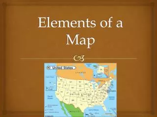
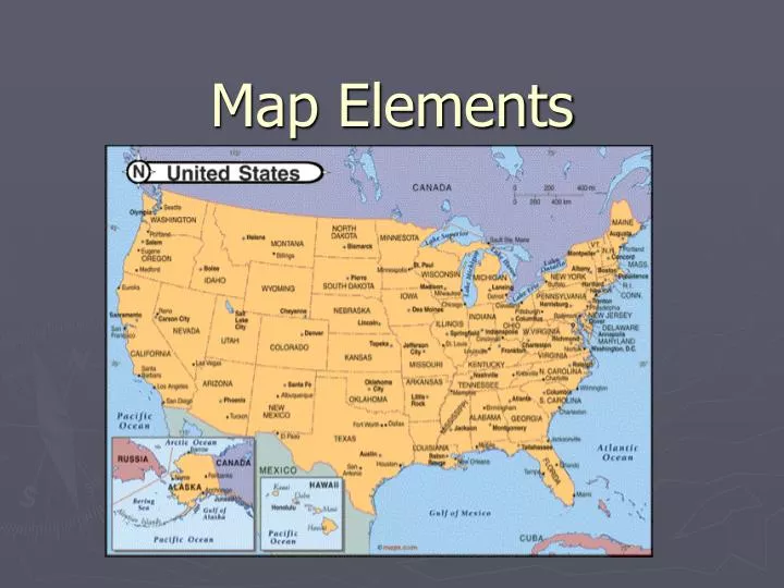
Map Elements. Learner Expectation. Content Standard: 3.0 Geography 3.01 Understand how to use maps, globes, and other geographic representations, tools, and technologies to acquire, process and report information from a spatial perspective. In this activity you will:.

E N D
Learner Expectation • Content Standard: 3.0 Geography • 3.01 Understand how to use maps, globes, and other geographic representations, tools, and technologies to acquire, process and report information from a spatial perspective.
In this activity you will: • Learn about the elements of a map: latitude, longitude, the hemispheres, directions, time zone, scale, and map legends. • Practice locating position using longitude and latitude
What is a map? • A generalized view of an area, usually some portion of Earth’s surface, as seen from above at a greatly reduced size • Any geographical image of the environment • A two-dimensional representation of the spatial distribution of selected phenomena
Why make maps? • To represent a larger area than we can see • To show a phenomenon or process we can’t see with our eyes • To present information concisely • To show spatial relationships
Who make maps? • Cartography: the science and practice of making maps. • From Greek meaning chartes or charax = sheet of papyrus (paper) and graphein = to write.
Map Types Aeronautical & Navigational Charts City/Street Maps Ecological Inventory Fire Insurance Maps Forest Maps Geologic & Hydrologic Maps Highway/Road Maps Outline Maps Parks & Recreational Maps Political Maps Soil Maps Topographic Maps Weather Maps
The World Physical • Physical maps show what the surface of the Earth looks like.
Arctic ocean Pacific ocean Indian ocean Atlantic ocean Oceans of the World • The world has four major oceans. • Atlantic • Pacific • Arctic • Indian
Global Climates • Arctic and Antarctic with cold weather, so we could make the observation that the climate at the poles is cold. This map shows the general climate regions of the world.
World Religions • Religious beliefs help define a people’s culture, so to understand a people, it is important to consider what religions influence that group.
Map scale • Ratio of the distance on the map to the distance on the ground • Scale is a fraction • Larger area covered means larger denominator • Larger denominator means smaller fraction • So a large-scale map covers a small area
Large-scale Small-scale
Map scale • Ratio of the distance on the map to the distance on the ground • Graphic: • Stays the same when photocopied • Might not be right for the whole map
Map scale • Verbal: 1 inch equals 10 miles • Easy to understand • Can change if photocopied
Map scale • Representative fraction or ratio: 1:24,000 • Units don’t matter • Can change if photocopied
Map symbolization • Symbols are a code instead of text • Three kinds: point, line, area • Consider shape, size, orientation, pattern, color, value
Map symbolization • Symbols are a code instead of text • Three kinds: point, line, area • Consider shape, size, orientation, pattern, color, value
Point symbols • Every symbol counts as one occurrence • Qualitative points • Indicate location • Can also describe that location • Quantitative points • Show a distribution • Indicate a value (graduated symbols)
Line symbols • One-dimensional • Mostly taken for granted (borders, roads) • Contour connect same values • Flow-line maps indicate value by width of line
Latitude and Longitude • The earth is divided into lots of lines called latitude and longitude.
Lines • Latitude (shown as a horizontal line) is the angular distance, in degrees, minutes, and seconds of a point north or south of the Equator. Lines of latitude are often referred to as parallels. Latitude
Lines • Longitude (shown as a vertical line) is the angular distance, in degrees, minutes, and seconds, of a point east or west of the Prime (Greenwich) Meridian. Lines of longitude are often referred to as meridians. Longitude
Where is 0 degree? • The equator is 0 degree latitude. • It is an imaginary belt that runs halfway point between the North Pole and the South Pole.
Where is 0 degree? • The equator is 0 degree latitude. • It is an imaginary belt that runs halfway point between the North Pole and the South Pole. Equator
Where is 0 degree? • The prime meridian is 0 degrees longitude. This imaginary line runs through the United Kingdom, France, Spain, western Africa, and Antarctica.
P R I M E M E R I D I A N Where is 0 degree? • The prime meridian is 0 degrees longitude. This imaginary line runs through the United Kingdom, France, Spain, western Africa, and Antarctica.
Hemispheres • By using the equator and prime meridian, we can divide the world into four hemispheres, north, south, east, and west.
Compass • A compass is a tool that helps the user know what direction one is headed. • On a map, a compass or a compass rose helps the user locate these directions.
Compass Rose • The needle on a compass is magnetized to point to the earth's north magnetic pole. Thus with a compass, a person can roughly tell which direction they are headed. • There are four major or cardinal directions on a compass- north, south, east & west. In between are the directions northeast, northwest, southeast, southwest.
Directions • The cardinal directions are north, south, east, and west. • The intermediate directions are northeast, southeast, southwest and northwest. • They help describe the location of places in relation to other places.
Time Zones • The Earth is divided into 24 time zones, corresponding to 24 hours in a day. • As the earth rotates, the sun shines in different areas, moving from east to west during the course of a day. • Places that have the same longitude will be in the same time zone.
Religions Legend Map Legends • The legend is the key to unlocking the secrets of a map. Objects or colors in the legend represent something on the map.
Legend Age Expectancy